Warwick, New York
Looking for the best photography in Warwick? We've got you covered with the top trails, trips, hiking, backpacking, camping and more around Warwick. The detailed guides, photos, and reviews are all submitted by the Outbound community.
Top Photography Spots in and near Warwick
-
West Milford, New Jersey
Hike the Terrace Pond North - South Loop
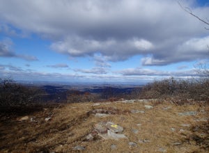
10.7 mi / 1200 ft gainFrom Warwick Road, parking at the northernmost road side parking area, cross the road, and the Terrace Pond North trail (marked with blue blazes) begins as a steady climb until you gain a ridge that offers some great views for several miles. Eventually, you'll reach a power line where you turn ri...Read more -
Ringwood, New Jersey
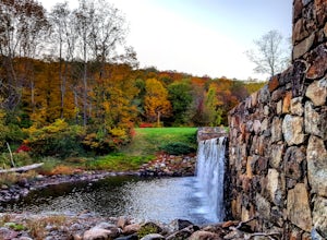
Explore Ringwood Manor State Park
5.01.3 miOn my way to the drive-in, I saw a sign for Ringwood Manor estate and wanted to adventure around. The parking is easy and the property was beautiful!As we walked through the estate, we found:a quaint tree foresta small cemetery with headstones hundreds of years olda river with a small waterfall ...Read more -
Monroe, New York
Hike the Jessup/Highlands/Long Path Trails
7.8 mi / 500 ft gainThis trails starts at a small park in Woodbury called Gonzaga Park. Closed from mid-November to April, you are still able to park just outside the gate if that is the time of year you are hiking. Three different trail names share this path. The Jessup trail starts/end at Gonzaga Park and trave...Read more -
89 Van Orden Road, New Jersey
Hike the Hank's Pond Loop
7 mi / 500 ft gainHank's Pond loop can be accessed from the south at the corner of Clinton road and Van Orden road or from the north, parking at the lot on Stephens road. I hiked from the south on this trip. Follow the wide trail known as Hank's East trail marked with white blazes. Soon you will reach a trail c...Read more -
Jefferson, New Jersey
Thru Hike the Four Birds Trail
19 mi / 1200 ft gainThe Four Birds Trail is about 19 miles long and is a great thru hike or can be done in sections as out and back hikes or part of loop hikes with other trails. Starting from the north, the trail ascends gradually over easy terrain until you reach a cliff ridge. There are several good view points...Read more -
New Windsor, New York
Hike Jessup/West Ridge Loop via the Sweet Clover Trail
10 mi / 1700 ft gainSchunnemunk Mountain State Park is one of my favorite parks. It offers many trails and possibilities for different loops. The attraction of Schunnemunk Mountain is the long double ridges running parallel to each other and amazing views in all directions.This hike starts at the Taylor Road parki...Read more -
Rockaway, New Jersey
Hike the Timberbrook Pond - Riley's Rise Loop
5 mi / 500 ft gainThe trailhead parking is at the end of Timberbrook Road, before the road enters Camp Winnebago (Boy Scouts). I hiked this in a clockwise directions starting on the Timberbrook Trail (yellow markers). After about 1 mile the trail ends at a junction with the Four Birds Trail (white markers). Turn...Read more -
Highland Falls, New York
Popolopen Torne
4.51.18 mi / 531 ft gainPopolopen Torne is a hidden gem in the Hudson Valley, a surprisingly unknown trail with a beautiful payoff and a far deeper meaning. A short hike to the top puts you at the foot of a memorial to those who have served their country, a pile of painted rocks carried up by those who want to pay their...Read more -
Frankford, New Jersey
Picnic at the Sunrise Mountain Pavilion
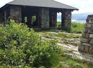
This pavilion is one of the key features along the New Jersey section of the Appalachian Trail. There is a parking lot a very short hike part way down the mountain, but I recommend backpacking in from a different area to take in more of the beauty of the trail, mountains, and views in this area. ...Read more -
Bear Mountain, New York
Hike Bald Mountain, Bear Mountain State Park
4.76.8 mi / 1080 ft gainFrom your starting point at the Bear Mountain Inn, go left along the Cornell Mine Trail. (This part can be a bit confusing, but go past the carousel to a shaded picnic area; that is where the trail starts.) You will go under a bridge and follow the trail until it takes a sharp left and descends t...Read more -
Philipstown, New York
Anthony's Nose via Appalachian Trail
4.61.95 mi / 682 ft gainParking for the trail runs along both sides of 9D right up until the Bear Mountain Bridge. It can be busy on the weekends so just make sure you're as far off the road as you can and be especially careful unloading kids and dogs. The trailhead is located at approximately 41.322571, -73.975949 and ...Read more -
Cortlandt, New York
Hike the Camp Smith Trail
4.55.92 mi / 1759 ft gainThis approximately 3-hour hike borders the Hudson River, and is one of the best in Westchester County. Start off at the parking area at the Bear Mountain Tollhouse, or at a small parking area farther up Bear Mountain Road, if you want a slightly shorter hike. The trail is fairly steep in places, ...Read more -
Cornwall-on-Hudson, New York
Hike the Stillman - Bluebird Loop
5.4 mi / 1200 ft gainThis loop hike starts at the northern trailhead of the park where the Stillman Trail begins. The parking area has enough space for only 6 or 7 cars. Start off on a wide maintained carriage road. After about a half mile, the Stillman Trail (yellow markers) breaks of to the left. However, stay ...Read more -
Cornwall, New York
Hike the North Point Loop
6.5 mi / 1400 ft gainThere is three different trailheads to access the North Point Loop. I chose the trailhead that would give me the longest hike. That would be the Butter Hill parking area on Route 9W north. From the parking lot, start on the connector trail designated with white markers. Follow this for about ...Read more -
Cornwall, New York
Storm King Mountain Loop
4.52.44 mi / 400 ft gainThis is an easy, yet very rewarding hike with a lot of viewpoints on the way up. Technically you scale up two mountains, Butter Hill and Storm King, but most people just describe it as Storm King Mountain. This is a great hike for families with younger kids, those who don't have much time but wan...Read more -
Sandyston, New Jersey
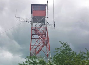
Hike the AT to Culvers Lookout Tower
3.2 miStart your journey in Stokes State Forest at the Culver Gap Parking Lot, located at 41.180239, -74.787954. From the parking lot, jump on over to the Appalachian Trail and hike Northbound. You know you're headed the right way if you are going away from the small town and cross over Sunrise Mountai...Read more

