Pawling, New York
Top Spots in and near Pawling
-
Hamden, Connecticut
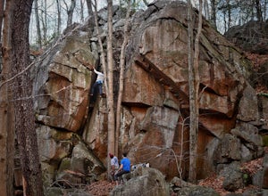
Boulder & Free Climb off the Blue Trail In Sleeping Giant SP
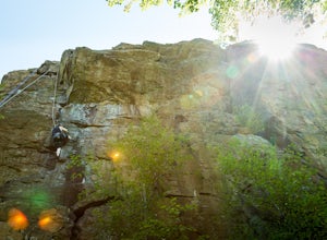
Sleeping Giant State Park does not just have great hiking, it also has great climbing and bouldering. Pick up the blue trail starting at the backside of the visitor center. This trail climbs pretty steadily but take note that as you hike up the cliff below you is a great spot to checkout for boul...Read more -
Sheffield, Massachusetts
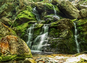
Hike to Race Brook Falls
4.03.4 mi / 1174 ft gainHiking along the Appalachian trail I made a detour in Mt Everett State reservation. About a 2.5 mile detour lead me down to a beautiful 100ft waterfall called Race Brook falls. The waterfall felt made me feel like i was in the tropical jungle in Hawaii. Adding to the beauty of the waterfall were ...Read more -
Mount Washington, Massachusetts
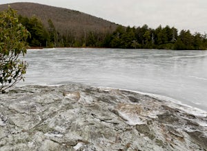
Guilder Pond and Mount Washington Lookout Trail
3.92 mi / 909 ft gainGuilder Pond and Mount Washington Lookout Trail is a loop trail that takes you by the lake located near Copake Falls, New York.Read more -
Norfolk, Connecticut
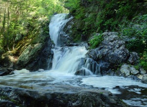
Hike to Campbell Falls
4.01.4 mi / 187 ft gainCampbell Falls, one of the most beautiful parks in CT. Don't let the size of the park fool you, that's what adds to the beauty. With it's strong pine and fresh flower scented woods you slowly forget that you're even in Connecticut. The trails aren't labeled the greatest but still can be made out....Read more -
Mount Washington, Massachusetts
Explore Bash Bish Falls
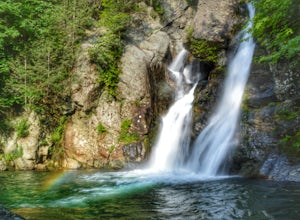
4.21 miOne of my favorite walks to a spectacular falls. The trail is easy to follow and one mile from NY parking lot and 0.5 from the parking lot. The apparent place to swim. There are several very nice, family safe swimmable pools in the creek above and after the falls. There are signs at the top of t...Read more -
Tuxedo Park, New York
Backpack Harriman State Park
4.518 mi / 1200 ft gainWhile the first day is a bit longer and less exciting in terms of frequent landmarks, its a relaxing hike through rocky, wooded, forest among bountiful blueberry bushes and the occasional raspberry bush. Enjoy the isolation on this leg. The second day is packed with frequent and beautiful landmar...Read more -
Southington, Connecticut
Hike the Crescent Lake & Metacomet Trail Loop
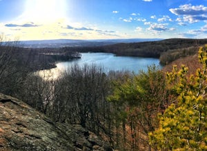
4.02.4 mi / 269 ft gainThe hike to view Crescent Lake is peaceful. You can either walk through the woods where you will be blessed with natures finest birds and wildlife or you can take the trail along the lake edge. Both are similar distances and lead to the same hill at the end! Once you get to the top take a left on...Read more -
Meriden, Connecticut
Hike the Metacomet, Blue, and Yellow Loop
5.04.5 mi / 976 ft gainStart from the Castle Craig road entrance. Walk until you're greeted by a beautiful reservoir. You'll notice the strange but beautiful Mine Island in the middle of all this. You'll also notice markers for White Trails and Yellow Trails. The White Trail is an easier/wider trail. The Yellow Trail C...Read more -
Cragsmoor, New York
Sam's Point, Ice Cave Trail, Verkeerderkill Falls
4.96.99 mi / 1063 ft gainLocated in Sam's Point Preserve, this hike has three major attractions – panoramic views from Sam's Point, mysterious and chilly Ice Caves, and a knee-weakening perch atop Verkeerderkill Falls. Pay attention to seasonal conditions before making this trip. Spring and early summer are best for see...Read more -
Cragsmoor, New York
Sam's Point Overlook to Ice Cave Trail
3.47 mi / 584 ft gainSam's Point Overlook to Ice Cave Trail is an out-and-back trail with scenic views near Lake Maratanza located near Ellenville, New York. This trail is dog friendly on-leash.Read more -
Southington, Connecticut
Rock Climb Ragged Mountain
The main face of Ragged Mountain (elev. 761 feet) is home to a lot climbing in central Connecticut. It runs north-south for about 600 feet. Its max height of 100 feet. The crag is home to several rock climbing guides and schools. Routes range in difficultly from great for the beginner (5.3) to su...Read more -
Berlin, Connecticut
Hike the Ragged Mountain Memorial Preserve
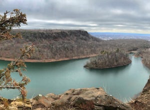
4.55.5 mi / 560 ft gainRagged Mountain main loop is approximately 5.5 miles long, and is known for its expansive bare-rock vistas, vertical cliff faces, and scenic views overlooking cliff-side reservoirs and ponds. The trail is rated moderate, with some flat stretches among the trees, mixed with some uneven rocky foot...Read more -
Tuxedo Park, New York
Hike to the Sterling Ridge Fire Tower
5.08.5 miStart out by turning right when you walk out of the visitor center onto Sterling Lake Loop (Blue Blazes). The visitor center is worth going in as they have a full diorama of the park with LED light to show trail routes. About .3 miles into the hike you will cross over a small bridge with a waterf...Read more -
Rye, New York
Hike the Marshlands Conservancy Loop
4.01.55 mi / 125 ft gainLocated along the Long Island Sound, this 147-acre conservancy is home to a plethora of different birds, including marsh wrens, seaside sparrows, and American woodcocks. The conservancy has 3 miles of trails, all easy to navigate. Starting out from the visitor's center, take the trail to the rig...Read more -
Closter, New Jersey
Hike Alpine White Trail (Stateline Lookout)
5.05 mi / -520 ft gainStarting at about 520 feet, the White path takes you along the Stateline Lookout which is a small stone building overlooking the Hudson River. The initial descent is your average hike through the woods and across a couple of wooden bridges until you reach the Giant Steps. The Giant Steps take you...Read more -
Yonkers, New York
Run the Old Croton Aqueduct Trail
5.026.5 miThis trail traces the route of the Old Croton Aqueduct, which carried water to New York City between 1842 and 1955. Our recommended route starts near the Greystone Station in Yonkers, NY (Metro-North Hudson Line) and ends by the Scarborough Station, but you can easily modify your route – the enti...Read more

