Pawling, New York
Top Spots in and near Pawling
-
3197 U.S. 44, New York
Hike to Sky Top via the Undercliff Road
7.3 mi / 900 ft gainStarting from the East Trapps parking area ascend the East Trapps connector trail marked with yellow blazes. You can also park at the Mohonk Preserve visitor center where you can purchase your access pass ($15 per person) and pick up a free map of the presere trails and carriage roads. The conn...Read more -
Monroe, New York
Hike the Jessup/Highlands/Long Path Trails
7.8 mi / 500 ft gainThis trails starts at a small park in Woodbury called Gonzaga Park. Closed from mid-November to April, you are still able to park just outside the gate if that is the time of year you are hiking. Three different trail names share this path. The Jessup trail starts/end at Gonzaga Park and trave...Read more -
Gardiner, New York
Hike the Dickie Barre, Peters Kill and Awosting Falls Loop
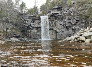
3.07.8 miThis loop hike takes you to Awosting Falls (65 ft.), as well as to great valley views along the ridge of Dickie Barre, and across Peters Kill, on the way.Start out on West Trapps Connector Trail (yellow blazes) at the east end of the West Trapps parking lot (get their early because the lot will ...Read more -
Gardiner, New York
Hike The Millbrook Mountain Ridge Trail
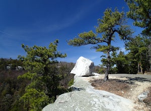
5.07 mi / 1400 ft gainWant to walk on the edge? visit Millbrook Mountain in the Catskills of NY. This loops hike follows the mountains ridge line most of the way to the summit with multiple viewpoints and cliff ledges to walk out on. This hike is recommended those in the area.Park at West Trapps Parking Lot and head ...Read more -
Gardiner, New York
Hike the Overcliff - Undercliff Road Loop
5.3 mi / 350 ft gainFrom the West Trapps parking lot ($15 for hikers), walk to the end of the parking lot and past a large kiosk. The trail connects the parking lot to the Overcliff Road/Undercliff Road junction. The loop can be done in either direction. I turned left on the Overcliff Road. This takes you behind...Read more -
Salisbury, Connecticut
Bear Mountain Loop
4.56.05 mi / 1516 ft gainAt 2,316 feet, Bear Mountain is the highest peak in Connecticut. The peak is about a half-mile south of the Massachusetts state line on the Appalachian Trail. The views are great. On a clear day you can see some of the peaks in southern New Hampshire. The remnants of a stone tower are on the summ...Read more -
Mount Washington, Massachusetts
Mount Frissell and Brace Mountain Loop Trail
5.08 mi / 807 ft gainMount Frissell and Brace Mountain Loop Trail is a loop trail where you may see beautiful wildflowers located near South Egremont, Massachusetts.Read more -
Gardiner, New York
Gertrude's Nose
4.96.97 mi / 919 ft gainIt would be impossible to see all of Minnewaska’s beautiful spots in one day. Gertrude's Nose is, in my opinion, the best view in the entire park. Round trip, the hike is approximately 5 hours, and is a 7.5 mile trip. To get to the trailhead: Drive to the Minnewaska State Park entrance, pass the...Read more -
Gardiner, New York
Hike the Millbrook Mountain/Gertrude Nose loop
9 mi / 1700 ft gainThis great loop hike starts from the upper parking lot of Lake Minnewaska State Park. Walk towards Lake Minnewaska and once on that carriage road, turn left and follow the road to the to the opposite end of the lake. Along the way are great view points of the lake and several picnic areas for day...Read more -
Gardiner, New York
Lake Minnewaska Loop Trail
2.01 mi / 348 ft gainLake Minnewaska Loop Trail is a loop trail where you may see beautiful wildflowers located near Kerhonkson, New York.Read more -
Bridgeport, Connecticut
Stroll around Fayerweather Island
0.5 miParking is at the end of Barnum Road in the Seaside Park. Though the lighthouse grounds are accessible the tower itself is not open to the public. To access the island you must walk across the breakwater. Please use caution as it is uneven footing and at times can be slippery. From the isla...Read more -
Cheshire, Connecticut
Hike to Roaring Brook Falls
1.2 mi / 377 ft gainArriving to the falls, parking is residential but don't worry everyone is friendly. Starting off the hike you will walk past a cool pond where you may be able to see some wildlife. Continuing on, you will follow the marked trail where it will take you further into the woods while gaining elevatio...Read more -
Hamden, Connecticut
Mountain Bike West Rock Ridge State Park
West Rock Ridge State Park is a 700 ft high scenic ridge that is located on the west side of New Haven. There are tons of good mountain biking trails located all around the ridge that can satisfy all types of skill levels. The easiest place to park is the Lake Wintergreen parking lot, which sits ...Read more -
Stamford, Connecticut
Hike Cove Island Park Loop Trail
5.01.1 mi / 3 ft gainThis trail is accessible year round and features water views of the Long Island Sound with beach access. The trail is a popular spot for walking, biking, fishing, and even bird watching. But if you’re not quite in the mood to get your steps in, you can use the small beach to sit and chat with a f...Read more -
Hamden, Connecticut
Hike the Tower Trail to the Blue Trail at Sleeping Giant SP
5.03 mi / 518 ft gainSleeping Giant State Park is a place very close to my heart. I spent 4 years right across the street at Quinnipiac University and have hiked “The Giant” more times then I can count and at all different hours. There are a few different trails you can explore but my favorite one is up to the cliffs...Read more -
Hamden, Connecticut
Hike the Mill River Trail to the Blue Trail at Sleeping Giant SP
5.03 mi / 518 ft gainSince I was a child, I’ve always enjoyed hiking the Giant. As Connecticut parks go, this terrain is some of the most challenging (and unfortunately, the most dangerous) in the state. The actual ridge is approximately 2.75 miles long by 1.75 miles wide, and offers approximately 24 miles of hiking ...Read more

