Kings Park, New York
Top Spots in and near Kings Park
-
Brooklyn, New York
Prospect Park Loop
4.03.65 mi / 223 ft gainThere are multiple places to enter Prospect Park. If you're looking for the main entrance to Prospect Park, it faces the stunning Soldiers' and Sailors' Arch in Grand Army Plaza. It is adjacent to the Brooklyn Botanical Garden, the flagship Brooklyn Public Library, and the Brooklyn Museum. As you...Read more -
New York, New York
Brooklyn Bridge Walk
5.02.4 mi / 26 ft gainBrooklyn Bridge Walk is an out-and-back trail that takes you by a river located near New York City, New York.Read more -
New York, New York
Walk the George Washington Bridge at Sunset
3.00.9 miJoin the thousands of people who cross the GWB each day, but do it by foot! This is an easy walk with beautiful views of the New York City skyline. You will begin seeing signs for the bridge bike path at Ft. Washington St. & E. 177th St., which you follow for a few blocks until you begin asce...Read more -
New York, New York
Explore the South Street Seaport
5.0Get a feel for what New York was like in the 19th century at the Seaport! The Seaport boasts some of the oldest buildings and architecture in Manhattan, and the area continues to bustle today. The Seaport borders the Financial District and the East River - so there are lots of wonderful sights to...Read more -
Hamden, Connecticut
Boulder & Free Climb off the Blue Trail In Sleeping Giant SP
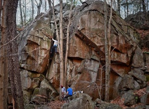
Sleeping Giant State Park does not just have great hiking, it also has great climbing and bouldering. Pick up the blue trail starting at the backside of the visitor center. This trail climbs pretty steadily but take note that as you hike up the cliff below you is a great spot to checkout for boul...Read more -
Hamden, Connecticut
Hike the Tower Trail to the Blue Trail at Sleeping Giant SP
5.03 mi / 518 ft gainSleeping Giant State Park is a place very close to my heart. I spent 4 years right across the street at Quinnipiac University and have hiked “The Giant” more times then I can count and at all different hours. There are a few different trails you can explore but my favorite one is up to the cliffs...Read more -
Hamden, Connecticut
Hike the Mill River Trail to the Blue Trail at Sleeping Giant SP
5.03 mi / 518 ft gainSince I was a child, I’ve always enjoyed hiking the Giant. As Connecticut parks go, this terrain is some of the most challenging (and unfortunately, the most dangerous) in the state. The actual ridge is approximately 2.75 miles long by 1.75 miles wide, and offers approximately 24 miles of hiking ...Read more -
Southampton, New York
Paddle Peconic Bay
4.0While there are many ways to access the Peconic Bay, I have found the best direction to explore is north west after launching and during the sunset. If you head to the public beach on Towd Point Rd. you can launch from there and make your way out toward Robins Island. Like most places the water i...Read more -
Cheshire, Connecticut
Hike to Roaring Brook Falls
1.2 mi / 377 ft gainArriving to the falls, parking is residential but don't worry everyone is friendly. Starting off the hike you will walk past a cool pond where you may be able to see some wildlife. Continuing on, you will follow the marked trail where it will take you further into the woods while gaining elevatio...Read more -
New Fairfield, Connecticut
Hike Squantz Pond Trail
2.2 mi / 321 ft gainThe hike is rated as moderate and is accessible all year round. While it’s accessible during all seasons, the sights of the leaves changing colors in the autumn makes it an exceptionally beautiful time to do this hike. You’ll definitely want to snap some photos along the way of the foliage reflec...Read more -
Staten Island, New York
Sunrise and Sunset from the Staten Island Ferry
5.0The Staten Island Ferry is a passenger ferry that runs between the boroughs of Manhattan and Staten Island. From the deck of the ferry, you will have a perfect view of The Statue of Liberty and Ellis Island. You'll see the skyscrapers and bridges of Lower Manhattan receding as you pull away and c...Read more -
Carmel Hamlet, New York
Ninham Mountain Fire Tower
5.01.23 mi / 367 ft gainThis is more of a stroll than a hike, which is nice because you can add it to another hike in the same day if you're in the area. From the dirt parking lot take the trail off to the right. Just stay straight and in about 15 minutes you'll see a huge fire tower (hard to miss). Feel free to climb a...Read more -
Cortlandt, New York
Hike the Camp Smith Trail
4.55.92 mi / 1759 ft gainThis approximately 3-hour hike borders the Hudson River, and is one of the best in Westchester County. Start off at the parking area at the Bear Mountain Tollhouse, or at a small parking area farther up Bear Mountain Road, if you want a slightly shorter hike. The trail is fairly steep in places, ...Read more -
Kent, New York
King's Chamber and Moose Hill Loop
3.14 mi / 499 ft gainKing's Chamber and Moose Hill Loop is a loop trail that takes you by a lake located near Carmel, New York.Read more -
Philipstown, New York
Hike the Osborn Loop
7.6 mi / 850 ft gainThe Osborn Loop trail itself is not a loop. It connects to a 2.5 mile section of the Appalachian Trail. Hiking these together creates the loop. Start at the trail head for the Appalachian Trail on South Mountain Pass Road. There is parking for two or three cars. Walk up the road a short dist...Read more -
Philipstown, New York
Anthony's Nose via Appalachian Trail
4.61.95 mi / 682 ft gainParking for the trail runs along both sides of 9D right up until the Bear Mountain Bridge. It can be busy on the weekends so just make sure you're as far off the road as you can and be especially careful unloading kids and dogs. The trailhead is located at approximately 41.322571, -73.975949 and ...Read more

