Cimarron, New Mexico
Top Spots in and near Cimarron
-
Colfax County, New Mexico
Hike to Clear Creek in Cimarron Canyon State Park
4.02.5 mi / 1000 ft gainHead North from Eagle Nest towards Cimarron, and about 7 miles (or less) on your right hand, you will find two big signs with a parking area on both sides of the road. If you park on the right side, walk on the inside of the guardrail until you find the trail head sign. If you parked on the left ...Read more -
Red River, New Mexico
Enchanted Forest Snowplay Area
Just above the town of Red River up Bobcat Pass is the Enchanted Forest. As you approach the top of the pass you’ll see signs that point you toward the forest into what looks like a neighborhood. Trust the signs and make the turn. Follow the main road up through the neighborhood and take your sec...Read more -
Taos Ski Valley, New Mexico
Climb Mount Wheeler
4.76.2 mi / 3083 ft gainMount Wheeler is the highest peak in New Mexico at 13,161 feet and is considered the 8th highest state peak. The hike begins just over 10,000 feet near the Bavarian Restaurant. Drive past the Taos Ski Resort and follow the signs for the restaurant until the road ends. The 6.2 mile trek begins a...Read more -
Taos Ski Valley, New Mexico
Hike to Williams Lake and Wheeler Peak
5.0This hike is conveniently located at Taos Ski Valley and offers two primary options: a fun 4-mile round trip hike to beautiful Williams Lake, or a 7-mile round trip hike all the way to the Wheeler Peak. You can’t go wrong with either option, but if you’re up for it, bagging Wheeler Peak is defini...Read more -
Red River, New Mexico
Sledding in Red River
If you’re looking for an alternative winter activity to indulge your need for gravity sports, you may take the time to rent a sled from Sitzmark’s for $5 and head over to the library to take your chance at reviving your childhood spirit! Heading to the library at the east end of town, you can fin...Read more -
Red River, New Mexico
No Name Point
Not even a mile down Bitter Creek Rd, there’s a right-hand turn that takes you next to this spectacular rock outcropping. There's a little dirt parking area when you come down and around the turn that sits right next to Bitter Creek itself. It’d be a swell place hang out, play around on the roc...Read more -
Red River, New Mexico
Explore Mallette Park & Canyon
We stumbled upon this little gem as we were driving through town. This park is nestled right at the base of Mallette Canyon and has several features that becken a winter visit. Along the west side of the canyon, over the small green bridge in the park you will find yourself following along a quar...Read more -
Red River, New Mexico
Hike the Red River Nature Trail
2 miThe Red River Nature Trail starts right in town next to the Platinum Lift off Pioneer Road. The trail travels 2 miles to Goose Lake Road. The hike itself can be taken as a two or four mile hike, depending on weather you access it point to point or out and back. We started the trail behind the vis...Read more -
Taos County, New Mexico
Ski Red River Ski Area
The resort itself, sits right in town, with 6 lifts. Two of the lifts come down to the river and access various parts of the town, it’s a place that makes you remember what skiing used to be like. The mountain has roughly 170 acres of skiable terrain, and appeals to those of all abilities. The u...Read more -
Arroyo Seco, New Mexico
Camp at Cuchillo del Medio
Drive towards the Taos ski area, passing through Arroyo Seco on NM-150 North. Four miles up this road, the Cuchillo del Medio campsites will be on the southeast side of the road. There are two sections of campsites, with side-by-side entrances. (Note: the southern section is currently closed due ...Read more -
Red River, New Mexico
Hike Colombine Trail
8.5 mi / 1935 ft gainThis moderate trail is accessed from the Columbine campground on Highway 38. It will be on your right side when traveling east from Questa. Drive to the back end of the campground, where there are several spaces for parking. The moderate version of this hike will travel about 4 miles south into t...Read more -
U.S. Highway 64, New Mexico
Devisadero Peak
5.48 mi / 1375 ft gainThe Basics: 8,304 foot Devisadero Peak, which literally translates to "lookout," does not actually provide a great view from its treed summit. However, this lollipop loop hike has many vantage points over the Taos Valley as it snakes up and around this foothill mountain. To get to the trailhea...Read more -
Taos, New Mexico
Drive the Enchanted Circle Scenic Byway
Start the drive at the Taos Plaza in downtown Taos. You can drive the whole loop and enjoy the beautiful scenery and small villages along the way. In the spring, there may still be snowfall, making the drive even more beautiful.Read more -
25 ABC Mesa road, New Mexico
Hotel Luna Mystica & Starlight Campground
5.0Located just Northwest of Taos, New Mexico you can find Hotel Luna Mystica. This is a one of a kind "hotel" site, which is just a site where you can rent out old but renovated trailers to stay in. Have you ever wanted to get a taste of the RV/Trailer life? this is the perfect place to do so. Loca...Read more -
Raton, New Mexico
Rock Climb at Sugarite Canyon
Most ratings range from 5.7 to 5.11 with fewer 5.12. Only one climb in the whole area is bolted-- and that is a 5.10a. To get to this area it is about a 10 minute scramble through woods and boulders on a path that leads straight to the south facing wall.Driving through Raton, New Mexico exit at t...Read more -
Questa, New Mexico
Camp at Rio Grande del Norte National Monument
4.32.4 mi / 800 ft gainCreated in 2013 from partly existing public lands, The Rio Grande del Norte National Monument encompasses a large amount of land along the Rio Grande River from the Colorado border to south of Taos. Far from any major city, you'll likely enjoy trails to yourself in the morning and few other visit...Read more
Top Activities
Camping and Lodging in Cimarron
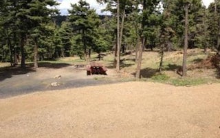
Colfax County, New Mexico
Cimarron Campground
Overview
Cimarron Campground is located in the scenic Valle Vidal within Carson National Forest in northern New Mexico, at an elevation o...
Questa, New Mexico
Fawn Lakes Campground
Overview
Fawn Lakes Campground is located in Carson National Forest, one of a few campgrounds located along the scenic canyons of Red Riv...
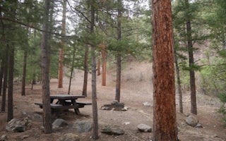
Red River, New Mexico
Elephant Rock Campground
Overview
Elephant Rock Campground has excellent fishing access to the well-stocked Red River, nearby Eagle Rock Lake and hiking into the ...
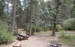
Red River, New Mexico
Columbine Campground (Nm)
Overview
Columbine Campground is located between Questa and Red River, New Mexico. The Red River flows past the campground and a trailhea...
Raton, New Mexico
Raton KOA Journey
For more than a century, Raton has been a convenient stopping place along the path between Colorado and New Mexico. Now the "path" has tu...
Vadito, New Mexico
Agua Piedra Campground
Overview
Agua Piedra, located in the Carson National Forest, is nestled near the Rio Pueblo and Agua Piedra Creek. The campground contain...


