Sparta, New Jersey
Looking for the best photography in Sparta? We've got you covered with the top trails, trips, hiking, backpacking, camping and more around Sparta. The detailed guides, photos, and reviews are all submitted by the Outbound community.
Top Photography Spots in and near Sparta
-
Brooklyn, New York
Photograph the Brooklyn Bridge
4.8Escaping the hustle and bustle of the city doesn't always require actually leaving the city. Hanging out next to the East River and focusing on photographing the Brooklyn Bridge can be just what you need to clear your head and get your fix for some outdoors time. This is a great spot to practice ...Read more -
Brooklyn, New York
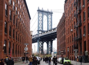
Photograph Manhattan Bridge from Washington Street NYC
4.7Located in DUMBO this is seen as one of of the prime photography spots in NYC for good reason. Off the intersection of Washington Street and Water Street is a perfect view of the Manhattan Bridge sandwiched between two buildings. If you want to take it one step further you are able to get a close...Read more -
Brooklyn, New York
Brooklyn Bridge Park Piers
5.01.5 miStarting at the Brooklyn Main Street Park, you are on the right side of the Manhattan Bridge. Here you can check out the new outdoor climbing gym. Keep walking along the water and you'll soon come upon Pebble Beach. Now this beach is not exactly a "let's bring our beach chairs and spend the da...Read more -
Cornwall-on-Hudson, New York
Hike the Stillman - Bluebird Loop
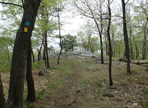
5.4 mi / 1200 ft gainThis loop hike starts at the northern trailhead of the park where the Stillman Trail begins. The parking area has enough space for only 6 or 7 cars. Start off on a wide maintained carriage road. After about a half mile, the Stillman Trail (yellow markers) breaks of to the left. However, stay ...Read more -
Cornwall, New York
Hike the North Point Loop
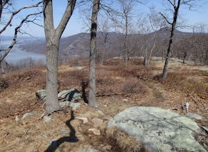
6.5 mi / 1400 ft gainThere is three different trailheads to access the North Point Loop. I chose the trailhead that would give me the longest hike. That would be the Butter Hill parking area on Route 9W north. From the parking lot, start on the connector trail designated with white markers. Follow this for about ...Read more -
Cornwall, New York
Storm King Mountain Loop
4.52.44 mi / 400 ft gainThis is an easy, yet very rewarding hike with a lot of viewpoints on the way up. Technically you scale up two mountains, Butter Hill and Storm King, but most people just describe it as Storm King Mountain. This is a great hike for families with younger kids, those who don't have much time but wan...Read more -
Brooklyn, New York
Prospect Park Loop
4.03.65 mi / 223 ft gainThere are multiple places to enter Prospect Park. If you're looking for the main entrance to Prospect Park, it faces the stunning Soldiers' and Sailors' Arch in Grand Army Plaza. It is adjacent to the Brooklyn Botanical Garden, the flagship Brooklyn Public Library, and the Brooklyn Museum. As you...Read more -
Hopewell, New Jersey
Hike through the Sourland Mountain Preserve
5.02.91 miThe Sourland Mountain Preserve stretches from Hunterdon County all the way into Somerset County. The trails referenced here are on the southwest side of the preserve in Hunterdon County. They are accessible from an on site parking lot at 233 Rileyville Road in Ringoes NJ.There are several trails ...Read more -
Cold Spring, New York
Hike the Cornish/Brook/Notch/Washburn/Undercliff Loop
8 mi / 1500 ft gainThis loop is a great option to avoid crowds on the west side of the Washburn trail. Start at the same trailhead for the Washburn Trail. The Cornish Trail is on the left and there is an obvious sign at the trail split a few feet from the parking area. The Cornish Trail is an old road from about...Read more -
Cold Spring, New York
Hike the Washburn/Nelsonville/Undercliff Loop
7.2 mi / 2000 ft gainThis is a difficult loop hike that has several different starting points. I chose to start at the Washburn Trail Head, which is the lowest starting point you can select. Nearly on the Hudson River, the trail ascends immediately along a well maintained road designated by white disc markers. Aft...Read more -
Cold Spring, New York
Sugarloaf Mountain and Breakneck Ridge Loop
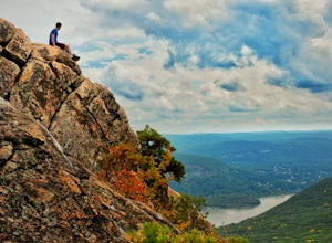
4.74.33 mi / 1562 ft gainThe Breakneck Ridge to Sugar Loaf Loop gives rise to various bypasses that offer hikers moderate to advanced terrain and multiple rock scrambles. The loop entails a total elevation gain of 1,670 feet and a total distance of 5.5 miles. The start of the trail begins at the (white blazes) at the no...Read more -
Beacon, New York
Sunset Point - South Beacon Mountain Loop
4.08.92 mi / 2470 ft gainThis loop hike form the Notch Trail northern trailhead on Route 9D. There is enough parking at this trailhead for about 5-6 cars. The Notch Trail is identified with blue trail markers. It is well maintained and plenty of markers to guide your way. This is important because there are m...Read more -
Beacon, New York
Sugarloaf Mountain via Wilkinson Memorial Trail
5.02.15 mi / 820 ft gainTrail is currently closed. Get updates at parks.ny.gov. Sugarloaf Mountain is part of the Hudson Highlands State Park, along with Breakneck Ridge, Bull Hill, and Mt Beacon. Though the views are just as impressive as its sister trails, it is never as crowded and it's one of my favorite spots in ...Read more -
Cold Spring, New York
Photograph Indian Brook Falls
2.8This is about as short a walk and as little effort as you can put in for a beautiful waterfall. You can barely call it a hike, but I'll list it as such since you do walk through the woods for 5 minutes. The trail is extremely well built, and is pretty easily accessible through the winter.The trai...Read more -
Stockton, New Jersey
Hike to the Hidden Lockatong Waterfall
3.72 miIf you're on Kingwood Stockton Road, there will be a dirt road with a Lockatong Nature Preserve sign before it (going north on Kingwood Stockton Road, the sign will be on your left. If you're driving south, the sign will be on your right). Just drive all the way until the end of the dirt road and...Read more -
Frenchtown, New Jersey
Hike to the Devil's Tea Table
3.00.5 mi / 20 ft gainApart from the rock, there's more trail to follow for a stunning overview and a great spot to hang out and relax. The view is a must-see, it is so much better in person. The hike is not challenging at all, it is basically a straight trail. Climbing some medium sized rocks might be required, but i...Read more

