Washoe County, Nevada
Top Spots in and near Washoe County
-
Reno, Nevada
Rock Climb The Pig
Pig Rock, aka The Pig, as its name suggests, is a pig-looking outcrop of volcanic tuff that has a variety of routes great for training and being introduced to trad climbing. There is no approach to the routes themselves, as you can park right at the base of The Pig. To get there, take Hwy 445/Pyr...Read more -
Reno, Nevada
Hike to the Monkey Condos and Needle Rock
7.25 mi / 1600 ft gainThis loop takes hikers past several features and areas of interest hidden in the Virginia Mountains about 25 miles north of Reno. These mountains are scenic and rugged, with towering dramatic features that make visitors feel immensely small amidst them. Couple that with how few visitors these roa...Read more -
Reno, Nevada
Camp at Tamarack Bay on Pyramid Lake
5.00.25 miPyramid Lake is the last remnant of the vast Pleistocene Lake Lahontan which reached its peak at the end of the last ice-age, being the terminus of many of the glaciers and ice sheets which covered much of California, Oregon, Idaho, and Nevada.Today it is an oasis in the heart of the Basis and Ra...Read more -
Reno, Nevada
Catch a Sunset at Pyramid Lake
Catching a Sunset at Pyramid Lake is a unique experience. The high desert lake is surrounded by mountains, and strange rock formations. The reds and browns of the surrounding desert landscape light up during sunset. Combined with the blue salt water lake make for an amazing sunset. The lake will ...Read more -
Sparks, Nevada
Stand-Up Paddleboard at the Sparks Marina
5.0The Sparks Marina, just minutes from downtown Reno, is a convenient and fun place to learn how to SUP or to spend an afternoon out on the lake. The Sparks Marina Park has ample parking and several places to put in, but there are also numerous others around the marina, including a lovely inlet on ...Read more -
Sparks, Nevada
Sparks Marina Loop
4.01.94 mi / 30 ft gainSparks Marina Loop is a loop trail that takes you by a lake located near Sparks, Nevada.Read more -
Reno, Nevada
Miners Trail to The "N"
3.51.89 mi / 371 ft gainMiners Trail to The "N" is an out-and-back trail that provides a good opportunity to view wildlife located near Reno, Nevada.Read more -
Reno, Nevada
May Arboretum and Herman Pond Trail
5.01.07 mi / 89 ft gainMay Arboretum and Herman Pond Trail is a loop trail where you may see beautiful wildflowers located near Reno, Nevada.Read more -
Reno, Nevada
Truckee River Pathway: Downtown to Dorostkar Park
4.04.42 mi / 220 ft gainTruckee River Pathway: Downtown to Dorostkar Park is a point-to-point trail that takes you by a river located near Reno, Nevada.Read more -
Reno, Nevada
Fly Fish the Truckee River from Wingfield Park
At just 121 miles long from Lake Tahoe to Pyramid Lake, the Truckee River continues to produce the largest trout in the Lower 48. Fly fisherman commonly divide the river into two reaches – East & West, and there is excellent fishing to be found right in downtown Reno all along the Truckee and...Read more -
Reno, Nevada
Peavine Peak Trail
3.08.89 mi / 2913 ft gainPeavine Peak Trail is a loop trail where you may see beautiful wildflowers located near Reno, Nevada.Read more -
Reno, Nevada
Oxbow Nature Study Area Nature Trail
4.00.77 mi / 23 ft gainOxbow Nature Study Area Nature Trail is a loop trail that takes you by a river located near Reno, Nevada.Read more -
Reno, Nevada
Highland Loop Trail
2.37 mi / 453 ft gainHidden Valley Park is a large, 480-acre regional park in southeast Reno, of which 65 acres are developed that features an extensive trail network along with equestrian grounds, a dog park, playground, and numerous other features. The Highland Loop Trail is a great way to experience the park and ...Read more -
Reno, Nevada
Hidden Valley County Park Loop
4.04.23 mi / 1207 ft gainThis is the hidden sight of Hidden Valley. Head south down Hidden Valley Drive from Mira Loma and turn right on Mia Vista Drive until you get to the parking lot for Hidden Valley Regional Park. Watch out for wild horses on all roads leading in and throughout your hike. There are hundreds of trail...Read more -
Reno, Nevada
Upper Chalk Creek Trail
4.01.44 mi / 121 ft gainUpper Chalk Creek Trail is an out-and-back trail located near Reno, Nevada.Read more -
Reno, Nevada
Dorostkar Park Nature Trail
3.01.48 mi / 39 ft gainDorostkar Park Nature Trail is a loop trail that takes you by a river located near Reno, Nevada.Read more
Top Activities
Camping and Lodging in Washoe County
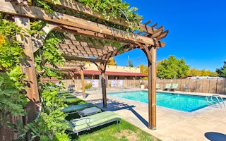
Reno, Nevada
Reno KOA Journey at Boomtown
Picture a peaceful campground and dazzling resort casino all in one - then come camp here! KOA and the adjacent Boomtown Casino & Hot...
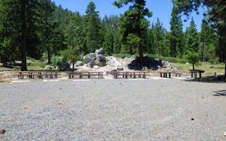
Unnamed Road
Lookout Campground
Overview
Lookout Campground is located on the California/Nevada border just west of Reno, Nevada. It sits at an elevation of 6,770 feet i...
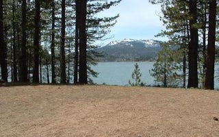
Unnamed Road
Big Cove
Overview
Big Cove Campground (5,700 feet) is located near the shores of Frenchman Lake in Northeastern California. Some families have bee...
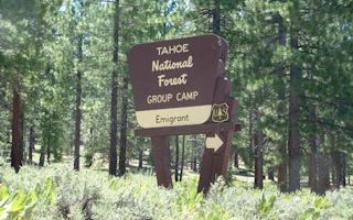
Dog Valley Road
Emigrant Group
Overview
Emigrant Group Campground is located alongside the beautiful Stampede Reservoir. The campground is located approximately 30 min...
Truckee, California
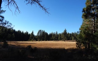
Boca Spring
Overview
Boca Spring Campground is located approximately one-mile east of Boca Reservoir, 20 minutes from Truckee, California. Visitors e...
Truckee, California
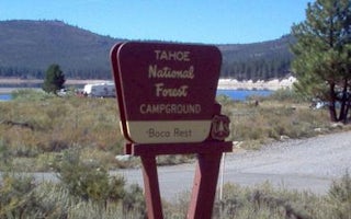
Boca Rest Campground
Overview
Boca Rest Campground is located along the shores of Boca Reservoir, 20 minutes from Truckee, California. Visitors enjoy the area...


