West Glacier, Montana
Looking for the best photography in West Glacier? We've got you covered with the top trails, trips, hiking, backpacking, camping and more around West Glacier. The detailed guides, photos, and reviews are all submitted by the Outbound community.
Top Photography Spots in and near West Glacier
-
Waterton, Alberta
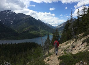
Hike to Crypt Lake
4.310.8 mi / 2296.6 ft gainThe hike begins with a gradual climb through shaded forest, which thins as you progress into the hanging valley. Along the way, you will pass by three amazing waterfalls: Twin Falls at 3.5km (2 mi), Burnt Rock Falls at 5.6km (3.5 mi) and the 600ft Crypt Falls at 8km (5 mi). There is also a 1km (0...Read more -
Browning, Montana
Backpack to Cosley Lake
27.2 mi / 475 ft gainThe hike goes through different wooded areas, open fields, and passes by the ranger's ranch. In no time, you will be able to see the aqua blue colors of Cosley Lake, as you approach the campground for the night.The campground has pit toilets and a bear bag hanging station, along with a cooking ar...Read more -
Waterton, Alberta
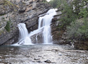
Explore Cameron Falls
Located on the west side of Waterton townsite in Waterton Lakes National Park is the iconic waterfall Cameron Falls. Probably one of the most photographed waterfalls in Waterton due to its accessibility The waterfall is practically right off of the road/bridge with easy parking right next to it. ...Read more -
Waterton, Alberta
Hike Mount Lineham
I’ve heard a lot about the hiking in Waterton and the stunning scenery, but I never really bought into it from the pictures alone – I’m glad I finally took the opportunity to find out for myself. Mount Lineham is a short extension of Lineham Ridge, and while it might not eclipse the views from th...Read more -
Waterton, Alberta
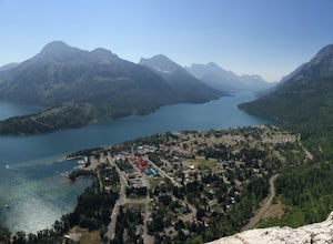
Hike Bear's Hump, Waterton Lakes NP
4.71.7 mi / 738 ft gainThe trailhead is located at the Visitor Center of Waterton Lakes National Park. The trail is very well maintained, but know that the elevation gain is quick - in less than a mile you gain 738 ft. Roundtrip is 1.7 miles and is totally worth the short but strenuous hike.When you reach the top there...Read more -
Waterton, Alberta
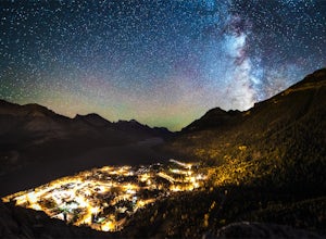
Stargaze at the Top of Bear's Hump
1.7 mi / 656.2 ft gainBear's Hump is one of the shortest hikes in Waterton Lakes National Park. Fortunately, it also offers one of, if not the best, views of the small mountain town of Waterton and surrounding peaks. At 2.8 kilometres and 200 meters of elevation gain round trip, this hike can be done in about an hou...Read more -
Bigfork, Montana
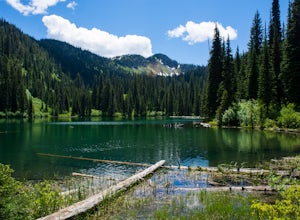
Hike to Bond Lake
5.011.6 mi / 2300 ft gainFrom Kalispell, head south towards Swan Lake along Highway 83 until a sign for Bond Creek Trailhead is located on the east side oft the road near mile marker 71. Turning onto Forest Service Road #680 and after 1.5 miles, turning on FS Road #9507, the trailhead will be 2.3 miles after the intersec...Read more -
Flathead National Forest, Montana
Hike Montana's Swan Crest Trail
47 miGetting There: Coming from Seeley Lake, take the road towards Bigfork. Continue until you get to mile marker 27 and turn right into the Morrell/Clearwater turn off. Stay on the road most traveled until you dead end at the trail head roughly 7 miles up the road. Park here. The Trail: The trail ...Read more -
Hungry Horse, Montana
Relax at Spotted Bear Beach
Spotted Bear Beach is a secluded white sand beach in the middle of Montana. To get here from the town of Hungry Horse, drive east on Highway 2 for ½ mile to the East Side Reservoir Road #38. Turn right (south) onto Road #38 and drive on through the town of Martin City. After two miles the pavemen...Read more -
Dayton, Montana
Kayak to Wild Horse Island
5.0There are many boat ramps to access Flathead Lake, but the closest location to Wild Horse Island is Dayton, MT. Dayton offers easy access with only about a 1-hour paddle to the island for the novice kayakers. Unfortunately, the boat ramp in Dayton does not have room for parking, thus it is only a...Read more -
Hungry Horse, Montana
Hike to the Blue Lakes
2 mi / 100 ft gainThe drive out to the trailhead where this hike starts is an adventure in and of itself. As the Forest Service website describes it. "Silvertip Trailhead is accessed from Highway 2. From the town of Hungry Horse, drive east on Highway 2 for ½ mile to the East Side Reservoir Road #38. Turn right (s...Read more

