West Glacier, Montana
Looking for the best fishing in West Glacier? We've got you covered with the top trails, trips, hiking, backpacking, camping and more around West Glacier. The detailed guides, photos, and reviews are all submitted by the Outbound community.
Top Fishing Spots in and near West Glacier
-
West Glacier, Montana
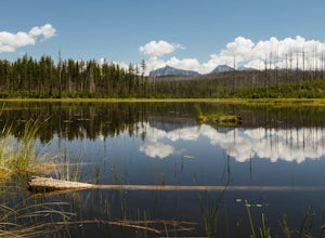
Hike to Howe Lake
4 mi / 240 ft gainThe hike begins along the Inner North Fork road across from a small parking area. The trail meanders up a slight incline most of the way through areas of a recent fire, as well as some areas with spectacular wildflowers when it gets a bit more lush. Around 1.7 miles in you will go up a relatively...Read more -
Flathead County, Montana
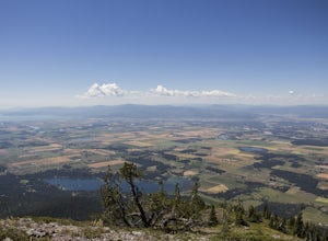
Hike to Blaine Mountain
7.3 mi / 2350 ft gainTo reach the trailhead for this hike, it is about an hour's drive from nearby Kalispell. You will drive around Hungry Horse Reservoir on the West Side Road, and turn off onto Doris Creek Road. Be sure NOT to get this mistaken with the nearby Doris Ridge Road. Once turning onto Doris Creek Road, i...Read more -
West Glacier, Montana
Backpack to Logging Lake
8.8 miBackcountry camping is the best plan if you’d like to visit Logging Lake, and the primitive campsites lay at the end of a four and a half mile hike through some of the most unspoiled sections of the park. The trail follows logging creek most of the way to the lake traversing through a variety of ...Read more -
Kalispell, Montana
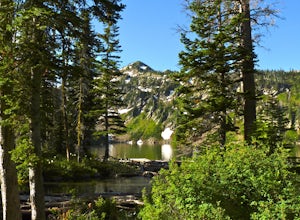
Backpack to Black Lake
7 mi / 1500 ft gainBegin at Camp Misery (elev. 5,717 ft). This is a total misname by the way! It should be titled Camp On The Way To Awesomeness! Anyway, head .6 miles on Trail 8 to the intersection of trail. From here turn right on Trail 68 and hike .7 miles until the intersection where you turn right on Trail 7 f...Read more -
West Glacier, Montana
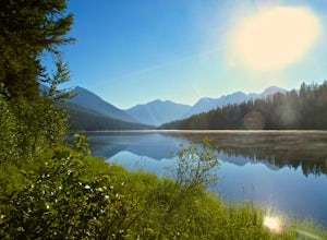
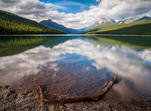
Camp at Bowman Lake
5.026.85 mi / 3005 ft gainBowman lake is the 3rd largest lake in Glacier National Park and one of the most remote areas accessible by car. The drive out on a dirt road is slow and bumpy but the reward is an area without crowds and lots of adventure potential. The first-come-first-served campground offers 48 sites near t...Read more -
Browning, Montana
Grinnell Glacier in Glacier NP
5.011.33 mi / 1840 ft gainThe Grinnel Glacier Hike begins at the Grinnell Glacier Trailhead just past the Many Glacier Lodge. A fee of $25 is required to enter Glacier National Park for a seven-day pass. The Many Glacier region is entered from the east side of the park from the Blackfeet Indian Reservation. The Grinnel...Read more -
Bigfork, Montana
Swim in Graves Bay Swimming Hole
To get to this swimming hole you drive south from Hungry Horse on the West Side Road (Forest Road 895) 33.6 miles to the Graves Creek Campground. Park in the small parking lot with the bear box and outhouse, opposite the campground closer to the lake. Follow the path as it leads you past the casc...Read more -
Bigfork, Montana
Explore Graves Creek Falls
Graves Creek Falls are a series of pleasant waterfalls viewable without much effort. To get here From Hungry Horse drive south on the West Side Road (Forest Road 895) 33.6 miles to the Graves Creek Campground. From here turn right into the campground, park and take a short walk of a couple hundre...Read more -
Glacier County, Montana
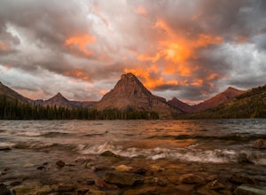
Explore Two Medicine Lake
5.0Two Medicine Lake sits in the southeastern part of Glacier NP away from the more popular Going-to-the-Sun Road. The 2-mile long lake has a 100 site campground that serves visitors on a first-come-first-serve basis; the campground opens mid-April and closes in November. From the main parking area...Read more -
Glacier County, Montana
Triple Divide Pass Trail to Red Eagle Lake
29.22 mi / 5499 ft gainA couple of notes to keep in mind before you start... this is a loop that takes you to a different part of the park so you will either need two vehicles (one for the pickup spot and one to take you to the trailhead) or you will need to hitchhike back to you drop off vehicle. Also you will need to...Read more -
Browning, Montana
Backpack the Continental Divide in Glacier NP
4.033.4 mi / 5257 ft gainPark your car at the Two Medicine North Shore Trailhead, and take a National Park Shuttle (if they are running during the season--they stop around Labor Day in September) or set up a private shuttle service to St. Mary and the Red Eagle Trailhead (only ~$10-20 bucks a person).The first day from t...Read more -
Flathead County, Montana
Backpack to Link Lake
1.3 mi / 600 ft gainTo reach the trailhead, travel west on US Hwy 93 for 17.9 mi. and then turn right onto Olney Crossover Rd. This road will continue for 8.8 mi. and then keep left onto NF-115 for 9.7 mi. and the destination will be on the right hand side. There is a parking area where the trailhead begins. From th...Read more -
Kalispell, Montana
Summit Lake Mountain and Nasukoin Mountain
5.012 mi / 3500 ft gainTo reach the trailhead, travel west on US Hwy 93 for 17.9 mi. and then turn right onto Olney Crossover Rd. This road will continue for 8.8 mi. and then keep left onto NF-115 for 9.7 mi. and the destination will be on the right hand side. There is a parking area where the trailhead begins. From th...Read more -
Flathead County, Montana
Kintla Lake Campground
* The road to this trailhead/lake is closed during the winter. Kintla Lake is one of the lesser explored lakes in Glacier National Park. Located on the west side of the park, it is accessible via an unpaved road from the Polebridge Ranger Station. From the Ranger Station, take a LEFT and contin...Read more -
Waterton, Alberta
Hike to Crypt Lake
4.310.8 mi / 2296.6 ft gainThe hike begins with a gradual climb through shaded forest, which thins as you progress into the hanging valley. Along the way, you will pass by three amazing waterfalls: Twin Falls at 3.5km (2 mi), Burnt Rock Falls at 5.6km (3.5 mi) and the 600ft Crypt Falls at 8km (5 mi). There is also a 1km (0...Read more -
Browning, Montana
Backpack to the Foot of Glenns Lake
20.6 mi / 950 ft gainStarting from the Chief Mountain Parking Area, take the trail to the left of the bathrooms at the end of the parking lot (left of the bathrooms if you are facing the bathrooms and the main road is to your right). You will quickly hike to a wooden kiosk. Read this kiosk for any pertinent informati...Read more

