Taunton, Massachusetts
Looking for the best hiking in Taunton? We've got you covered with the top trails, trips, hiking, backpacking, camping and more around Taunton. The detailed guides, photos, and reviews are all submitted by the Outbound community.
Top Hiking Spots in and near Taunton
-
Sutton, Massachusetts
Hike the Purgatory Chasm Trail
4.71 mi / 115 ft gainFor this 1-mile hike, you can park at the Purgatory Chasm Visitor Center. From there hit the trail and explore the unusual gap between the tall granite walls, which might be adorned with climbers. Great for all ages and dogs are welcome too. The trail is open March-November.Read more -
Douglas, Massachusetts
Hike the Coffeehouse Loop, Douglas State Forest
3.02.2 mi / 500 ft gainDouglas State Forest is located off of Rte 16 in south central Massachusetts. To access trails and the lake, head to the parking area on Wallum Lake Park Road. From the parking lot, you can access the Coffeehouse Loop Trail, as well as a few other shorter trails by the lake. The Coffeehouse Loop ...Read more -
Medford, Massachusetts
Hike Southern Middlesex Fells Loop
4.73.5 mi / 756 ft gainPark in the parking area near Bellevue Pond. There are multiple entrances to the reservation (some closer to the reservoir itself than others). I have spent days in there hiking around and never seeing the water and there are days when I just hiked right in to the water and sat and enjoyed it. Th...Read more -
Marlborough, Massachusetts
Hemingway Street Trail
1.73 mi / 197 ft gainHemingway Street Trail is an out-and-back trail that provides a good opportunity to view wildlife located near Marlborough, Massachusetts.Read more -
Concord, Massachusetts
Hike around Walden Pond
4.51.69 mi / 45 ft gainPark in the lot ($8 for MA residents) by Walden Pond to access the trail, and head out either direction on the loop around the pond. Trail is accessible from April-October.Read more -
West Greenwich, Rhode Island
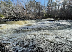
Stepstone Falls via Ben Utter Trail
5.02.64 mi / 125 ft gainStepstone Falls via Ben Utter Trail is an out-and-back trail that takes you by a waterfall located near West Greenwich, Rhode Island.Read more -
Chilmark, Massachusetts
Menemsha Hills Reservation Loop
5.02.98 mi / 344 ft gainGPS service in densely wooded areas on the Vineyard is hard to come by, so plugging in Menemsha Hills Reservation before getting on the road is advised. Traveling down N Road, you'll find an unmarked gravel road located between Turtle Cove and Trustees Lane. A short 400 meter drive will take you ...Read more -
Acton, Massachusetts
Hike the Pratt's Brook Conservation Area Loop
4.01.5 mi / 85 ft gainPark in the small parking area right before the trailhead. *Notice this parking area is small and only fits about 3-4 cars so prepare to find street parking on a busy day. You can punch in the coordinates to a GPS if you need help finding it: 42.4545482, -71.4358192. The loop is very diverse wit...Read more -
South Kingstown, Rhode Island
Hike the Osprey Point Loop on Trustom Pond
2 miCareful on the drive in for deer! From the parking lot head right around the Farm Field Loop Trail then continue to your right down Osprey Point Trail (0.8 miles). This is where you will most likely see the deer up close. Continue to your right to the Osprey Point Overlook, which will (on a clear...Read more -
Hopkinton, Rhode Island
Hike to Long Pond & Ell Pond
5.05.7 miLong & Ell Pond is a favorite hike at any time of the year, but it is not for the faint of heart (or small children)! The path immediately becomes more of a rock-scrambling adventure than a hike, but the views are so worth it. This GPS address will lead you down a dirt road but you should ea...Read more -
Voluntown, Connecticut
Hike Pachaug State Forest Trails
5.03.6 mi / 200 ft gainLawden Brook Trail Loop is a 3.6 mile loop hike that takes you by a lake located near Voluntown, Connecticut.Read more -
Plainfield, Connecticut
Hike Sugar Brook Loop Trail
4.03.3 mi / 200 ft gainSugar Brook Loop Trail is a 3.3 mile loop hike that takes you by a river located near Plainfield, Connecticut.Read more -
Provincetown, Massachusetts
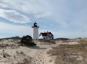
Explore Hatches Harbor and Race Point
5.03.3 miHatches Harbor & Race Point Lighthouse trail is not super long or difficult. Pretty straight forward, at least up to Hatches Harbor. There is a small parking lot that fits about six cars off Province Lands Rd. I think we had a good amount of rain leading up to that day and the trail reflect...Read more -
Edgartown, Massachusetts
Hike Huckleberry Barrens Trail
0.5 miThe Huckleberry Barrens property is a 17 acre expanse of land in Katama, MA managed by the Sheriff's Meadow Foundation. Though the property is quite vast, the trail loop is only approximately 0.5 miles. Quite conveniently, If you're looking to extend your walk, run or bike, there is an opening ha...Read more -
Westerly, Rhode Island
Grills Preserve
4.04.27 mi / 351 ft gainGrills Preserve is a loop trail that takes you by a lake located near Bradford, Rhode Island.Read more -
Provincetown, Massachusetts
Hike Provincetown Dunes on the Cape Cod National Seashore
4.82.8 mi / 287 ft gainBegin your journey from a small parking area that holds 3 cars just off route 6 (additionally you can park on the side of the road) The trail head is unmarked until about 50' into the woods where you will find a sign describing the rich history of the area. Continue up the large sand dune immedia...Read more


