Holyoke, Massachusetts
Looking for the best hiking in Holyoke? We've got you covered with the top trails, trips, hiking, backpacking, camping and more around Holyoke. The detailed guides, photos, and reviews are all submitted by the Outbound community.
Top Hiking Spots in and near Holyoke
-
Berlin, Connecticut
Hike the Ragged Mountain Memorial Preserve
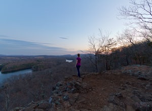
4.55.5 mi / 560 ft gainRagged Mountain main loop is approximately 5.5 miles long, and is known for its expansive bare-rock vistas, vertical cliff faces, and scenic views overlooking cliff-side reservoirs and ponds. The trail is rated moderate, with some flat stretches among the trees, mixed with some uneven rocky foot...Read more -
Westminster, Massachusetts
Summit Mt. Wachusett via the West Side Trail
5.01.2 mi / 750 ft gainSet your GPS to Wachusett Mountain ski area. Coming from Rt. 2 turn onto Mile Hill Rd and look for your first right to take Bolton Rd. Take this road all the way until it intersects with West Princeton Rd. Turn left. and drive down W Princeton Rd for 1.2 miles and there should be a small parkin...Read more -
Sheffield, Massachusetts
Hike to Race Brook Falls
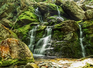
4.03.4 mi / 1174 ft gainHiking along the Appalachian trail I made a detour in Mt Everett State reservation. About a 2.5 mile detour lead me down to a beautiful 100ft waterfall called Race Brook falls. The waterfall felt made me feel like i was in the tropical jungle in Hawaii. Adding to the beauty of the waterfall were ...Read more -
Williamstown, Massachusetts
Hike the March Cataract Falls Trail
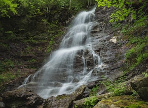
4.02.2 mi / 511 ft gainPark at the Junction of Sperry Rd and Rockwell Rd. To get to the trailhead, hike along Sperry Road for about 30 minutes. (Not to the end of the road, see map below.) Then hike along the March Cataract Trail, an out-and-back. You can bring dogs on leash. The trail is short but steep in some parts ...Read more -
Canaan, Connecticut
Explore Great Falls
3.00.5 miStumbled upon Great Falls in the Falls Village section of Canaan, CT. The stunning 50ft waterfall doesn't disappoint. very easy hike from parking lot, you must cross the river in order to get close for bottom view. Hop on top of turtle rock and relax as the waterfall tumbles in the distance.Read more -
Williamstown, Massachusetts
Hike Mt. Greylock via Money Brook Trail
9.7 mi / 3034 ft gainPark in the parking lot on Hopper Rd. Walk to the end of the road where you will find the Hopper Trailhead. Take the right fork. The Money Brook trail will take you to a waterfall, the Mt. Greylock summit, and back to the end of Hopper Rd. The trail is long but worth the hike, exploring parts of ...Read more -
Mount Washington, Massachusetts
Guilder Pond and Mount Washington Lookout Trail
3.92 mi / 909 ft gainGuilder Pond and Mount Washington Lookout Trail is a loop trail that takes you by the lake located near Copake Falls, New York.Read more -
Salisbury, Connecticut
Bear Mountain Loop
4.56.05 mi / 1516 ft gainAt 2,316 feet, Bear Mountain is the highest peak in Connecticut. The peak is about a half-mile south of the Massachusetts state line on the Appalachian Trail. The views are great. On a clear day you can see some of the peaks in southern New Hampshire. The remnants of a stone tower are on the summ...Read more -
Middlesex County, Connecticut
Hike to Glen Falls
5.00.75 miAccessing Glen Falls may be a little tricky at first. Parking will be very minimal, you will park on Grist Mill Ln. Hop onto the road and you will see the trail map on the left side. The adventure begins when you cross the street and go through the gate with the yellow blaze symbol. Keep followin...Read more -
Mount Washington, Massachusetts
Mount Frissell and Brace Mountain Loop Trail
5.08 mi / 807 ft gainMount Frissell and Brace Mountain Loop Trail is a loop trail where you may see beautiful wildflowers located near South Egremont, Massachusetts.Read more -
Douglas, Massachusetts
Hike the Coffeehouse Loop, Douglas State Forest
3.02.2 mi / 500 ft gainDouglas State Forest is located off of Rte 16 in south central Massachusetts. To access trails and the lake, head to the parking area on Wallum Lake Park Road. From the parking lot, you can access the Coffeehouse Loop Trail, as well as a few other shorter trails by the lake. The Coffeehouse Loop ...Read more -
Mount Washington, Massachusetts
Explore Bash Bish Falls
4.21 miOne of my favorite walks to a spectacular falls. The trail is easy to follow and one mile from NY parking lot and 0.5 from the parking lot. The apparent place to swim. There are several very nice, family safe swimmable pools in the creek above and after the falls. There are signs at the top of t...Read more -
Salisbury, Connecticut
Explore Riga Falls
The best part of the adventure is finding this hidden gem also known as Riga Falls. Riga Falls is actually one of Connecticut's lesser known waterfalls, but arguably the most scenic. A helpful hint is that the waterfall lies beside dirt road, keep your ears open! I've already said too much, happy...Read more -
Meriden, Connecticut
Higby Mountain Trail
2.11 mi / 486 ft gainThe popular route for this hike is to park your car at the base of the trail which is located right before merging onto 91-S in Middlefield, CT. The parking lot does seem to get crowded mid-day, especially if the weather is nice! The beginning of the hike is mostly flatter land and an incline w...Read more -
Middletown, Connecticut
Explore Wadsworth Falls
5.00.25 miWhen it comes to exploring Wadsworth Falls its ease of access couldn't be better. As soon as you pull into the parking lot you hear the falls roaring. Take the quick walk to see the picturesque scenery.Facts about Wadsworth Falls:Height: 25ft tall and doubled in width Rock: Hampden Basalt -the ro...Read more -
Franklin, Connecticut
Hike Baileys Ravine at Ayer's Gap Preserve
1.6 mi / 314 ft gainIt's steep and rocky in the beginning but it levels out after a while! When standing in the parking lot, the trailhead is hidden! Look to the right. The trail ends on Ayer's Road so you have to walk back a little ways on the road.Read more

