Joliet, Illinois
Looking for the best photography in Joliet? We've got you covered with the top trails, trips, hiking, backpacking, camping and more around Joliet. The detailed guides, photos, and reviews are all submitted by the Outbound community.
Top Photography Spots in and near Joliet
-
Lemont, Illinois
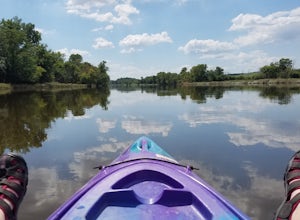
Kayak the Des Plaines River
Not the easiest to get in or out of the river at this location, but it works, at least for a kayak. Look out for people using the Centennial trail, and those fishing nearby. Be careful and if you are able, wear good shoes or sandals (not flip flops) with some tread as it can get muddy. Nearby thi...Read more -
Willow Springs, Illinois
Black Oak Trail
4.52.64 mi / 148 ft gainThe trails traverse a rolling glacial highland of oak woods and prairie. The hiking trails connect to miles of multi-use trails where you can hike, mountain bike, cross country ski and snowshoe. Lastly, there is an interpretive center with exhibits about local nature and history. The trailhead...Read more -
Lisle, Illinois
Hike the Morton Arboretum's Main Trail Loops
5 mi / 0 ft gainThe Morton Arboretum is located off of Route 53 in Lisle, IL. The arboretum spans both the east and west sides of the road. Head to the east side of the park to access the Main Trail Loops. Visitors have to pay a small fee to enter the arboretum ($14 April through November, $9 December through Ma...Read more -
Oak Brook, Illinois
Run the Fullersburg Woods Loop
4.76 miThis is a six-mile loop along the banks of the Salt Creek in Oakbrook, IL. The flat trail features trees and wildflowers (great walk to do in autumn). Trail is also good for bike riders. There is a picnic area and the Graue Mill and Museum. Graue Mill is 150 years old and played a part in the Und...Read more -
Brookfield, Illinois
Salt Creek Greenway Trail
13.99 mi / 551 ft gainThis trail is almost 7 miles one-way (14 miles out-and-back) of paved path, makes for an ideal biking (especially those of us with road bikes), skating, and even running path. The trail runs out-and-back along the Salt Creek in Brookfield, IL. The trailhead is right near the Brookfield Zoo (for a...Read more -
Chicago, Illinois
Luire Garden
0.18 mi / 10 ft gainVisiting Chicago I was on a mission to find a great outdoors spot to be in. This definitely fulfilled my goal of finding a beautiful garden to hangout in! There are plenty of different paths and areas to explore just within the city! Location Located in Millennium Park it will be easy to find,...Read more -
Des Plaines, Illinois
Watch the Sunset at Axehead Lake
In a large city, it's nice to be able to find pockets of nature oasis amidst the chaos. It's great to come here with a journal or sketchbook and pass the time while watching the sunset. Fishing is available at this lake and there is a forest preserve that has a couple small trails.Read more -
Evanston, Illinois
Catch a Sunrise at The Lakefill
5.0From the Northwestern University campus, head to the Ryan Center for the Musical Arts to access the southern-most section of The Lakefill. If driving, parking is usually available nearby on Sheridan Road, to the southwest of The Lakefill. Once at the Ryan Center, take the pedestrian bridge on the...Read more -
Gary, Indiana
Hike the Dune Succession Trail, Indiana Dunes National Lakeshore
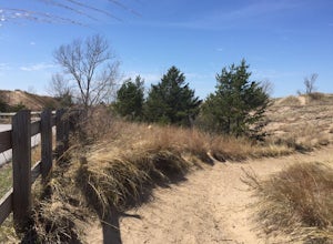
4.51 mi / 150 ft gainThis hike provides a great opportunity to explore the variable landscape and terrain in Indiana Dunes National Park. From the parking lot head north on a paved walkway toward Lake Michigan's shoreline. Next, walk down the boardwalk to the beach. Once you reach the coast, you'll have amazing view...Read more -
Oglesby, Illinois
Hike to Starved Rock's La Salle Canyon
4.34.4 mi / 370 ft gainThis out-and-back trail is one of the parks longest trails. Starting from the visitors center it is 2.2 mile hike one way and 4.4 miles if you go out and back. The trail is very much worth the long trek. You enjoy the views and fresh air of the Illinois river. You will also walk past the Illinois...Read more -
Oglesby, Illinois
Hike to Wildcat Canyon at Starved Rock SP
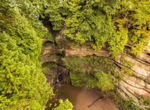
4.52 miIf you happen to find yourself in the Chicagoland area be sure to check out the Wildcat Canyon hike at Starved Rock State Park. This is a 2 mile out and back hike from the visitor's center that leads to the largest waterfall in the park. There are two viewpoints from the top of the canyon or yo...Read more -
Oglesby, Illinois
Hike Starved Rock's French Canyon
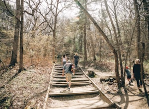
4.50.4 miStarting from the visitors center or the parks restaurant, depending on where you parked. If you were forced to park by the restaurant because of a busy day, you will start the trail head with a map of the park. You will follow the tallest stairs of the park down to the visitors center where the ...Read more -
Oglesby, Illinois
Hike Ottawa Canyon at Starved Rock State Park
5.03.9 miThis canyon is not as popular as some of the others in this park but it is my favorite by far. You can either hike the full 3.9 miles from the visitor center or you can jump in your car and head over to one of the parking lots on the east side for a shorter hike. Either way you will not be disap...Read more -
Oglesby, Illinois
Hike to St. Louis Canyon at Starved Rock State Park
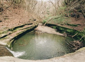
5.03 miStarved Rock has some very interesting rock formations you can explore. The valley was formed by a series of floods as glacial melt waters broke through moraines, sending torrents of flood water surging across the land that eventually eroded the sandstone and sedimentary rock. If you arrive in ...Read more

