Chatsworth, Georgia
Top Spots in and near Chatsworth
-
Rising Fawn, Georgia
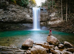
Cloudland Canyon's Waterfall Trail
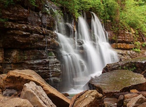
4.91.21 mi / 325 ft gainWhen you enter Cloudland Canyon State Park you will drive straight through all of the 4 way stops for about 1 mile before you reach the parking lot for the Waterfall Trail. The parking area does have restrooms and picnic tables if you would like to bring a lunch. What goes down must come up! I...Read more -
Cartersville, Georgia
Pine Mountain Loop
4.62.11 mi / 597 ft gainThe Pine Mountain Trail winds and climbs its way to awesome summit views, along massive granite outcrops and serene forest. Hike over wooden bridges, across sparkling streams, past misty waterfalls & rock outcroppings, varied forest, scenic overlooks, & leaping deer. This local gem is tuc...Read more -
Rising Fawn, Georgia
Camp at Cloudland Canyon State Park
4.8If you're looking to camp somewhere with exceptional hiking and beautiful waterfalls, Southeastern Tennessee locals know not to look further than Lookout Mountain. Located on the western edge, Cloudland Canyon State Park straddles Sitton Gulch Creek and is perfect for a weekend exploration.If sta...Read more -
Rising Fawn, Georgia
Hike Sitton's Gulch Trail
5.05.7 mi / 1060 ft gainHiking Sitton's Gulch is a great option for those who want to get a little more distance than what the 2.1 mile Waterfalls trail has to offer. This bit of extra distance will separate you from a lot of the weekend crowd and will expose you to two more waterfalls, in addition to Cherokee and Heml...Read more -
Chattanooga, Tennessee
Mountain Bike Raccoon Mountain
5.0Raccoon Mountain is an extensive, yet newer system of singletrack that circle the TVA Raccoon Mountain pumped storage facility, just 15 minutes east of downtown. The 30 miles of trails primarily span from intermediate to advanced levels, but a few beginner friendly routes can be found as well.Gra...Read more -
Signal Mountain, Tennessee
Hike to Rainbow Falls
4.75.7 mi / 1500 ft gainMost Rainbow Lake Trail hikers have seen or heard the majestic Rainbow Falls, but fewer have ventured down the treacherous path to the falls themselves. Albeit a bit daunting, especially if there has been recent rain, the path from Rainbow Lake Trail down to Rainbow Falls is a rewarding trek for ...Read more -
Chattanooga, Tennessee
Hike and Swim at the Middle Creek Slide
3.04 mi / 200 ft gainYou park just west of the map waypoint on the wide shoulder (remember to lock your car, thefts have been reported in this area). The trailhead is really just an opening on the side of the road. Follow this to the creek and start making your way along the rocks upstream. The difficulty of the cl...Read more -
Signal Mountain, Tennessee
Hike to Edwards Point
4.75.8 mi / 50 ft gainThe Signal Point to Edwards Points trail serves as the southernmost leg of the Cumberland Trail, winding through part of the Chickamauga and Chattanooga National Military Park. From the initial Signal Point overlook, the path descends into Middle Creek Gorge, passes through the Rainbow Lake Wilde...Read more -
Soddy-Daisy, Tennessee
Hike the Hogskin Loop to Stripmine Falls
2.51.3 miStripmine Falls is not the biggest waterfall in the area, but it is both beautiful and accessible with just a short and easy out-and-back (or loop) hike. The additional attraction of cool swimming pools along Chickamauga creek make this an ideal destination for a day full of relaxation and adven...Read more -
Soddy-Daisy, Tennessee
Bouldering Stone Fort, TN
4.50.25 miStone Fort sits atop the Cumberland Plateau just half an hour from downtown Chattanooga, and is one of the premiere bouldering locations in the Southeast. One of the three sites of the annual Triple Crown Bouldering competition, Stone Fort offers a wealth of climbing problems for any climber's a...Read more -
Soddy-Daisy, Tennessee
Hike the Hogskin Upper and Lower Loop
5.01.4 miAfter an easy 25 minute drive from Chattanooga you will reach North Chickamauga Gorge on Montlake Road in Soddy Daisy. Park any where in the gravel loop just make sure other cars can get through. From the Montlake Road Trailhead Kiosk the trail begins on an old mining road. Hogskin Upper Loop Tr...Read more -
Chattanooga, Tennessee
Hike to Middle Creek Falls
3.50.5 miMiddle Creek Falls, despite its proximity to the Cumberland Trail hikes, has no official designated trail. However, there is a pull-off on Suck Creek Road (informally marked by graffiti and bumper stickers adorning the guard rail) with room on either side of the street to park. The trail begins ...Read more -
Murphy, North Carolina
Hike to Panther Top Fire Tower
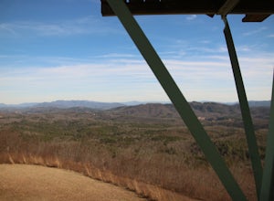
1.5 mi / 450 ft gainThe Panther Top fire tower is located in the Nantahala National Forest outside of Murphy, NC. To get there you get off of US 74 then turn onto panther top rd and continue till you see the signs for the tower. Once you get there the hike is about .75 there mostly up on the way to the top of the to...Read more -
Acworth, Georgia
Hike and Swim at Red Top Mountain
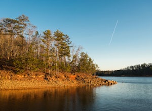
4.54.74 mi / 472 ft gainThe Georgia summer is no joke. Fortunately, Red Top Mountain's Homestead Trail hosts enough shade and swimming for all adventurers. The 5.5 mile loop is located on a large peninsula stretching out into Lake Allatoona. Hikers enter a lush forest of wildlife and will encounter moderate elevation...Read more -
Cartersville, Georgia
Camp at Red Top Mountain State Park
4.5Red Top Mountain State Park finds itself just 30 minutes up I-75 from the urban sprawl of Atlanta, and it is surprising how quickly you can forget exactly how close you are to the city with just one night of camping here. The State Park has a range of activities to offer, so there is bound to be...Read more -
Euharlee, Georgia
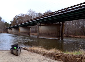
Paddle the Lower Etowah (Euharlee Road to 411)
The nine mile stretch of river between Euharlee Road and 411 provides a beautiful getaway near Cartersville. As it sits downstream of Allatoona Lake, this is considered the Lower Etowah, and the temperament of the current depends largely on whether or not the Corps is releasing water upstream fro...Read more

