Chatsworth, Georgia
Looking for the best camping in Chatsworth? We've got you covered with the top trails, trips, hiking, backpacking, camping and more around Chatsworth. The detailed guides, photos, and reviews are all submitted by the Outbound community.
Top Camping Spots in and near Chatsworth
-
Chatsworth, Georgia
Hike the Gahuti Trail
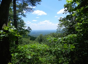
4.08.1 mi / 1223 ft gainFort Mountain rises prominently from the plateau to the West, serving as the start of the Blue Ridge Mountain range in Georgia. The Gahuti Backcountry Trail circumnavigates the mountain, with several overlooks with views in all directions. At 8.1 miles, this hike is moderately difficult, but can...Read more -
Chatsworth, Georgia
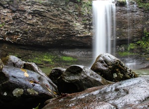
Emery Creek Falls
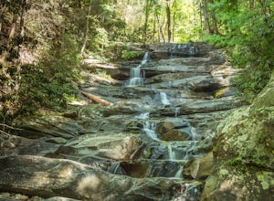
5.05.9 mi / 833 ft gainThe hike to the five waterfalls on the Emery Creek trail is one of the most spectacular hikes in Georgia. This trail is moderate in climb, yet secluded in the Cohutta Wilderness and challenging enough to keep crowds away. Two things to note about this trail: it is wet (there are 20 creek crossing...Read more -
Benton, Tennessee
Watch the Sunset from Sugarloaf Overlook
The overlook is easily accessible from a parking circle located off Oswald Road. Follow U.S. Highway from Ocoee, Tennessee for 8 miles then turn left onto Oswald Road. Follow Oswald Road for 2.5 miles until you encounter the overlook on your left. The overlook will be clearly marked with signage....Read more -
Morganton, Georgia
Camp at Morganton Point
Morganton Point Campground is one of the most well-maintained campgrounds in North Georgia. There are sites available for both RVs and tents, but the tent section is separate from the RV area so don't worry about any noisy generators! I camped at Site F, a tent-only campsite. This campsite (and ...Read more -
Dawsonville, Georgia
Hike to Springer Mountain
3.519 mi / 4346 ft gainBegin your journey from Amicalola Falls State Park. Despite the steep climb, you should park at the base of the falls and climb the steps for a great view of one of the grandest falls in the South. (For more on that hike, see: "Climb the Stairs to Amicalola Falls"). From the top of the falls, fol...Read more -
Summerville, Georgia
Hike the Marble Mine Trail
4.31.7 mi / 200 ft gainThis 1.7 mile loop is almost entirely on a wide pebbled road making this hike perfect for getting families and friends outdoors. Though there is some elevation gain, the Marble Mine Loop is quite an easy walk. Go during the Fall and the trees are boasting all the reds, oranges, and yellows of the...Read more -
Rising Fawn, Georgia
Cloudland Rim Loop via East Rim Campground
4.66 mi / 873 ft gainCloudland Rim Loop via East Rim Campground is a loop trail in Cloudland Canyon State park, which offers up stunning vistas and several waterfalls. This trail is located near Rising Fawn, Georgia.Read more -
Rising Fawn, Georgia
Hike the West Rim Trail to Cherokee Falls
4.54.77 mi / 814 ft gainGood luck finding something you dislike about Cloudland Canyon State Park - one of Georgia's largest and most scenic parks. Sitting on the western edge of Lookout Mountain, it is home to a plethora of luscious trails, easily-accessible campgrounds or yurts, and flowing waterfalls. The West Rim L...Read more -
Rising Fawn, Georgia
Camp at Cloudland Canyon State Park
4.8If you're looking to camp somewhere with exceptional hiking and beautiful waterfalls, Southeastern Tennessee locals know not to look further than Lookout Mountain. Located on the western edge, Cloudland Canyon State Park straddles Sitton Gulch Creek and is perfect for a weekend exploration.If sta...Read more -
Soddy-Daisy, Tennessee
Hike the Hogskin Upper and Lower Loop
5.01.4 miAfter an easy 25 minute drive from Chattanooga you will reach North Chickamauga Gorge on Montlake Road in Soddy Daisy. Park any where in the gravel loop just make sure other cars can get through. From the Montlake Road Trailhead Kiosk the trail begins on an old mining road. Hogskin Upper Loop Tr...Read more -
Cartersville, Georgia
Camp at Red Top Mountain State Park
4.5Red Top Mountain State Park finds itself just 30 minutes up I-75 from the urban sprawl of Atlanta, and it is surprising how quickly you can forget exactly how close you are to the city with just one night of camping here. The State Park has a range of activities to offer, so there is bound to be...Read more -
Blairsville, Georgia
Camp at Vogel State Park
5.0Nestled at the foot of Blood Mountain is one of Georgia's most scenic State Parks. With over 90 campsites and 35 charming cottages, 17 miles of hiking trails, a beautiful alpine lake, and a charming waterfall, Vogel State Park highlights all of the best things that North Georgia has to offer. T...Read more -
Blairsville, Georgia
Appalachian Trail from Blood Mountain to Cowrock Mountain
4.014 mi / 2907 ft gainNorth Georgia is packed with awesome mountain trails, but few boast the beauty and magnitude of the Appalachian Trail. The hike from Blood Mountain to Cowrock Mountain is one of the more scenic sections of the AT in Georgia, in terms of mountain views. Do this hike as a full day hike, or spread ...Read more -
Blairsville, Georgia
Blood Mountain via Byron Reece Trailhead
4.74.34 mi / 1447 ft gainThe Chattahoochee National Forest and Cohutta Wilderness make up the wild and scenic southern tip of the Blue Ridge Mountains. The Blood Mountain trail offers the day hiker a taste of the Appalachian Trail that does not disappoint. The hike starts at the Byron Reece trailhead at Neels Gap where ...Read more -
Cleveland, Georgia
Hike to Desoto Falls, Georgia
3.72 miThe Chattahoochee National Forest is another kind of jungle. On hot summer days well over 95 degrees, the forest canopy provides a shelter for human and wildlife alike. Here adventurers can enjoy hiking the Desoto Falls trail(s), try their luck at fishing, or take in the solitude of the North Ge...Read more


