Suffield, Connecticut
Top Spots in and near Suffield
-
Meriden, Connecticut
Hike the Metacomet, Blue, and Yellow Loop
5.04.5 mi / 976 ft gainStart from the Castle Craig road entrance. Walk until you're greeted by a beautiful reservoir. You'll notice the strange but beautiful Mine Island in the middle of all this. You'll also notice markers for White Trails and Yellow Trails. The White Trail is an easier/wider trail. The Yellow Trail C...Read more -
Litchfield, Connecticut
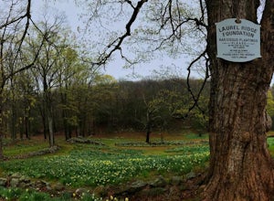
Photograph Daffodils at Laurel Ridge
Laurel Ridge is a private owned Farm , the owners are generous enough to let people visit these flowers so please be respectful of there rules. You may see the Daffodils from Sunrise-Sunset and usually fully bloomed Early April-May. Laurel Ridge is the perfect way to start Spring, the smell and ...Read more -
Deerfield, Massachusetts
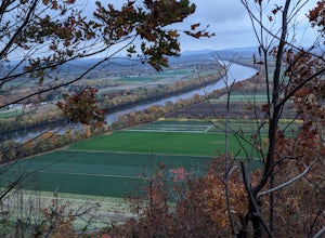
South Sugarloaf Trail
1.48 mi / 404 ft gainSouth Sugarloaf Trail is a loop trail that takes you by a river located near South Deerfield, Massachusetts.Read more -
Franklin, Connecticut
Hike Baileys Ravine at Ayer's Gap Preserve
1.6 mi / 314 ft gainIt's steep and rocky in the beginning but it levels out after a while! When standing in the parking lot, the trailhead is hidden! Look to the right. The trail ends on Ayer's Road so you have to walk back a little ways on the road.Read more -
Great Barrington, Massachusetts
Mt. Wilcox and Beartown Mountain Trail Loop
5.09.29 mi / 981 ft gainMt. Wilcox and Beartown Mountain Trail Loop is a loop trail that takes you by the lake located near Great Barrington, Massachusetts.Read more -
East Haddam, Connecticut
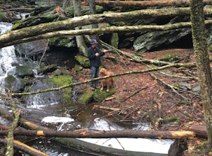
Explore Chapman Falls in Devil's Hopyard SP
4.0If you map to Chapman Falls in East Haddam, CT, you will be brought to a parking lot opposite from the waterfall in Devil's Hopyard, a beautiful Connecticut state park. Once there, it's only a few minute walk down a very clear trail to the base of the 60 foot falls. There's plenty of room to set ...Read more -
Cheshire, Connecticut
Hike to Roaring Brook Falls
1.2 mi / 377 ft gainArriving to the falls, parking is residential but don't worry everyone is friendly. Starting off the hike you will walk past a cool pond where you may be able to see some wildlife. Continuing on, you will follow the marked trail where it will take you further into the woods while gaining elevatio...Read more -
Canaan, Connecticut
Explore Great Falls
3.00.5 miStumbled upon Great Falls in the Falls Village section of Canaan, CT. The stunning 50ft waterfall doesn't disappoint. very easy hike from parking lot, you must cross the river in order to get close for bottom view. Hop on top of turtle rock and relax as the waterfall tumbles in the distance.Read more -
Washington, Connecticut
Hike the Mount Tom Tower Trail
1.3 mi / 337 ft gainStarting from the parking lot of Mt. Tom State Park, hop onto the Tower Trail (yellow trail) which leads more into the woods. During winter time, the trail may be slippery, please use your best judgement and always know your limits. Gaining about 300 feet in total elevation in approximately 1 mil...Read more -
Sharon, Connecticut
Hike the Pine Knob Loop, Housatonic Meadows SP
5.02.5 mi / 770 ft gainThe Pine Knob loop is a 2.5 mile loop trail that takes you through beautiful thick woods filled with vistas, wild flowers and tons of wild life. You will start your adventure at the Pine Knob Trail head where you will be able to a Connecticut Appalachian trail guide. Pine Knob is a blue blaze ...Read more -
Stockbridge, Massachusetts
Laura's Tower and Ice Glen
5.02.4 mi / 676 ft gainYou will park at the end of Park Street in Stockbridge, Massachusetts. From the parking are you will cross a beautiful bridge over the Housatonic River. The trail crosses railroad tracks and immediately begins to climb into the woods. You will reach a split in the trail, a left will take you...Read more -
Great Barrington, Massachusetts
Hike Monument Mountain
4.02 mi / 720 ft gainAt 1642 feet (with a total elevation gain of 720 feet), Squaw Peak is a great spot to see both Mt Greylock along the Vermont border, and the Catskills in New York. There are several trail options here to get to the summit, but no matter which combination you choose, you can keep your trip under ...Read more -
Plainfield, Connecticut
Hike Sugar Brook Loop Trail
4.03.3 mi / 200 ft gainSugar Brook Loop Trail is a 3.3 mile loop hike that takes you by a river located near Plainfield, Connecticut.Read more -
Sheffield, Massachusetts
Hike to Race Brook Falls
4.03.4 mi / 1174 ft gainHiking along the Appalachian trail I made a detour in Mt Everett State reservation. About a 2.5 mile detour lead me down to a beautiful 100ft waterfall called Race Brook falls. The waterfall felt made me feel like i was in the tropical jungle in Hawaii. Adding to the beauty of the waterfall were ...Read more -
Salisbury, Connecticut
Bear Mountain Loop
4.56.05 mi / 1516 ft gainAt 2,316 feet, Bear Mountain is the highest peak in Connecticut. The peak is about a half-mile south of the Massachusetts state line on the Appalachian Trail. The views are great. On a clear day you can see some of the peaks in southern New Hampshire. The remnants of a stone tower are on the summ...Read more -
Hamden, Connecticut
Hike the Tower Trail to the Blue Trail at Sleeping Giant SP
5.03 mi / 518 ft gainSleeping Giant State Park is a place very close to my heart. I spent 4 years right across the street at Quinnipiac University and have hiked “The Giant” more times then I can count and at all different hours. There are a few different trails you can explore but my favorite one is up to the cliffs...Read more

