Pitkin County, Colorado
Looking for the best hiking in Pitkin County? We've got you covered with the top trails, trips, hiking, backpacking, camping and more around Pitkin County. The detailed guides, photos, and reviews are all submitted by the Outbound community.
Top Hiking Spots in and near Pitkin County
-
Carbondale, Colorado
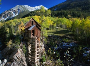
Hike by Lizard Lake to Crystal Mill
5.010 miAlthough the iconic Crystal Mill is the main attraction on this hike, the river that leads you there through the magnificent mountains of the White River National Forest is nothing short of extraordinary.Getting ThereThe hike is located in the small town of Marble, about 40 minutes east of Carbon...Read more -
Leadville, Colorado
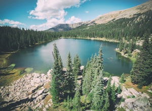
Savage Lakes Trail
5.03.97 mi / 1299 ft gainThe majority of this hike traverses through the beautiful forest that is part of the Holy Cross Wilderness. No significant views are to be had until you've climbed 1,300 ft over 2. miles and reach lower Savage Lake. The trail is easy enough to follow with no junctions along the way, and is adjace...Read more -
Crested Butte, Colorado
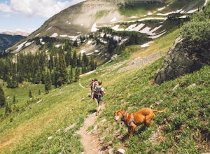
Blue Lake via Oh Be Joyful Campground
12.96 mi / 2201 ft gainOverview: Round Trip is about 13 miles, about 500 ft ascent at the beginning and 1500 ft ascent in the last 1.5 miles. The majority of the hike is flat and through an AMAZING valley. Getting There: Blue Lake Trailhead is located at Oh Be Joyful Campground on Slate River Rd, just across a river,...Read more -
Crested Butte, Colorado
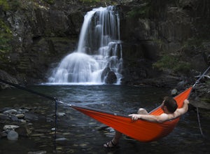
Explore the waterfalls of Oh Be Joyful Creek
If you're not already camping there, park at Oh Be Joyful Campground, about 5 miles up County Road 734 from downtown Crested Butte. There's parking on either side of the river crossing, but you're going to have to get your feet wet anyway, so might as well park in the first parking lot and walk a...Read more -
Crested Butte, Colorado
Hike Oh Be Joyful Pass
16 miFrom Crested Butte, drive north on Gothic Road and turn left on Slate River Road. Drive 4.5 miles on the dirt road and look for the Oh-Be-Joyful Campground which will be on your left. Drive about 0.5 miles to the campground at the bottom of the hill, by a wide river. This trail begins by a quick...Read more -
Leadville, Colorado
Hike Mount Massive
4.8Starting from the Mt Massive Trailhead off of Halfmoon Creek Road (a half mile past the more popular Mt Elbert Trailhead), follow the excellent and easy trail into the woods. This trail is wide and abnormally flat for a 14er trail for the first three miles. During these first 3 miles the only rea...Read more -
Buena Vista, Colorado
Mt. Elbert via Black Cloud Trail
4.510.69 mi / 4967 ft gainDirections: Heading south from Leadville from U.S. 24: West on CO 82 for 10.5 miles to a hidden right turn that leads to a trail head. If you make it to the Mt. Elbert Lodge, you have gone just a bit too far. The parking lot (aka: dirt access) should be relatively empty as everyone tends to hik...Read more -
Leadville, Colorado
Colorado Trail: Mount Elbert Trailhead to Twin Lakes
8.49 mi / 1099 ft gainColorado Trail: Mount Elbert Trailhead to Twin Lakes is a point-to-point trail that takes you by a lake located near Leadville, Colorado.Read more -
Leadville, Colorado
North Mount Elbert Trail
4.59.07 mi / 4432 ft gainStart your trip at the North Elbert Creek trailhead, reached by taking Colorado 300 just south of Leadville, and then a left on County road 11 and a right on Halfmoon Creek road. The dirt road to the trailhead is well traveled. The trail begins from the parking lot and winds upwards past 2 clear...Read more -
Crested Butte, Colorado
Drive Kebler Pass for Fall Colors
5.0Kebler Pass, or Gunnison County Road (GCR) 12, is an excellent place to see fall colors in Colorado. You won't get nearly as much congestion as on Independence Pass in Aspen, but you get just as many yellow and amber leaves. The road is dirt but passable by any vehicle–although because it's at ov...Read more -
Buena Vista, Colorado
Summit Mount Huron
6 mi / 3500 ft gainThere are some dispersed campsites along side the 4x4 road that leads to the trailhead. Ideally you can sleep here to get an early start to your hike in the morning, to avoid the afternoon storms that frequent the mountains. The 4x4 is rough in spots, though my Subaru Outback did make the trek un...Read more -
2203-2407 County Road 12, Colorado
Camp at Kebler Pass
4.5Camping on Kebler Pass begins at around GPS: 38.89575, -107.214655. The pass is only available during the warmer summer months but is quite the treat. We went in August to catch an eclipse and the rolling free hills made it a great place to view from. You pass a reservoir on your way in where man...Read more -
Leadville, Colorado
Mountain Bike the Colorado Trail near Mount Elbert
This is the way to see fall colors if you're into empty trails and endorphins. Grind up the trail starting from South Elbert Trailhead. You'll turn right onto the Colorado Trail at .3 miles and stay here for as long as you like, or 7.3 miles to the Mount Elbert Trailhead. Turn around and go back ...Read more -
Buena Vista, Colorado
Hope Pass via Willis Gulch
5.08.75 mi / 3297 ft gainHope Pass is accessed from the Willis Gulch trailhead about 25 miles outside of Leadville, Colorado. To get to the trail head, follow Highway 24 East for about 16 miles until you arrive at the junction for Highway 82. Turn right and follow Highway 82 for about 8.3 miles. You will see a sign on th...Read more -
Carbondale, Colorado
Explore Hayes Creek Falls
3.50 miRight off of Highway 133 about 2 miles south of Redstone, lies a very easy-to-get-to Waterfall. Park your car off to the side of the highway, walk about 100 feet and you will find this glorious waterfall. The fall is best to see in the late Spring to early Summer. From late Spring, to early Summe...Read more -
Carbondale, Colorado
Mountain Bike Prince Creek
Turn south off Colorado State Highway 82 onto Highway 133 toward Carbondale. Continue south past the Carbondale Main Street roundabout. After two miles, turn East onto Prince Creek Road. Follow this four miles to where the pavement ends. This is the best place to park to start biking or running.F...Read more

