Golden, Colorado
Top Spots in and near Golden
-
Evergreen, Colorado
Evergreen Mountain Loop
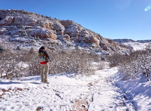
4.75.89 mi / 0 ft gainThe way up Evergreen Mountain is actually a few different trails stitched together throughout Alderfer/Three Sisters Park. The trail connects to both parking lots in the park, so if one is full you can just start from the other one, giving you lots of options for a quick day-hike. If you start ...Read more -
Evergreen, Colorado
Private and Tranquil Retreat at Beaver Brook Watershed
4.0Note: This is NOT the Beaver Brook Trail in Genesee Park/Lookout Mountain! If you enjoy the scenery and ambiance of Evergreen, but Evergreen Lake has become too crowded for your tastes, Beaver Brook Watershed (owned by the City of Golden) is an excellent alternative. It’s a small, secluded area a...Read more -
Boulder, Colorado
Hike the Flatirons Vista Loop Trail
4.73.3 miFrom the parking lot, take South Flatiron Vista Trail for 2.4 miles, where you'll cross onto North Flatiron Vista Trail. In 1 mile, take the connector trail back to the trailhead. To shorten the loop to 2 miles, hike South Flatiron for just 1 mile to Prairie Vista Trail, which leads back to the c...Read more -
Golden, Colorado
Hike Beaver Trail in Golden Gate Canyon State Park
2.3 mi / 1046 ft gainThis trail starts off at Slough Pond, a great fishing pond or picnic spot. The trail starts out tree-covered. After a few tenths of a mile you have the choice to go clockwise or counter-clockwise. If you go counter-clockwise you have about 3/4 of a mile of steep uphill hiking to do (the Park rate...Read more -
Golden, Colorado
Hike the Blue Grouse Trail Loop
3.06 mi / 400 ft gainStart the hike at the Blue Grouse Trailhead located next to Kriley Pond. Travel along Blue Grouse Trail for 0.7 miles until you reach a fork in the trail at Mule Trail where you will take a right. Along the Mule Trail you will travel up a series of switch backs before the trail levels out and you...Read more -
Boulder, Colorado
Hike the Rattlesnake Gulch Trail
4.35.3 mi / 1304 ft gainRattlesnake Gulch Trail is located in Eldorado Canyon State Park. It is a short 20 minute drive from Boulder and is one of three hikes in the park. You will need to pay an entrance fee to get inside to the park which costs $8. The trail is approximately 2.8 miles one way and carries a consistent ...Read more -
Boulder, Colorado
Rattlesnake Gulch Trail
3.49 mi / 1093 ft gainRattlesnake Gulch Trail is a loop trail that takes you by a river located near Eldorado Springs, Colorado.Read more -
Boulder, Colorado
Hike the Eldorado Canyon Trail
4.56.3 mi / 1875 ft gainEldorado Canyon Trail makes for a great day hike, with great views and a steady, challenging uphill – bring lots of water!For something shorter, try Streamside Trail (1 mile roundtrip), Fowler Trail (1.4 miles), or Rattlesnake Gulch (2.8 miles). Streamside, appropriately, leads you alongside a cr...Read more -
Boulder, Colorado
Rock Climb Supremacy Rock in Eldorado Canyon
5.0This is a great spot for beginner climbers, as long as you have an experienced climber with you to anchor the top rope and belay you. It is in a beautiful state park, Eldorado Canyon, in Boulder, Colorado. This canyon is famous for rock climbing and attracts climbers from around the country. Many...Read more -
Boulder, Colorado
Doudy Draw Trail
4.37 mi / 433 ft gainDoudy Draw Trail is an out-and-back trail where you may see beautiful wildflowers located near Boulder, Colorado.Read more -
Boulder, Colorado
Hike Bear Peak
4.87 mi / 2810 ft gainThe best advice I can give you? Wake up early to start this hike.Even though the Bear Peak hike will only take you about 4-5 hours round trip, it will still be advantageous to get off the mountain before afternoon and evening storms might pass through. This is a steep 7-mile out and back trail.St...Read more -
Boulder, Colorado
Hike South Boulder Peak
4.56.7 mi / 2900 ft gainStarting at the Mesa trailhead, continue a half a mile through a relatively even grade before arriving at the North Fork Shanahan trailhead, which will take you another half a mile on much steeper grade up to Fern Canyon where you will start a much harder portion of the hike; here, you'll head st...Read more -
Boulder, Colorado
Hike the Big Bluestem Trail Loop
4.04.35 mi / 841 ft gainThis is a great spot for an easy/moderate hike or trail run. The trail is accessible year round and can often be hiked in winter as well as other seasons. You start out at the Mesa Trailhead parking lot off of Hwy 170. There is a parking lot here but this is a starting spot for several hikes into...Read more -
Littleton, Colorado
Hike the Coyote Song-Swallow Trail Loop
3.83 mi / 350 ft gainWe all love to live our weekends to the fullest, but say you're itching for an adventure and it's midweek with the weekend still a good 3 or 4 days away? South Valley Park is the place to go if you're looking for an after-work adventure or just don't feel like driving too far from the city. A sho...Read more -
Denver, Colorado
Washington Park Loop
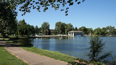
2.34 mi / 72 ft gainWashington Park in located near Denver South High School is the perfect spot for a run, walk, or an afternoon picnic! This paved loop is just over 2 miles and offers up scenic views of both Grasmere Lake and Smith Lake. This is also a family-friendly destination with a playground for the kids and...Read more -
Evergreen, Colorado
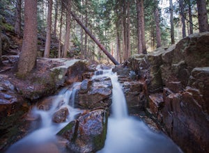
Maxwell Falls
3.43.95 mi / 928 ft gainLocated just outside of Evergreen, this beginner hike is a great escape from the city for a few hours. There are three different options to hike to the falls: Maxwell Falls Lower Trail (4 miles), Upper Maxwell Falls Trail (1.1 miles), and Maxwell Falls Bluffs Cliffside Trail Loop (5 miles). On th...Read more

