Frisco, Colorado
Looking for the best hiking in Frisco? We've got you covered with the top trails, trips, hiking, backpacking, camping and more around Frisco. The detailed guides, photos, and reviews are all submitted by the Outbound community.
Top Hiking Spots in and near Frisco
-
Idaho Springs, Colorado
Hike St. Mary's Glacier
4.32 mi / 467 ft gainJust West of Idaho Springs on I-70 take the St. Mary's Alice Exit. Take a right and stay on the main road and follow the signs for about 8 miles (watch on the right side of the road for a surprise pink pig). There are two parking lots for the trailhead. The larger one is South of the trail and a ...Read more -
Leadville, Colorado
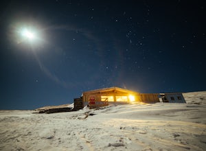
Ski or Snowshoe to the Weston Pass Hut
5.013.4 mi / 2400 ft gainYour trip starts at the winter trailhead for Weston Pass, approximately 6.7 miles from the hut. Depending on road conditions, you may be able to cut off a few miles by driving further up the road.In the summer, you can drive all the way to the hut, and enjoy a great basecamp for hiking and trail ...Read more -
Basalt, Colorado
Backpack & Fish at Lake Charles
11 mi / 1700 ft gainI decided to make an Outbound listing for this because the AllTrails listing is incredibly inaccurate. Hopefully you're reading this one! Your adventure starts at the trailhead of Fulford Cave / Fulford Cave Campground in Yeoman Park. Yeoman Park is just past Sylvan Lake State Park and is consid...Read more -
Idaho Springs, Colorado
Hike Chief Mountain, CO
4.54 mi / 1100 ft gainSitting at 11,709’, Chief Mountain is not one of Colorado’s highest peaks, but the views from this mountain are spectacular nonetheless and rival the views of any 14er I’ve climbed. This mountain sits along Squaw Pass Road so you get the luxury of a high trailhead for this peak.To get there, foll...Read more -
Basalt, Colorado
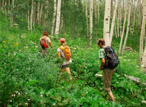
Hike to Eagle Lake, Colorado
5.05.5 mi / 1036 ft gainIf you find yourself back in the Lime Creek area just outside of Eagle, Colorado and south of Sylvan Lake State Park - you should make the time to get yourself up to Eagle Lake! The hike starts off of Brush Creek Road and follows a property line in the forest of Aspens and towering wildflowers fo...Read more -
Idaho Springs, Colorado
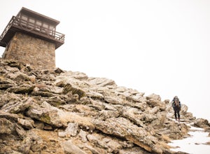
Squaw Mountain Fire Lookout
4.03.92 mi / 791 ft gainCome check out the Squaw Mountain Fire Lookout, a historic spot located in the Mount Evans Wilderness Area of Colorado, and one of the highest lookout towers in the country, at an elevation of 11,486 ft. Just a short drive from the Front Range corridor, you can hike/backpack in to this lookout ar...Read more -
Nederland, Colorado
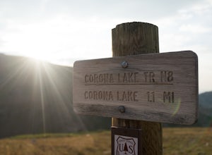
Hike Rollins Pass to Devils Thumb
2.1 mi / 622 ft gainCorona Lake is an easy, short hike if you're pressed for time. It's scenic, secluded, and will put you in a great spot to hike to Devils Thumb the next day. There are two ways to reach Devils Thumb. This is considered the "easier" route because of the "lack of elevation gain." The sun and wind re...Read more -
Nederland, Colorado
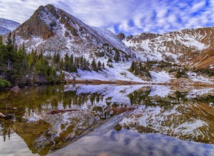
Heart and Rogers Peak Lakes
4.88.62 mi / 2113 ft gainThe hike begins at the East Portal Trailhead outside Rollinsville. Start hiking along the South Boulder trail to the right (north) of the very obvious Moffat Rail tunnel. The trail begins with moderate grades past the Forest Lakes cutoff just 1.25 miles from the trailhead. Continue hiking straigh...Read more -
Nederland, Colorado
3 Crater Lakes via South Boulder Creek
5.06.92 mi / 1804 ft gainAfter turning on to Co. 16 (Tolland Rd.) from 119 at Rollinsville, drive about 8 miles down the dirt road along South Boulder Creek. The road will dead end at Moffat Tunnel where you'll find ample parking in a gravel lot with restrooms. You'll begin your hike along sweeping meadows until you ent...Read more -
Nederland, Colorado
Upper Forest Lakes Trail
7.86 mi / 1778 ft gainUpper Forest Lakes Trail is an out-and-back trail that takes you by a river located near Rollinsville, Colorado.Read more -
Bailey, Colorado
Payne Creek Trail via Brookside McCurdy Trailhead
4.517.98 mi / 3773 ft gainDay 1: Park at the Payne Creek/Brookside Trailhead (8,040 ft.) right outside Bailey. You'll go on the trail for about a mile before the trail parts to Craig Meadows or Craig Park. If you start this in the nighttime, it's best to camp before you part ways on the trail as it's a little more spaciou...Read more -
Leadville, Colorado
North Mount Elbert Trail
4.59.07 mi / 4432 ft gainStart your trip at the North Elbert Creek trailhead, reached by taking Colorado 300 just south of Leadville, and then a left on County road 11 and a right on Halfmoon Creek road. The dirt road to the trailhead is well traveled. The trail begins from the parking lot and winds upwards past 2 clear...Read more -
Nederland, Colorado
Explore the Historic Railroad Route up Rollins Pass
5.0Rollin's Pass Road is a dirt road that follows an old railroad route from the historic town of Tolland, over the Continental Divide, and into Fraser. The road no longer allows you to drive over the summit, due to a partial tunnel collapse, but the road still takes you to within a short hike of th...Read more -
Leadville, Colorado
Colorado Trail: Mount Elbert Trailhead to Twin Lakes
8.49 mi / 1099 ft gainColorado Trail: Mount Elbert Trailhead to Twin Lakes is a point-to-point trail that takes you by a lake located near Leadville, Colorado.Read more -
Leadville, Colorado
Hike Mount Massive
4.8Starting from the Mt Massive Trailhead off of Halfmoon Creek Road (a half mile past the more popular Mt Elbert Trailhead), follow the excellent and easy trail into the woods. This trail is wide and abnormally flat for a 14er trail for the first three miles. During these first 3 miles the only rea...Read more -
Meredith, Colorado
Hike to Chapman Lake
1.6 miFrom downtown Basalt, drive up the Fryingpan River Road 28 miles and turn right on CR #504, also known as Elliot Way, just before Norrie Colony. Drive across the river and up the switchbacks for approximately 3 miles. Take the left fork, continue 1 mile and take the right fork approximately 1/2 m...Read more

