Black Canyon of the Gunnison National Park, Colorado
Looking for the best hiking in Black Canyon of the Gunnison National Park? We've got you covered with the top trails, trips, hiking, backpacking, camping and more around Black Canyon of the Gunnison National Park. The detailed guides, photos, and reviews are all submitted by the Outbound community.
Top Hiking Spots in and near Black Canyon of the Gunnison National Park
-
Ridgway, Colorado
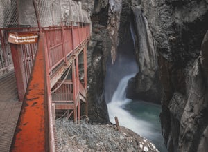
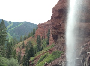
Box Canyon Falls
5.00.57 mi / 243 ft gainBox Canyon Falls is located on the outskirts of Ouray, Colorado less than five minutes from downtown. The nearly 300 foot waterfall crashes through the canyon down to the town's hot springs. The park also features a bridge overlooking the waterfall, river, and the town of Ouray. To get to Box Ca...Read more -
Mesa County, Colorado
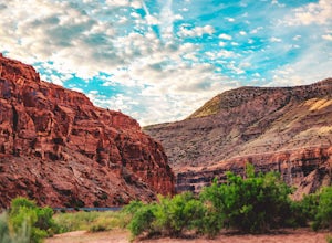
Backpack along the Gunnison River in the Dominguez-Escalante NCA
5.03.4 miIf you're looking to take your first backpacking adventure, but want something that is manageable yet thrilling, this is what you're looking for. Located along the Gunnison River in Western Colorado, the Dominguez-Escalante National Conservation area is easy to access yet full of adventure and be...Read more -
Lake City, Colorado
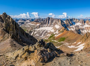
Uncompahgre Peak (14,309')
5.07.3 mi / 2881 ft gainAt 14,309 feet, the summit of Uncompahgre Peak is the highest point in the entire San Juan range, but getting to it requires only good hiking skills, good physical shape, and a four-wheel-drive, high-clearance vehicle to get to the trailhead. From Lake City, head west along the Alpine Loop about...Read more -
Ouray County, Colorado
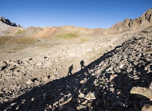
Mount Sneffels via Yankee Boy Basin
5.01.94 mi / 1581 ft gainThe most common route, sometimes called the standard route or the Lavender Col route, begins at or near the top of Yankee Boy Basin, just outside of Ouray. Take the Camp Bird Road as far as you can, though be warned that the last few miles of the road are extremely rough and should only be attem...Read more -
Ouray County, Colorado
Climb Mt. Sneffels via the Southwest Ridge
4.53 mi / 1800 ft gainThere is a great description of this trailhead here: Hike Mount SneffelsThe SW Ridge route of Mt Sneffels is a Class III scramble in the Mount Sneffels Wilderness area of the San Juan Range located between Ouray and Telluride, Colorado. This route is 3 miles RT with 1,800 feet of elevation gain ...Read more -
Ridgway, Colorado
Explore Twin Falls in Yankee Boy Basin
While small, Twin Falls sits in the extremely photogenic backdrop of Yankee Boy Basin. To reach the falls 7.5 miles outside of Ouray follow Camp Bird road for 4.7 miles before taking a right onto Yankee Boy Basin Road. After 2.8 miles you'll reach one of several small parking areas on the left ...Read more -
Lake City, Colorado
Explore Nellie Creek Falls
5.00.8 mi / 300 ft gainNellie Creek Falls is a beautiful little falls, up County Road 23. The waterfall is surrounded by a forest of aspens leading up the valley. To get to the falls take the northern route of the Alpine Loop from Lake City towards Engineer Pass. In about 5 miles you come to Nellie Creek Road on the ri...Read more -
2203-2407 County Road 12, Colorado
Camp at Kebler Pass
4.5Camping on Kebler Pass begins at around GPS: 38.89575, -107.214655. The pass is only available during the warmer summer months but is quite the treat. We went in August to catch an eclipse and the rolling free hills made it a great place to view from. You pass a reservoir on your way in where man...Read more -
Telluride, Colorado
Hike the Jud Wiebe Trail
5.03.1 mi / 1300 ft gainThe Jud Wiebe can be accessed from two trailheads: 1) The top of North Aspen St (opposite direction of the Gondola) and across the bridge on the left (where this adventure starts) 2) North Oak St - hike up Tomboy Road and head to the left at the sign for the Jud Wiebe trail Street parking is ava...Read more -
Telluride, Colorado
Hike to Cornet Creek Falls
4.0Only 5 minutes from the center of Telluride, Cornet Creek Falls is the perfect hike for those seeking a serene mountain escape without having to go far away from the center of all the action.From town, head up North Aspen Street towards the Jud Wiebe Trailhead. Once arrived, continue straight up ...Read more -
Ridgway, Colorado
Running to Grizzly Bear Mine
Bear Creek Trail, which leads to Grizzly Mine, is located just 2 miles outside of Ouray, Colorado on Highway 550 immediately following the first tunnel. There's two parking lots, a large one and a small one, the trail leads from the small parking lot over the tunnel and highway. There are no bath...Read more -
Lake City, Colorado
Capture Fall Foliage and Whitmore Falls on Engineer Pass
5.0Just outside of the small community of Lake City, Colorado is Engineer Pass, a dirt road that has amazing views and opportunities to hike, take pictures, and maybe even explore an abandoned mining town. Four wheel drive or all wheel drive is preferable, but the road can definitely be driven by a ...Read more -
Telluride, Colorado
Hike to Bear Creek Falls in Telluride
5.05 mi / 1000 ft gainThe trail begins at the south end of Pine Street in Telluride, and proceeds 2.5 miles up the Bear Creek Canyon trail with an elevation gain of about 1,000'.Be sure to stay to the left at the divide with the Wasatch Trail.At the waterfall there is a small use trail that contours up to the right an...Read more -
Telluride, Colorado
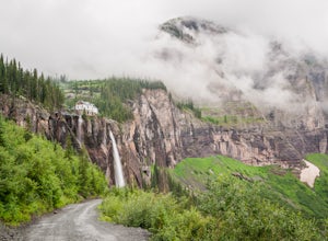
Hike to Bridal Veil Falls in Telluride
5.02.4 mi / 850 ft gainPark at the Pandora Mill just east of Telluride and lace up your footwear of choice. At 1.2 miles to the base of the falls with 850 feet of gain, this can make for a great thigh burning hike or run. The trail is a gravel road that eventually passes a gate to further trails up the Bridal Veil Ba...Read more -
Crested Butte, Colorado
Blue Lake via Oh Be Joyful Campground
12.96 mi / 2201 ft gainOverview: Round Trip is about 13 miles, about 500 ft ascent at the beginning and 1500 ft ascent in the last 1.5 miles. The majority of the hike is flat and through an AMAZING valley. Getting There: Blue Lake Trailhead is located at Oh Be Joyful Campground on Slate River Rd, just across a river,...Read more -
Crested Butte, Colorado
Explore the waterfalls of Oh Be Joyful Creek
If you're not already camping there, park at Oh Be Joyful Campground, about 5 miles up County Road 734 from downtown Crested Butte. There's parking on either side of the river crossing, but you're going to have to get your feet wet anyway, so might as well park in the first parking lot and walk a...Read more

