Yosemite National Park, California
Looking for the best photography in Yosemite National Park? We've got you covered with the top trails, trips, hiking, backpacking, camping and more around Yosemite National Park. The detailed guides, photos, and reviews are all submitted by the Outbound community.
Top Photography Spots in and near Yosemite National Park
-
Groveland, California
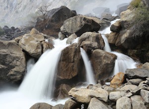
Wapama Falls
4.71 mi / 623 ft gainHetch Hetchy has a completely different character than other areas of Yosemite National Park, and the hike to Wapama Falls is an excellent way to explore this relatively remote section of the park. You can only imagine what this valley looked liked before it was dammed and is second to none compa...Read more -
Mariposa County, California
Hike Old Big Oak Flat Road
4.1 mi / 1070 ft gainOld Big Oak Flat Road used to be one of the main entries into Yosemite Valley, before HWY 120, 140 and 41. It was a dangerous road which had to be realigned, reconstructed and maintained continuously and was eventually closed in the 1940’s after a giant rockslide made it completely irreparable. T...Read more -
Tuolumne County, California
Mono Pass to Silver Lake Trailhead via Koip Peak Pass
20.25 mi / 3606 ft gainThis trip begins in Yosemite National Park and can be completed as an out-and-back or by hiking one-way to the Ansel Adams Wilderness and exiting at Silver Lake on the east side of the mountains. Start at the Mono/Parker Pass trailhead, a few miles past Tuolumne Meadows. Don't forget to make a pe...Read more -
Yosemite National Park, California
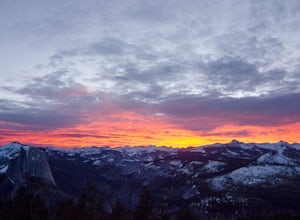
Winter Backpack to Sentinel Dome in Yosemite
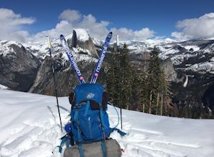
5.019.23 mi / 860 ft gainThe goal for our weekend was to do some winter camping in the Yosemite backcountry; we decided on Sentinel Dome as our destination. The trail is a cakewalk during the summer, but winter turns it into a 10 mile uphill grind from the car. Most people opt to head for the ski hut at Glacier Point, bu...Read more -
Twain Harte-Tuolumne City, California
Mount Dana
5.04.89 mi / 3120 ft gainThere's something special about the landscape that Yosemite National Park offers, and the scenery around Mount Dana is no different. The trail begins at the Tioga Gate entrance to Yosemite with the trailhead at the north end of the small parking lot south of the gate. It winds through the ponds,...Read more -
YOSEMITE NATIONAL PARK, California
Nordic Ski and Snowshoe to Glacier Point
5.021 miKnown for its breathtaking vistas, towering granite faces, and thundering waterfalls, Yosemite National Park truly is one of the world’s most astounding landscapes. Though the park covers nearly 1200 square miles, the vast majority of the ~4 million annual visitors spend almost all their time ar...Read more -
YOSEMITE NATIONAL PARK, California
Cross-Country Ski to the Ostrander Ski Hut
Start your trip from the Badger Pass ski area. The Glacier point road is closed past here, and you'll spend your first couple of miles skiing mostly downhill to the Bridalveil Falls trailhead.The Bridelveil Creek trail gains slightly less elevation but is less scenic and longer than the more popu...Read more -
Lee Vining, California
20 Lakes Basin Loop
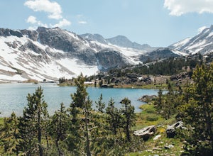
5.07.81 mi / 915 ft gainThis trail is overall very easy to hike, but the 9.1mi distance at a 10,000ft altitude is what makes it a bit of a doozy for people who aren't frequent hikers. That said, if you are a relatively in-shape individual, you should have no problem with this trail. Remember to take frequent water bre...Read more -
Lee Vining, California
Climb North Peak via the NW Ridge
DirectionsAlthough North Peak lies right on the border of Yosemite, the hike starts just outside the park at the Saddle Bag Lake trail-head. There are also some campsites here if you wish to spend the night, but I think they are usually in high demand and hard to come by. To get to Saddlebag Lak...Read more -
Tuolumne County, California
Tuolumne Grove of Giant Sequoias
4.22.67 mi / 653 ft gainThe Tuolumne Grove of Giant Sequoias is one of three sequoia groves in Yosemite National Park. This particular grove has gorgeous forest scenery and provides great solitude compared to the crowded Yosemite Valley. The trail used to be an old road offering a wide path with a gradual descent, makin...Read more -
Mariposa County, California
Camp at Crane Flat Campground
Crane Flat Campground is located on the Big Oak Flat Road (Highway 120) just west of Crane Flat, about 30 minutes northwest of Yosemite Valley. Sites are open July-October at $26/night. More info at https://www.nps.gov/yose/plany...Read more -
Lee Vining, California
Junction Campground, Mono County
Junction campground is by far one of my favorite campsites when I am visiting the High Sierra and Tuolumne Meadows. The only downside is, you can only camp certain months; usually from June through October when highway 120 is open. The Junction campground is far away from the crowds of Yosemite...Read more -
Mariposa County, California
Merced Grove
5.03.32 mi / 600 ft gainMerced Grove is technically the smallest and most secluded of the three sequoia groves found in Yosemite National Park, which lends itself to be less crowded offering a peaceful solitude hike. The trailhead is located at the Merced Grove parking lot on Big Oak Flat Road. This trail begins by foll...Read more -
Lee Vining, California
Hike to the Waterfalls of Lundy Canyon
3 mi / 200 ft gainIn order to get to the trail you first have to drive past the beautiful Lundy Lake nestled in deep canyon. When the pavement ends continue for a couple miles as the scenery gets more amazing passing two beaver ponds and an Indian head. The hike begins where the dirt road ends in a loop. The trail...Read more -
Bridgeport, California
Snowshoe to Cooney Lake
3.5 miWhen it's winter time, one of the best things you can do is experience the snow in the Eastern Sierra! If you've ever been hiking and/or backpacking in the Sierra, you know it's one of the most beautiful mountainous ranges in the US. Driving up the Hwy 395 North past Conway Summit, turn left on ...Read more -
Lee Vining, California
Backpack Virginia Lakes to Green Creek
10.5 mi / 1234 ft gainKeep in mind that this is a point to point hike, so you will need to park a vehicle at Green Creek trailhead in Bridgeport as well as your start point at Virginia Lakes Resort.Starting at 9,886' at The Virginia Lakes Trailhead, you will begin by heading Northwest towards Virginia Pass. During yo...Read more

