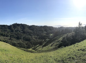
Winters, California
Looking for the best fitness in Winters? We've got you covered with the top trails, trips, hiking, backpacking, camping and more around Winters. The detailed guides, photos, and reviews are all submitted by the Outbound community.
Top Fitness Spots in and near Winters
-
Winters, California
Hike the Homestead-Blue Ridge Loop
5.0From the official trailhead, start off by taking the Homestead Trail, which forks towards the right. A trail connecting Homestead and Blue Ridge will take you to a creek nearby. Veer off the trail along the creek and there is a water hole for cooling off on hot days. Onward into the trail, you wi...Read more -
Napa, California
Lake Marie Road, Marie Creek, Buckeye Trail Loop
3.55.8 mi / 961 ft gainEnter the parking lot just off of Hwy 221. Plan to pay a $5 entrance fee at the kiosk. The trail head begins at the edge of the parking lot where you'll soon be passing by the Martha Walker Native Habitat Garden on your right. Veer left to continue along Lake Marie Road where you'll enter the blu...Read more -
Napa, California
Westwood Hills Park Loop
4.02.12 mi / 476 ft gainThis park can get a little crowded on weekends, so best to go early if possible. In terms of parking, there's a lot at the trailhead, but also plenty of available street parking. The loop can be broken up in a various ways as there are several offshoots from the main trailhead/trail leaving fro...Read more -
Santa Rosa, California
Hood Mountain Summit Via Lower and Upper Johnson Ridge Trails
5.95 mi / 2054 ft gainHood Mountain Summit via the Lower Johnson and Upper Johnson Ridge Trails is a 6 mile out-and-back trek located in Santa Rosa, CA. The trailhead starts at the Pythian Road parking lot, accessed from Highway 12. The hike takes 3.5 to 4 hours to complete and is considered strenuous. All trails are...Read more -
Carmichael, California
Hike through the Effie Yeaw Nature Preserve
4.34.48 mi / 161 ft gainDetailsEffie Yeaw Nature Preserve is named after Effie Yeaw, a teacher, conservationist and environmental educator who frequented the area on educational nature walks. She was one of the leading forces behind preserving the land now known as The American River Parkway.Effie Yeaw Nature Preserve...Read more -
Santa Rosa, California
Hike Crane Creek Regional Park
4.03.5 miWith multiple loops of varying length, this park is great for anyone looking for a casual hike around a beautiful area in the foothills of Rohnert Park. Crane Creek has nice secluded picnic areas next to the creek in the cover of willow, alder, buckeye and bay trees. There's also an 18-hole disc ...Read more -
Santa Rosa, California
Taylor Mountain Loop
4.21.5 mi / 1000 ft gainFrom the northern entrance to the park, you can access an 18-hole disc golf course as well as a number of trails. The Eastern Trail takes you up a steep 1,000 feet to the top of Taylor Mountain, where you can see most of Sonoma County laid out before you. Mt. St. Helena is visible in the distance...Read more -
Clayton, California
Hike the Waterfalls of Mount Diablo Loop Trail
5.06 mi / 1627 ft gainWinter and spring rains create scenic waterfalls in this hike at Mount Diablo, the East Bay's signature peak. Be careful hiking immediately post-rain, watch for slippery sections of mud. The trail is moderately difficult and is used by hikers, walking groups, trail runners, and for nature trips. ...Read more -
Richmond, California
Explore Point Pinole Shoreline
5.0Point Pinole Regional Shoreline is a 2,315-acre parkland that juts out into the San Pablo Bay. Only a brief car ride from San Francisco, this is a great spot for a Sunday stroll, picnic or simply to find a quiet space.There are several short trails to choose from that wind through eucalyptus grov...Read more -
Petaluma, California
Hike Helen Putnam Regional Park
4.06 mi / 550 ft gainA 216-acre park, Helen Putnam offers 9 trails that are relatively short but can be combined however you wish. Go 2 miles or 10 miles. Loop in and out, up or around. I take a different route every time I hike here.For a good 6-mile hike, begin at the southwest corner, where the parking lot and res...Read more -
Walnut Creek, California
Castle Rock Trail
5.06.06 mi / 971 ft gainLocated near Walnut Creek, the trail is easily accessible from anywhere in the Bay Area. The trail is kept open year-round, and happens to be part of the American Discovery Trail and the Coast to Crest trail. If you are not done hiking, connecting trails allow you to summit Mt. Diablo. This tra...Read more -
Walnut Creek, California
Run the Mt. Diablo Foothill Loop
5.06.2 mi / 875 ft gainContinue by car down Castle Rock Road until it dead ends at the beginning of the trail. Parking is usually easy to find. If full, there is another overflow lot about 500 ft back the way you came in.You'll walk a good half mile down the trail before getting the main gate. As you're walking, you'll...Read more -
Lafayette, California
Lafayette Reservoir via Nature Area Rim Trail
5.05 mi / 758 ft gainLafayette Reservoir is perfect for canoeing, mountain biking, trail running, and hiking. The Reservoir trail system is also used for nature walks and birding. The loop has several high points that have amazing views. The trails become very muddy after wet weather - so tread with caution. Th...Read more -
Orinda, California
Wildcat Peak Loop
4.05.89 mi / 1050 ft gainFrom Inspiration Point, head toward Nimitz gate. Once you pass through the gate, keep an eye out for Curran Trailhead; this is the trail you'll be starting on. After about 1/8 of a mile, you'll reach a junction with the Meadows Canyon Trail. Turn right onto this trail to continue the loop. This p...Read more -
Berkeley, California
Seaview and Big Springs Loop
4.54.28 mi / 1007 ft gainThe trail is dog and horse friendly, and many trail loops make Tilden Regional Park fun for families and those of any skill level. The Seaview and Big Springs Trail loop is typically used by avid hikers, trail runners, or mountain bikers. The first half of the trail is exposed to the sun and rock...Read more -
Danville, California
Summit Mount Diablo via Rock City Trail
5.07.8 mi / 2299 ft gainAlthough steep in sections, this trail is a wonderful workout and hikers are more than rewarded for their efforts. The Rock City Trail is a direct route to the summit of Mount Diablo, and the park is an ecological treasure dear to the hearts of Bay Area residents. The best views are on clear days...Read more


