Whitewater, California
Looking for the best photography in Whitewater? We've got you covered with the top trails, trips, hiking, backpacking, camping and more around Whitewater. The detailed guides, photos, and reviews are all submitted by the Outbound community.
Top Photography Spots in and near Whitewater
-
Palm Springs, California
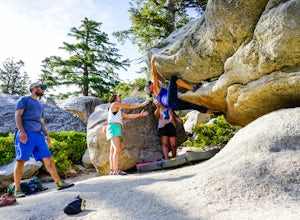
Climb at the Tramway of Mount San Jacinto
John Muir once wrote, "The view from San Jacinto is the most sublime spectacle to be found anywhere on this earth!" So it's no surprise that this is a sought after destination for hikers and climbers alike. Named after the fact that most climbers use the Palm Springs Aerial Tramway to reach this...Read more -
Palm Springs, California
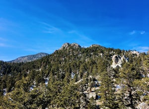
Scramble Cornell Peak
3.5 mi / 1000 ft gainEntering Mt San Jacinto State Park via the Palm Springs Aerial Tram is one of the easiest ways to get into the wilderness area. Purchase your ticket and ride to the station where you'll be able to walk out the backdoor and onto the trail. In order to get to Cornell, your route finding skills wil...Read more -
Riverside County, California
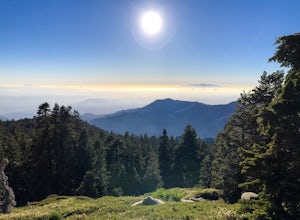
San Jacinto Peak via Marion Mountain Trailhead
11.25 mi / 4505 ft gainSan Jacinto Peak is the second highest peak in Southern California which sits at 10,833'. There are several trails to summit San Jacinto, but Marion Mountain is the shortest but also a tough one. You will start the hike at an elevation of 6300' and continuously climb 4500' in less than 6 miles. ...Read more -
Mountain Center, California
Tahquitz Peak via Devils Slide Trail
5.08.31 mi / 2238 ft gainTahquitz Peak via Devils Slide Trail is a moderately trafficked 8+ mile out and back trail located near Idyllwild, California. This trail is one of the most popular hikes in the San Jacinto area that features a fire lookout tower at the peak and amazing views of the valley below. At an elevation...Read more -
Mountain Center, California
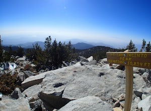
Mount San Jacinto via Devil's Slide
4.514.57 mi / 4475 ft gainMt. San Jacinto is the second tallest peak in Southern California at 10,834’. Although this route requires a fair amount of work, the effort is more than rewarded by the expansive views, forest, meadows, and dramatic topography. You will need an Adventure Pass ($5/day) to park at Humber Park, as...Read more -
Banning, California
Lake Fulmor Loop Trail
5.00.53 mi / 89 ft gainLake Fulmor is a small lake in the San Jacinto Wilderness near Idyllwild, CA. The trail loops around the lake offering spectacular views and is good for all skill levels. There are picnic tables, grills, and a small dock where you can peer out over the lake or cast a line. To fish in Lake Fulm...Read more -
Palm Springs, California
Andreas Canyon
5.01.03 mi / 154 ft gainAndreas Canyon in Indian Canyons is located very close to Palm Springs in the Agua Caliente band of Cahuilla Indians Reservation. It is one of the few places with abundant shade and running fresh water in an otherwise dry desert landscape. Enjoy a longer hike to a waterfall (Seven Falls) or stay ...Read more -
Palm Springs, California
Seven Falls via Murray Canyon Trail
4.01 mi / 587 ft gainA very scenic 4-mile round trip with a rewarding waterfall after a 2.5-mile hike/stroll. Lucky visitors may catch a glimpse of the Peninsula Big Horn Sheep (an endangered species), mule deer or other wild animals still roaming the high ground above the canyon. Less visited, Murray Canyon has its ...Read more -
Palm Springs, California
Palm Canyon Trail
4.51.94 mi / 308 ft gainThe fifteen mile long Palm Canyon, one of the Indian Canyons, is among the most beautiful natural sites in Western North America. Its indigenous flora and fauna, expertly used by the Cahuilla people, and its abundant Washingtonia Filifera (California Fan Palm) stand in breathtaking contrast to th...Read more -
Hemet, California
Hike South Fork Trail
5.4 mi / 1056 ft gainBegin by following the unsigned but visible trail on the south side of the turnout. You climb steadily through bushes and past granite boulders. At half a mile, you pass over to the western slope of the hill where the trail bends southeast, providing your first look of the river valley far below....Read more -
Yucca Valley, California
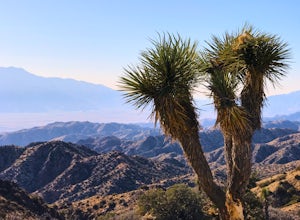
Backpack the California Riding and Hiking Trail in Joshua Tree
36.97 mi / 2792 ft gainThe starting point for this hike is at the Black Rock campground, 5 miles from the town of Yucca Valley. You'll need to self register for a free backcountry permit before starting. The first section of the trail follows a wash then the trail narrows and, after only a mile or two, you'll begin cl...Read more -
Pioneertown, California
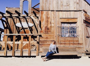
Visit Historic Pioneertown
Here in California we have a lot of desert to sift through. When trying to figure out how to navigate the mass, you have to know the places worth fighting the brutal heat or chilling cold. Pioneertown will lure you in regardless. You will see why as you make your way up the 4-mile winding road of...Read more -
Yucca Valley, California
Eureka Peak
5.00.47 mi / 82 ft gainAccessing Covington Flats in Joshua Tree National Park requires a high ground-clearance overland vehicle. Bring spare water and emergency tools incase of a breakdown. From Route 62 in Yucca Valley, CA take La Contenta Dr. South toward Joshua Tree. This is a backcountry entrance that does not hav...Read more -
Riverside County, California
Hike the Covington Crest Trail
4.2 mi / 200 ft gainAccessing Covington Flats in Joshua Tree National Park requires a high ground-clearance overland vehicle. In the summer months a standard car might make it to the parking lot after the 7.5 mile off-road drive, but should always be prepared for soft sand. Bring spare water and emergency tools inca...Read more -
Angelus Oaks, California
Jenks Lake
4.00.77 mi / 49 ft gainIf you want to experience beauty and solitude in SoCal look no further than Jenks Lake. Not too far from Big Bear Lake, but secluded enough to keep most away in the winter, Jenks Lake is a small but lovely alpine lake near HWY 38 in Angelus Oaks. Driving to the lake is beautiful in itself as HWY...Read more -
Forest Falls, California
Summit Mt. San Bernardino from Angelus Oaks
16 mi / 4775 ft gainThe trailhead is somewhat 'interesting' to get to given the dirt roads are in questionable shape and some of the roads in Angelus Oaks are not easily identifiable but I didn't have any problems finding it by closely following Google Maps. Trailhead parking requires an Adventure Pass parking pe...Read more

