Vallejo, California
Looking for the best fitness in Vallejo? We've got you covered with the top trails, trips, hiking, backpacking, camping and more around Vallejo. The detailed guides, photos, and reviews are all submitted by the Outbound community.
Top Fitness Spots in and near Vallejo
-
San Francisco, California
Twin Peaks and Mt. Sutro Loop
4.26 miAre you thinking, hit up two of the bigger peaks in SF, what a great idea? Well, you thought right! The first mile and a half is uphill as you charge to the top of Twin Peaks. This 6% grade leads to a 460 ft elevation gain. The good news is, if it's not foggy, the views of the bay are stunning, e...Read more -
Santa Rosa, California
Hike Crane Creek Regional Park
4.03.5 miWith multiple loops of varying length, this park is great for anyone looking for a casual hike around a beautiful area in the foothills of Rohnert Park. Crane Creek has nice secluded picnic areas next to the creek in the cover of willow, alder, buckeye and bay trees. There's also an 18-hole disc ...Read more -
San Francisco, California
Stow Lake
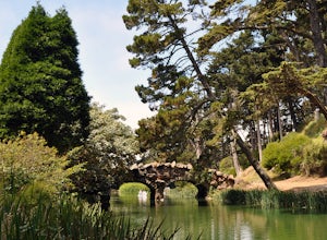
5.0Not too many people know that you can rent a rowboat at Stow Lake in Golden Gate Park, but you can. And you should! This is one of my favorite ways to spend a few hours on a beautiful day in San Francisco. Grab your loved one, your favorite bottle of wine, some snacks, and hop in a rowboat. You’...Read more -
San Francisco, California
Stow Lake And Strawberry Hill
4.92.09 mi / 253 ft gainStrawberry Hill is one of the hidden gems of Golden Gate Park. It is named after the once abundant strawberry fields that inhabited the island. The hill, which reaches up to 430ft, is located in the middle of Stow Lake and has 2 foot bridges for access. This is a great place to run if you're look...Read more -
San Francisco, California
Twin Peaks Loop
4.02.04 mi / 259 ft gainThere are a ton of ways to get here (and obviously that can affect the total distance) but this is starting from Clarendon. Follow along up Twin Peaks boulevard where you'll see the peaks upon your approach. Keep an eye out for traffic as there may be visitors driving toward and away from Twin Pe...Read more -
San Francisco, California
Hidden Garden Steps
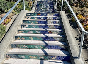
4.30.1 mi / 39 ft gainThese tiles steps are ironically iconic, as they are called the "Hidden" Garden Steps. They are one of 3 tiled staircases that San Francisco is famous for. The others are the 16th Ave Tiled Steps and the Lincoln Park Steps. Tip: When calling an uber, try to get dropped off at the top of the ste...Read more -
San Francisco, California
16th Avenue Tiled Steps
4.60.09 mi / 79 ft gainThe 16th Avenue Tiled Steps also known as the Moraga steps are an impressive community achievement, and an equally killer workout. Take an easy lap up the stairs to check out the amazing art, take in the views from the top, then get down to business. You'll be glad you made the trek over to this ...Read more -
Winters, California
Hike the Homestead-Blue Ridge Loop
5.0From the official trailhead, start off by taking the Homestead Trail, which forks towards the right. A trail connecting Homestead and Blue Ridge will take you to a creek nearby. Veer off the trail along the creek and there is a water hole for cooling off on hot days. Onward into the trail, you wi...Read more -
Santa Rosa, California
Hood Mountain Summit Via Lower and Upper Johnson Ridge Trails
5.95 mi / 2054 ft gainHood Mountain Summit via the Lower Johnson and Upper Johnson Ridge Trails is a 6 mile out-and-back trek located in Santa Rosa, CA. The trailhead starts at the Pythian Road parking lot, accessed from Highway 12. The hike takes 3.5 to 4 hours to complete and is considered strenuous. All trails are...Read more -
Santa Rosa, California
Taylor Mountain Loop
4.24.89 mi / 1096 ft gainFrom the northern entrance to the park, you can access an 18-hole disc golf course as well as a number of trails. The Eastern Trail takes you up a steep 1,000 feet to the top of Taylor Mountain, where you can see most of Sonoma County laid out before you. Mt. St. Helena is visible in the distance...Read more -
Point Reyes Station, California
Sky Trail Loop
5.09.55 mi / 1818 ft gainSky Trail in Point Reyes National Seashore is a dramatic, mostly single-track trail that runs along the main spine of the Inverness Ridge and across highest mountains in Point Reyes, looming above the Olema Valley and Highway 1 which mark the San Andreas Fault rift zone and the dividing line betw...Read more -
Point Reyes Station, California
Sky Campground via Sky Trail
2.66 mi / 495 ft gainEntering Point Reyes National Seashore from Bear Valley Road the Sky Trailhead is a 4.9 mile drive. Camping in Sky Camp requires a Camping Permit. Once at the Sky Trailhead parking lot. The Sky Trailhead will be on the left side pulling in. The hike is not very strenuous and not all that lo...Read more -
Pacifica, California
Milagra Overlook Trail
5.02.51 mi / 558 ft gainFound this hike with some friends after spending some time googling in my car when we were in the area looking for a quick hike with a view! Dog friendly Free parking (but quite limited) Ocean views Known to have gorgeous wildflower blooms (we were not there during this)Porta-potty type toilet...Read more -
San Bruno, California
Sweeney Ridge via Sneath Lane
4.53.88 mi / 646 ft gainStarting from the parking lot on Sneath Lane Trail, you’ll head through the gate and continue on the path up Sweeney Ridge. This is a 5.7 mile out-and-back trek. There is a 600 ft. elevation gain, which comes mainly in the first 1.5 miles of the trail. Your legs and lungs may hurt a bit, but if t...Read more -
Inverness, California
Hike the Estero Trail
5.08 mi / 200 ft gainJune sunshine blazes on your shoulders during this scenic stroll through the Point Reyes Seashore. The trail is alive and awash with colorful wildflowers around every corner.Beginning at the trailhead, just off Home Ranch Road, with a convenient parking lot and bathroom, you'll wade through a hal...Read more -
Pacifica, California
Mori Point Loop
4.82.54 mi / 276 ft gainStart at the parking lots close to the pier, where bathrooms are also available. Walk along the pier to watch the sunset as it begins. Next, walk along Sharp Park Beach to discover the plethora of wild flowers and friendly locals always ready to guide you on your walk. Take the stairs up to the...Read more


