Sonoma County, California
Sonoma County, California, offers some of the best trails and outdoor activities for those seeking scenic outdoor adventures. The top must-visit is the Pomo Canyon Trail. This 6-mile round trip trail features a stunning redwood grove and panoramic views of the Russian River. It's moderately challenging, making it suitable for most hikers. If you're a fan of bird-watching, the Bodega Head Trail is perfect. This 1.7-mile loop trail offers views of the Pacific Ocean and is a prime spot for whale watching. For a unique adventure, try kayaking on the Russian River. It's a great way to enjoy the beautiful scenery and spot local wildlife. These are just a few of the top outdoor activities and attractions in and near Sonoma County.
Top Spots in and near Sonoma County
-
Stinson Beach, California
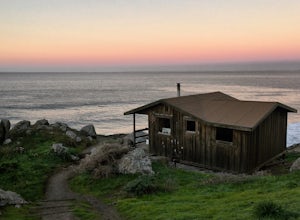
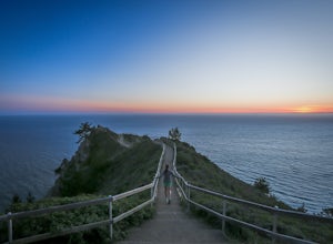
Steep Ravine Cabins
5.0Although these cabins are bare bones, lacking both water and electricity, they couldn't put you in a better spot for views of the Pacific Ocean. From your cabin, you can enjoy amazing sunsets, possibly whale watching, and access to trails like the cabin's namesake, Steep Ravine Trail. The cabins...Read more -
Stinson Beach, California
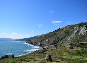
Steep Ravine Environmental Campground
5.0Gain access through a private locked gate, and descend about 1 mile down to the bluff's edge. There is only parking for 1 car per site and also several cabins that can be rented. A camp host is on site and there are bathrooms and water spigots throughout the campground. Each site has a fire ring...Read more -
Winters, California
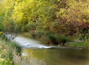
Fly Fishing on the Putah
4.0Putah Creek is a little over an hour drive from SF without traffic. The creek has flows beginning in April, which can reach up to 700cfs during the summer months. The creek begins to drop after September. Keep in mind that wet-wading isn't recommended until the river is under 300cfs. Most fly fis...Read more -
Richmond, California
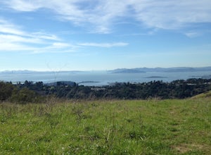
Hike the Wildcat Canyon Loop
4.010.5 mi / 2300 ft gainStarting off on Wildcat Creek Trail, the trail is wide and rolling. After about 4 miles make a left on Jewel Trail, then onto Sylvan Trail. Another left puts you on Wildcat Peak Trail. Be sure to check your map, as many trails intersect here. Wildcat Peak Trail runs into Nimitz Way, at which poin...Read more -
Muir Beach, California
Muir Beach Overlook
4.9The Muir Beach Overlook is one of the most convenient spots to take in an amazing view of the entire coastline, and one of the best places to catch a dramatic sunset. It’s conveniently located one mile north of Muir Beach and parking is easy. It’s a 5 minute walk down the trail to the Overlook. O...Read more -
Muir Beach, California
Owl Trail
5.01.2 mi / 300 ft gainThe Owl Trail runs between Slide Ranch and the Muir Beach Overlook and is a great way to take in the breathtaking views, flora and fauna of the Northern California coast. The easiest way to access the trail is to park at the Muir Beach Overlook and to take the trail down to Slide Ranch and then...Read more -
Mill Valley, California
Oakwood Trail, Marin Headlands
5.02.56 mi / 538 ft gainLooking to escape the hustle of San Francisco, but don't want to commit to an entire day on the trail? When setting out for this morning hike, be prepared for about 1.5 hour hiking adventure (longer if you stop for extra photos) and a 20 minute commute from San Francisco. This hike is recomend...Read more -
Muir Beach, California
Bonfire at Muir Beach
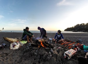
5.0Take in a scenic sunset and enjoy the warmth of a bonfire on the beach! Muir Beach changes the number of fire pits it has seasonally. May through November, the beach offers 6 fire pits, and in the colder months (December through April), there are 3 fire pits on the beach toward the south end of t...Read more -
Muir Beach, California
Pirate's Cove
5.03.43 mi / 856 ft gainPirate's Cove is an out-and-back trail where you may see wildflowers located near Mill Valley, California.Read more -
Mill Valley, California
Coyote Ridge Loop
5.06.15 mi / 1001 ft gainStarting just before the Tennessee Valley parking lot, head out from the Miwok Trailhead. This Mill Valley hike offers incredible views of the San Francisco Bay, the Pacific Ocean (fog permitting of course!), and on occasion, wildlife. Unfortunately, this trail is not dog-friendly. Keep in mind...Read more -
Mill Valley, California
Tennessee Beach via Tennessee Valley Trail
4.63.64 miThe Tennessee Valley trail is leisurely 3.6 mile roundtrip hike that turns around at Tennessee Valley Cove. Along the way, you’ll hike past shrublands, wetlands, and a lake before you get to a cool little secluded beach that many people picnic at. This is probably the easiest to access, and most...Read more -
Napa, California
Hike To Zim Zim Falls
5.08 mi / 500 ft gainThis 8 mile (out and back) hike begins at the trail head off of Knoxville Road, just before mile marker 24. The first 3 miles are relatively flat, though you will cross the creek about 9 times. Right before you reach the waterfall, you will come to a fork in the trail marked by a pink boulder. St...Read more -
Vacaville, California
Bike the Cantelow Climb
5.019.68 mi / 1119 ft gainBegin your ride from Lagoon Valley Park in Vacaville, California. There is a parking lot here if you drive to the start of your ride (the park entrance fee is $3 per vehicle per day). Head out of the parking lot and turn right onto Rivera Road where you'll cross over Hwy 80. The road becomes Cher...Read more -
Vacaville, California
Bike the Lake Berryessa Loop
55.82 mi / 1007 ft gainBegin your ride in Vacaville, California out of Alamo Creek Park (street parking is available and free). Head north on Alamo Drive and veer left onto Foothill Drive, then left (South) onto Pleasants Valley Road. After two miles, veer left onto Cherry Glen Road. Stay to the right when you reach th...Read more -
Belvedere Tiburon, California
Mt. Livermore via North Ridge Trail
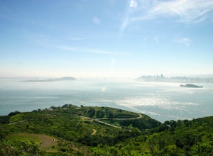
4.54.92 mi / 1178 ft gainUnless you own a boat or a kayak, this adventure requires a ride on the Blue and Gold Ferry from Pier 41 in San Francisco. But let’s be honest, that’s actually half the fun. Who doesn’t love a ferry ride? Angel Island State Park is the largest island in the Bay, and recommend the 6-mile loop aro...Read more -
Tiburon, California
Camp on Angel Island
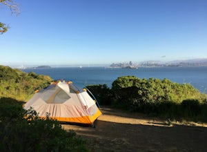
5.0Thousands of years ago, this island was a fishing and hunting ground for the Miwok Native Americans. It has also been an outpost for the U.S. Army and a cattle ranch. Now, it’s one of the closest places to escape from the hustle of San Francisco and set up camp. Camping on the island requires ba...Read more

