Sebastopol, California
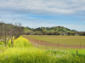
Sebastopol, California offers some of the best trails and outdoor activities. The Laguna de Santa Rosa Trail is a must-visit. This is a 1.8-mile trail that is perfect for all skill levels. It features a river and is primarily used for hiking, walking, bird watching, and horseback riding. It's a scenic trail with lots of wildlife to spot. Ragle Ranch Regional Park is another top spot for outdoor adventures. It boasts 157 acres of recreational activities, including hiking, bird watching, and picnicking. The park's peaceful West County Prairie trail offers views of rolling grasslands and oak woodlands. The park also has a children's playground and a peace garden. Sebastopol is the perfect place for those seeking scenic outdoor adventures.
Top Spots in and near Sebastopol
-
Sausalito, California
Ninja Loop
9.37 mi / 1831 ft gainThis loop can start from several different locations, including Rodeo Beach and the Golden Gate Bridge parking lot. Starting from the GGB will add 2 more miles onto this run. I like to start at the Coastal Trailhead parking lot off of McCullough and Conzelman Roads (just a notch down from Hawk Hi...Read more -
Sausalito, California
Marin Headlands Trail Loop
10.5 mi / 1990 ft gainThis trail starts at the Coastal Trail in Marin Headlands Park, where there's a small parking lot and outhouse bathroom off the circle when coming from Conzelman Road.Take the Coastal Trail until you intersect with Bunker Road (you can even turn right and spit off the trail just before intersecti...Read more -
Sausalito, California
Black Sands Beach
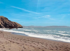
5.00.54 mi / 285 ft gainBlack Sand Beach is a beautiful, mile-long stretch of black sand just north of the Golden Gate Bridge. On a sunny day, it’s best to try and arrive in the morning, as the parking lot can fill up quickly. To get down to the beach, you’ll need to hike for about 5 minutes down 250 or so wooden steps....Read more -
Mill Valley, California
Explore WWII Ruins on Point Bonita
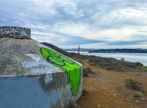
4.30.25 mi / 200 ft gainAll throughout the Marin Headlands are WWII-era bunkers, batteries and ruins, including a complex on the hillside above the Point Bonita Lighthouse that provide amazing views of San Francisco, the Golden Gate, and the north coast.Drive out to the parking lot for the Point Bonita Lighthouse in the...Read more -
Sausalito, California
Hawk Hill
5.00.76 mi / 144 ft gainIf you're leaving from SF, head over the bridge and exit onto Alexander Ave. Make the immediate left under the overpass and you'll be on the road to Hawk Hill. There's a parking area just below the gate leading up to Hawk Hill. From the parking lot you can walk west about ten yards along the outs...Read more -
Mill Valley, California
Headlands Ride to Point Bonita Lighthouse
4.3The Headlands are a quick ride over the Golden Gate. On the ride, you'll see wildflowers, rugged coastline, and the Point Bonita Lighthouse. Once you cross the bridge, take Conzelman Rd up ~700 feet to Hawk Hill. From here, continue on to the lighthouse. On the return trip, head back on Conzelman...Read more -
Sausalito, California
Vista Golden Gate
4.3The headlands offer great views of the Golden Gate Bridge, particularly at Vista Golden Gate. You can make the Vista Viewpoint your starting off point to leave your car or if you're riding, just stop in and enjoy the view. This spot allows you to capture views of the Golden Gate as well as Angel ...Read more -
Sausalito, California
Battery Spencer
4.00.47 mi / 46 ft gainThis is a very popular spot to hike up to from Conzelman Road. You can find parking in the lot or on the street and do the quick hike up to Battery Spencer. You can get a perfect view of the Golden Gate Bridge and SF from the Marin side of the Bay. This is a unique perspective as you also get the...Read more -
Mill Valley, California
Kirby Cove
4.72 miThis scenic hike is a 1.8 mile out-and-back trail located near Sausalito, CA. From the trail and beach, you'll get scenic of the Golden Gate, San Francisco's skyline, and glimpses of the East Bay. The best news, there's rarely any crowd. Consider packing a blanket and a small picnic. With panora...Read more -
Mill Valley, California
Camp at Kirby Cove
4.5Yes, you can camp just over the Golden Gate! Kirby Cove Campground has 4 overnight campsites and 1 picnic area for day use. The campground is set near a coarse-sand beach and offers amazing views of the Golden Gate, as long as it’s not a super foggy SF day. From the parking lot, it's a steep ~1 m...Read more -
Guinda, California
Hike Pierce Canyon
6.2 mi / 1079 ft gainThis hike follows a fire road through some farms, up into the woods and up the ridge. It's an accessible and easy trail, with some decent incline starting about halfway through (thus the "moderate" rating instead of easy). Park at the end of the road before the gate. (There is a sign that say...Read more -
Vacaville, California
Bike the Cantelow Climb
5.019.68 mi / 1119 ft gainBegin your ride from Lagoon Valley Park in Vacaville, California. There is a parking lot here if you drive to the start of your ride (the park entrance fee is $3 per vehicle per day). Head out of the parking lot and turn right onto Rivera Road where you'll cross over Hwy 80. The road becomes Cher...Read more -
Vacaville, California
Bike the Lake Berryessa Loop
55.82 mi / 1007 ft gainBegin your ride in Vacaville, California out of Alamo Creek Park (street parking is available and free). Head north on Alamo Drive and veer left onto Foothill Drive, then left (South) onto Pleasants Valley Road. After two miles, veer left onto Cherry Glen Road. Stay to the right when you reach th...Read more -
San Francisco, California
Ride Paradise Loop
4.3Riding this loop has long been a popular option for San Franciscan riders looking to escape the busy city streets. This 38-mile ride with 1,600 feet of elevation, is suitable for all personalities of rider: the fast paced racer or the person just out to relax and cruise.A great place to start thi...Read more -
San Francisco, California
Run to Hopper's Hands
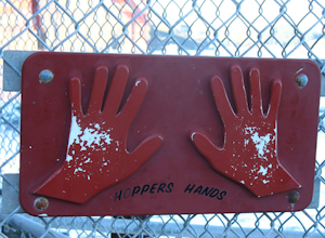
4.6Hundreds of people touch Hopper's Hands every day as a turn-around point on their runs in and around Crissy Field and The San Francisco Bay Trail. Running west through Crissy Field, passing the Warming Hut and pier, you follow Marine Drive until you dead end at Fort Point. If you continue through...Read more -
San Francisco, California
Surf Under The Golden Gate at Fort Point
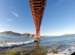
4.2This has to one of the coolest spots to surf in the world. The break itself is a left point that requires a healthy swell to wrap into the bay, and only gets good on occasion. But when it's good, it can be an experience you'll never forget.It's important to note, that when it's good, this is not ...Read more

