Ragged Point, California
Looking for the best chillin in Ragged Point? We've got you covered with the top trails, trips, hiking, backpacking, camping and more around Ragged Point. The detailed guides, photos, and reviews are all submitted by the Outbound community.
Top Chillin Spots in and near Ragged Point
-
Baywood-Los Osos, California
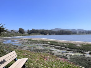
Baywood Park & Pier
5.0A quiet little beach front, with a raised boardwalk and beautiful views all around. A great place to walk the dog or take small children. Amazing sunsets and A+ for bird watching. Excellent spot to launch a kayak, canoe, or SUP. But watch the tides before you do. The water is usually glassy when ...Read more -
San Luis Obispo County, California
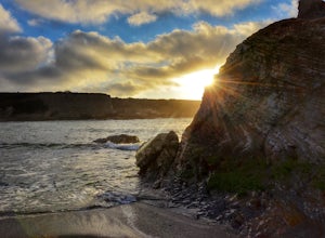
Spooner's Cove
5.0Spooner’s cove is one of those small hidden beaches where you can watch stunning sunsets in a peaceful environment. Located in Montana De Oro State Park, the small gem is surrounded by countless hikes and camping spot. It is also one of the only areas of the park that is dog friendly. If you are ...Read more -
San Luis Obispo County, California
Camp at Montaña de Oro State Park
5.0Located about 7 miles south of Morrow Bay, follow Los Osos Valley Rd into the state park. Watch for the signs to park, as you will be cited after 10pm.The campground is located just across the road from the famous Spooner's cove, but there are any number of trails and hikes you can enjoy (check ...Read more -
Big Sur, California
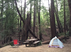
Camp at Ventana Campground, Big Sur
4.6This campground is a gem when it comes to Big Sur camping, book here. Each site includes a parking spot, a campfire ring with grill, a picnic table, and plenty of space for 1-2 tents. There are multiple immaculate restroom facilities with showers, clean trash enclosures (emptied and sanitized dai...Read more -
Soledad, California
Explore Dreamy Wrath Wines Vineyards
Just a short drive from some of the best trails and rock climbing at Pinnacles National Park, Wrath Wines' Soledad winery is a great way to wine'd down after a day of adventure. What makes this grape growing region unique is the constant marine layer fog and wind stress out the grapes (that’s a ...Read more -
Big Sur, California
Hike the Andrew Molera State Park Loop
4.58.8 mi / 1100 ft gainThe loops starts at the Andrew Molera State Park parking lot (4.5 miles north of the entrance to Pfeiffer Big Sur State Park along Highway 1). Begin by crossing the Big Sur River using the seasonal bridge. If the bridge has been removed, you will need to cross the water by foot. Usually the water...Read more -
Big Sur, California
Hike the Creamery Meadow Trail to Molera Beach
2 miEntrance to the parking lot is $10 per car, and once you get in be sure to use the restroom before you head for the trail, since you will likely spend a good amount of time out there.Look for the sign that says Creamery Meadow Trail. You'll know it's right when the very first thing you'll need to...Read more -
Big Sur, California
Camp at Andrew Molera State Park
4.51 miAndrew Molera is about 27 miles south of Carmel and one of the first State Parks you'll hit heading down the coast. There will be signs for the Park as you approach and the main parking lot is only a couple hundred yards from Hwy 1. There are a number of hiking trails and activities to do around ...Read more -
Paicines, California
Hike to Bear Gulch Reservoir in Pinnacles National Park
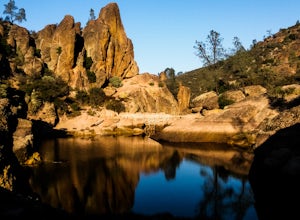
3.51.5 mi / 275 ft gainStart the hike from the Bear Gulch Trail Parking lot. While pulling in, the trail head is on the left. The Trail is marked Reservoir, Caves, and High Peaks. Continue down the trail until faced with a junction. Make sure to admire rock formations while hiking!At the junction take the Bear Gulc...Read more -
San Luis Obispo, California
Mountain Bike Cuesta Ridge
5.07 mi / -1600 ft gainStart at the parking lot directly off of Highway 101, head up TV tower Road for 2.8 Miles and a 900' climb from 1500' to 2400'. The trail is an old fire road that has degraded over the years and is full of potholes. Starting October 2015, the road has been closed to vehicles as its being repaved ...Read more

