Pleasanton, California
Pleasanton, California is home to some of the best outdoor activities and attractions. From scenic trails to outdoor adventures, there's something for everyone. Must-visit attractions include the Pleasanton Ridge Regional Park, Shadow Cliffs Regional Recreation Area, and the Pleasanton Golf Center. For the best trails and activities, head to the Pleasanton Ridge Regional Park for a hike or bike ride. Shadow Cliffs Regional Recreation Area is great for fishing, swimming, and picnicking. Pleasanton Golf Center is a great spot for golfers of all levels. Whether you're looking for a peaceful day outdoors or an exciting experience, Pleasanton has it all.
Top Spots in and near Pleasanton
-
San Rafael, California
China Camp Loop
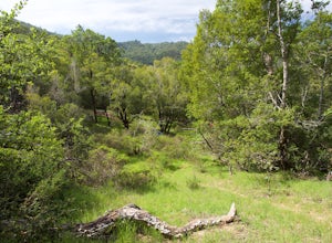
4.09.23 mi / 1716 ft gainPark at the lot in the China Camp State Park. Hop onto the Bay View trail to gain to begin the loop trail. Switchbacks take you up to a long and easy path passing through shaded and open areas. Enjoy the grasslands speckled with oak trees and coyote brush. You can see the San Rafael bay and bridg...Read more -
Mill Valley, California
Temelpa Trail
4.52.94 mi / 1929 ft gainThe Mt. Tam Hill Climb via Temelpa Trail is an iconic, "best-of" climb in the trail running community, drawing some of the world's greatest athletes to experience its breathtaking views and technical downhill. Surprisingly though, outside of locals and the running community, the trail remains lar...Read more -
Pescadero, California
Catch a Sunset at Bean Hollow State Beach
5.0There are a bunch of places to photograph this beach if you head north on the trail that runs along the beach.There is parking at the beach but it can fill up quickly!The only warning you need is about the tide. Make sure you are watching it the entire time because it can creep up on you and will...Read more -
Mill Valley, California
Summit of Mt. Tamalpais Loop
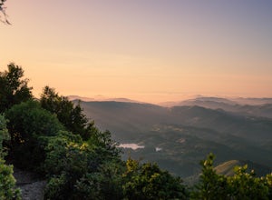
5.01.15 mi / 394 ft gainMt. Tam is a large park with plenty of amazing viewpoints, but the East routes and the East Peak are best for sunsets. Once you're at the top, it's an amazing spot to view a large number of Marin trails, which can help you can get a head start on planning your next adventure. At 2,570 feet, this ...Read more -
Mill Valley, California
Steep Ravine Trail via Pantoll Station
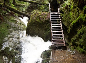
5.03.96 mi / 1079 ft gainThe trailhead Pantoll Station is easy to find on GPS and there are friendly rangers there as well to answer questions.Maps: Paper map are available at the trailhead Pantoll Station in Marin, CA. For a moderate hike, I suggest going the one and a half miles down the trail to the ladder and retu...Read more -
Mill Valley, California
Camp at Mt. Tam's Pantoll Campground
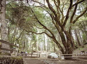
5.0Need an escape from SF, but can't seem to find an available campground, then head to Pantoll Campground in Mount Tamalpais State Park. If you get there early on friday (or even better Thursday afternoon), you should be able to lock down one of these first-come, first-serve campgrounds. Each of th...Read more -
Marin County, California
Dipsea Trail - Steep Ravine Loop
5.03.97 mi / 1204 ft gainThis is definitely a worthwhile short hike, with views of the Bay Area, Marin Headlands, Golden Gate, and the San Mateo coastline. It's a 3.8 mile loop which takes you through forests of Redwoods and out to the coastline, even above the clouds on a lucky day. The trailhead begins at the Pantoll ...Read more -
Bootjack Campground, California
Bootjack Campground to Muir Woods
8.61 mi / 1594 ft gainGetting permits into Muir Woods can be hard, but if you want to work for it, there's a much better way to visit the National Monument. To do this loop into Muir Woods National Monument, first drive to the Bootjack Parking Area in Mt. Tamalpais State Park. The Bootjack Parking Area should be fou...Read more -
Mill Valley, California
Camp at Bootjack Campground in Mount Tamalpais State Park
4.0Bootjack Campground is located within California's Mount Tamalpais State Park. There are a couple of campsites within the park, but if you are driving on the Panoramic Highway from Mill Valley, this will be the first campground you pass. The fee is $25 fee to camp, but they have bathrooms and ru...Read more -
Mill Valley, California
Steep Ravine and Bootjack Trails Loop
5.06.66 mi / 2083 ft gainThis hike is best done in the winter and spring in order for the creeks and waterfalls to be flowing. Park at the Bootjack Campground in Mount Tamalpais State Park. Cross the road to reach the Bootjack trail. Continue on this until you reach the Alpine trail. Go right towards the Pantoll Ranger ...Read more -
Ross, California
Phoenix Lake Loop
4.52.85 mi / 518 ft gainEnjoy the peacefulness of making it out to the lake for a quick hike without worrying too much about challenging climbs or difficult terrain. Take the wide fire road from the car uphill and then jump on the Phoenix Lake Trail. From here, you’ll combine this trail with the Gertrude Orr and Bill Wi...Read more -
Felton, California
Tree Climb Mount Hermon
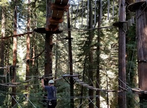
5.0Climbing an aerial obstacle course through the redwoods of Mount Hermon is a great way to experience the thrill of climbing and being in the trees. See what it's like to scurry through the trees like a squirrel. This unique vantage point offers amazing views of the redwoods. There are many aeri...Read more -
Fairfield, California
Bike the Gordon Valley to Wooden Valley Scramble
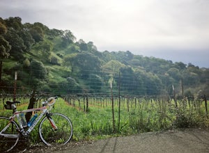
5.013.5 mi / 498 ft gainThis is a 13.5 mile loop route in Fairfield, California. The route has a total ascent of 498 feet and has a maximum elevation of 369 feet.Begin your ride at the corner of Oliver Road and Mankas Corner Road. Along Mankas Corner Road you'll pass the Napa Grass Farmer community farm and Il Fiorello ...Read more -
Pescadero, United States
Relax at Costanoa Lodge
3.0Looking for a quick escape from the city, but sleeping on the ground isn’t really your thing? Look no further than Costanoa Lodge in Pescadero, an upscale "glamping" experience just an hour south of San Francisco with tons of hiking options. This is a really fun option for anyone who enjoys being...Read more -
Mill Valley, California
Trojan Point
4.50.25 mi / 75 ft gainThe endlessly scenic Trojan Point can be reached by taking the Panoramic Highway to Pantoll road from Stinson Beach to the west, or Mill Valley / Highway 1 to the east. It can also be reached by taking West Ridgecrest Boulevard from the north from the Fairfax-Bolinas road. Park at the large par...Read more -
Pescadero, California
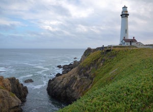
Explore the Pidgeon Point Lighthouse
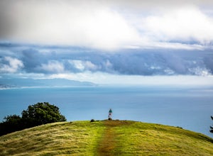
5.0Pidgeon Point Lighthouse is conveniently located just 50 miles south of San Francisco. Constructed in 1872 and standing at 115 feet, it is among the tallest lighthouse in America.Part of the state park system, it is surprisingly secluded. Numerous parking space were available in the lot with hand...Read more

