Orange, California
Looking for the best mountain biking in Orange? We've got you covered with the top trails, trips, hiking, backpacking, camping and more around Orange. The detailed guides, photos, and reviews are all submitted by the Outbound community.
Top Mountain Biking Spots in and near Orange
-
Anaheim, California
Oak Canyon Bluebird and Wren Trail
1.42 mi / 187 ft gainThe Oak Canyon Bluebird and Wren Trail features beautiful wildflowers and is accessible year-round. The trail is well kept and offers lots of shady spots. The first portion of this hike will take you up a hill, and then to a fork. One direction will take you around a reservoir and another will ta...Read more -
Newport Beach, California
Newport Beach Back Bay Trail
4.010.62 mi / 499 ft gainThe Newport Beach Back Bay Trail features beautiful wildflowers and is open for use year round. Very minimal elevation gain makes this hike food for all skill levels, but be mindful of the distance. Dogs are allowed on the trail but must be kept on leash. Cooling sea breezes make this one of th...Read more -
Newport Beach, California
Bommer Ridge from the Pacific Ridge Trailhead
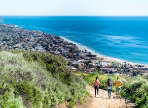
7.54 mi / 394 ft gainThe Bommer Ridge West Trailhead aka The Pacific Ridge Trailhead begins at the edge of Ridge Park Road, overlooking CA State Highway 73, and marks the northwest entrance to the Laguna Coast Wilderness and its neighbor, Crystal Cove State Park. From the well-marked trailhead follow the trail south...Read more -
Newport Beach, California
Explore Deer Canyon
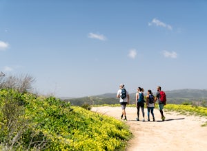
6.9 mi / 1489 ft gainThe Deer Canyon Loop Trail is an easy drive from Orange County and Newport Beach. In the spring, wildflowers are abundant along the trial. This is a favorite spot for trail runners, hikers, and mountain bikers. The trail is kept in great condition year-round and is very wide. There is very little...Read more -
Corona, California
Skyline Drive Trail
3.09.07 mi / 1946 ft gainThis trail is shared by hikers, mountain bikers and trail runners. Rock climbers can find areas to boulder off the trail. Bring lots of extra water as this trail is rather dusty and can get very hot. This is a good training hike for those looking to do some backpacking. The trail is open year-r...Read more -
Trabuco Canyon, California
The Luge: Santiago Truck Trail Loop
5.07.46 mi / 1371 ft gainThe Luge: Santiago Truck Trail Loop is a loop trail that takes you through a nice forest located near Lake Forest, California.Read more -
Aliso Viejo, California
Top of the World via West Ridge Trail
5.04.76 mi / 443 ft gainDirections to get here are pretty straight forward via the map. You park your car in a residential neighborhood along the street, and from there, you can't miss the entrance. The trail is paved for the first 100yds or so and after you make a right turn at the top, you'll be on dirt and sand the r...Read more -
Laguna Beach, California
El Moro Canyon Trail
5.04.94 mi / 814 ft gainThe trail features a waterfall and is open year-round, but is best used in the spring. Remember to bring $15 cash for the parking fee. The Laguna Beach trail is shared by trail runners, mountain bikers, hikers, and the occasional horseback rider. Dogs are not allowed in Crystal Cove State Park.Read more -
Laguna Beach, California
B.F.I. Trail in Crystal Cove State Park
5.00.78 mi / 125 ft gainTo get to the trailhead, enter Crystal Cove State Park through the Crystal Cove El Moro Campground entrance immediately next to El Moro Elementary School. Follow the road behind the school which leads to the main gate where you will need to pay a day-use parking fee of $15. Drive past the Campgr...Read more -
Silverado, California
Bedford Peak Trail
5.06.78 mi / 1972 ft gainThe Bedford Peak Trail in Silverado, California is a challenging hike that offers a variety of natural features. The trail spans 6.78 miles round trip and has an elevation gain of 1,972 feet. It is rated as difficult due to its steep inclines and rocky terrain. The trail begins in a dense oak w...Read more -
Laguna Beach, California
Emerald Canyon & Bommer Ridge Loop
5 mi / 873 ft gainThere a numerous trails in the Laguna Coast Wilderness that proceed up and along the ridges and down into the canyons (or the reverse), and are quite popular for mountain biking, hiking, and trail running. A great mountain biking loop begins in Emerald Canyon at the end of Emerald Canyon Road an...Read more -
Laguna Beach, California
Trail Run the Boat Road and Laguna Ridge
4.34 mi / 600 ft gainThere a numerous trails in the Laguna Coast Wilderness that proceed up and along the ridges and down into the canyons (or the reverse), and most are excellent for trail running, hiking, and mountain biking. A classic out-and-back (with many options for loops) begins at the end of Dartmoor Street ...Read more -
Laguna Beach, California
Hike the West Ridge Trail
5.01.5 mi / 150 ft gainBeginning at Alta Laguna Park at Top of the World, the West Ridge Trail is a popular starting (and ending) point for adventures into the Laguna Coast Wilderness, leading to trails and areas like Car Wreck, Big Bend, and Willow Canyon. You can also do it in reverse from the north. The ridge itself...Read more -
Laguna Beach, California
West Ridge to Car Wreck Trail and Mathis Canyon Loop
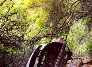
4.53.31 mi / 856 ft gainThere are numerous ways to incorporate the Car Wreck trail into a larger loop through the Laguna Coast Wilderness and Aliso Canyon Park, but a common route is to begin at Alta Laguna Park at "Top of the World" in Laguna Beach. Take the West Ridge Trail .5 miles, bearing right onto the marked Car...Read more -
Laguna Beach, California
Water Tank Trail
4.33.05 mi / 502 ft gainThere a numerous trails in the Laguna Coast Wilderness that proceed up and along the ridges and down into the canyons (or the reverse), and most are excellent for hiking, trail running, and mountain biking. A classic out-and-back (with many options for loops) begins in Irvine Bowl Park at the en...Read more -
Laguna Niguel, California
Dripping Cave in the Aliso & Wood Canyons Wilderness
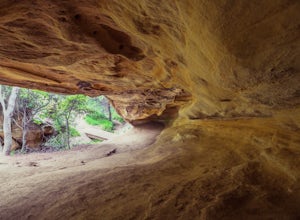
4.47.68 mi / 889 ft gainDripping Cave sits tucked away in a corner of Wood Canyon, part of the Aliso and Wood Canyons Wilderness Park, and the trail to the cave, while short, requires *at least* a 2.25 mile hike in from the nearest trailhead (West Ridge Trail to Mathis Canyon), though this is less than ideal as that rou...Read more


