Top Spots in and near Muir Woods National Monument
-
Sausalito, California
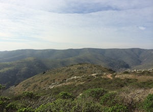
This loop can start from several different locations, including Rodeo Beach and the Golden Gate Bridge parking lot. Starting from the GGB will add 2 more miles onto this run. I like to start at the Coastal Trailhead parking lot off of McCullough and Conzelman Roads (just a notch down from Hawk Hi...
Read more
-
Sausalito, California
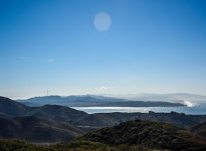
This trail starts at the Coastal Trail in Marin Headlands Park, where there's a small parking lot and outhouse bathroom off the circle when coming from Conzelman Road.Take the Coastal Trail until you intersect with Bunker Road (you can even turn right and spit off the trail just before intersecti...
Read more
-
Sausalito, California
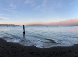
This is a small tucked away beach in Sausalito, CA. Being in the bay, it has very calm waters and is easy to swim in, though the water will be very cold. There are pilings in the water that are remnants of the old piers. It is a great beach to watch the sunset at.
There is very limited street...
Read more
-
Sausalito, California
5.0
0.76 mi
/ 144 ft gain
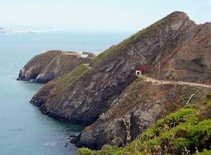
If you're leaving from SF, head over the bridge and exit onto Alexander Ave. Make the immediate left under the overpass and you'll be on the road to Hawk Hill. There's a parking area just below the gate leading up to Hawk Hill. From the parking lot you can walk west about ten yards along the outs...
Read more
-
Mill Valley, California
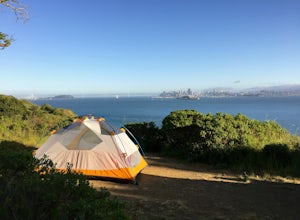
Yes, you can camp just over the Golden Gate! Kirby Cove Campground has 4 overnight campsites and 1 picnic area for day use. The campground is set near a coarse-sand beach and offers amazing views of the Golden Gate, as long as it’s not a super foggy SF day. From the parking lot, it's a steep ~1 m...
Read more
-
Mill Valley, California
The Headlands are a quick ride over the Golden Gate. On the ride, you'll see wildflowers, rugged coastline, and the Point Bonita Lighthouse. Once you cross the bridge, take Conzelman Rd up ~700 feet to Hawk Hill. From here, continue on to the lighthouse. On the return trip, head back on Conzelman...
Read more
-
Mill Valley, California
This scenic hike is a 1.8 mile out-and-back trail located near Sausalito, CA. From the trail and beach, you'll get scenic of the Golden Gate, San Francisco's skyline, and glimpses of the East Bay. The best news, there's rarely any crowd.
Consider packing a blanket and a small picnic. With panora...
Read more
-
Sausalito, California
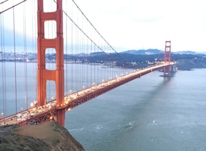
The headlands offer great views of the Golden Gate Bridge, particularly at Vista Golden Gate. You can make the Vista Viewpoint your starting off point to leave your car or if you're riding, just stop in and enjoy the view. This spot allows you to capture views of the Golden Gate as well as Angel ...
Read more
-
Sausalito, California
This is a very popular spot to hike up to from Conzelman Road. You can find parking in the lot or on the street and do the quick hike up to Battery Spencer. You can get a perfect view of the Golden Gate Bridge and SF from the Marin side of the Bay. This is a unique perspective as you also get the...
Read more
-
San Rafael, California
4.0
4.37 mi
/ 988 ft gain
The Gold Hill Grade to Nike Missile Site trail in San Rafael, California, is a moderately challenging hike. The trail spans approximately 4.37 miles round trip, with an elevation gain of about 988 feet. The path is well-maintained and marked, making it suitable for hikers of varying skill levels....
Read more
-
San Rafael, California
5.0
5.85 mi
/ 1089 ft gain
This San Rafael neighborhood trail is quite popular, but there is plenty of room for everyone and the parking is easy. After you park at the trailhead, you walk (or bike) up a relatively short and steep path that takes you to the beginning of the trail.
This hike takes you along a scenic ridge ...
Read more
-
Tiburon, California
Thousands of years ago, this island was a fishing and hunting ground for the Miwok Native Americans. It has also been an outpost for the U.S. Army and a cattle ranch. Now, it’s one of the closest places to escape from the hustle of San Francisco and set up camp. Camping on the island requires ba...
Read more
-
San Francisco, California
Riding this loop has long been a popular option for San Franciscan riders looking to escape the busy city streets. This 38-mile ride with 1,600 feet of elevation, is suitable for all personalities of rider: the fast paced racer or the person just out to relax and cruise.A great place to start thi...
Read more
-
Belvedere Tiburon, California
4.5
4.92 mi
/ 1178 ft gain
Unless you own a boat or a kayak, this adventure requires a ride on the Blue and Gold Ferry from Pier 41 in San Francisco. But let’s be honest, that’s actually half the fun. Who doesn’t love a ferry ride?
Angel Island State Park is the largest island in the Bay, and recommend the 6-mile loop aro...
Read more
-
Tiburon, California
Angel Island Perimeter Loop is a loop trail around the circumference of the island in the San Francisco Bay. The island is located near Tiburon, California with views of downtown San Francisco, Alcatraz, the Golden Gate Bridge, Oakland, Sausalito, and TIburon as you traverse around the island.
...
Read more
-
San Francisco, California
Hundreds of people touch Hopper's Hands every day as a turn-around point on their runs in and around Crissy Field and The San Francisco Bay Trail. Running west through Crissy Field, passing the Warming Hut and pier, you follow Marine Drive until you dead end at Fort Point. If you continue through...
Read more

