Top Spots in and near Muir Woods National Monument
-
Calistoga, California
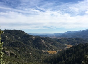
The incline on this trail begins pretty much right away and is fairly gradual for the entire hike, some of it is quite rocky, making this an easy to moderate level hike. However, with some shade (probably wouldn't attempt it on a hot summer day) and the sweeping views of the valley that get bette...
Read more
-
Calistoga, California
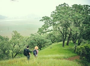
Bald Hill is the first serious peak/summit that can be reached via the Oat Hill Mine Trail as it breaks from the more popular loop and heads into the heart of Robert Louis Stevenson State Park.
To get there you can either begin at the less frequently used trailhead at Picket and Rosedale Roads he...
Read more
-
Sunol, California
4.0
3.01 mi
/ 705 ft gain
Please note this is a fragile ecosystem and watershed. There is NO swimming allowed in Alameda Creek and trespassing is prohibited on Water Department lands that are not accessible to the public. You can learn more about the restrictions and the area at ebparks.org.
After entering the kiosk you...
Read more
-
Livermore, California
This hike is best done during the spring, fall, or winter when moderate temperatures make the hike more comfortable.
Be warned that this hike has a large elevation change despite being less than 4 miles.
Starting at the Arroyo Road Staging Area, take the East Shore Trail east, heading towards a s...
Read more
-
La Honda, California
Like redwood hikes? We do too, they're always very scenic and take you away from the hustle and bustle of the bay area. Not to mention, they also stay cool during the summer months. If you want a hike in the middle of the peninsula, this is a great bet.When starting this hike, head out from headq...
Read more
-
Pescadero, California
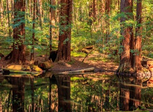
This short hike follows Little Butano Creek through a lush redwood forest. The trail crosses the creek multiple times as you walk over redwood pine needles and through pockets of ferns. Dogs can join on this trail, but must be on leash.
Read more
-
Pescadero, California
Butano State Park definitely flies under the radar. But for those who love quick escapes, small crowds, fun hikes, and beautiful redwoods, it's a favorite. The park features miles of hiking trails, 21 drive-in campsites and 18 walk-in campsites. Restrooms with running water are provided. Drinking...
Read more
-
Pescadero, California
Located deep within the Santa Cruz Mountains, Butano State Park boasts a large redwood canyon with many miles of hiking trails as well as campsites. This state park is one of the quietest and least visited parks on the peninsula making a perfect place to escape the hustle of the Bay Area Butano S...
Read more
-
Guerneville, California
4.5
3.37 mi
/ 810 ft gain
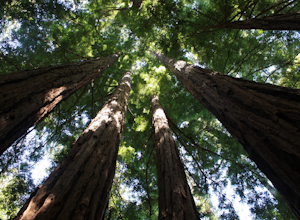
This park most resembles Muir Woods, and if you're looking to get out of the tourist trap, head to Armstrong Redwoods and make a day of it. This 3-mile hike takes off from the sign pointing to East Ridge Trail. As you begin a slight climb up the trail, you'll be under the cover of the redwoods, s...
Read more
-
Pescadero, California
4.0
3.76 mi
/ 761 ft gain
This steep and winding trail takes you to the top of a ridge where you can see the Pacific coastline and the redwoods piercing through the forest canopy. To do this trail connect the Ano Nuevo Trail, Olmo Fire Road, Goat Trail and the Six Bridges Trail. If you don't have all day to do the Canyon ...
Read more
-
Los Gatos, California
Communes, dairy, and gold. These words are not often associated with trail running, but out on Monte Bello Ridge and Black Mountain which rise high above Silicon Valley, you might just hear them uttered.From the parking area in Skyline Open Space we start our run by crossing Skyline Boulevard and...
Read more
-
Winters, California
5.0
4.46 mi
/ 1299 ft gain
At the bend in the road on Highway 128, you will pass two silver gates. The gate with the UC Davis logo is the entrance to the trailhead. Past the entrance there is a large dirt pullout off the road with plenty of parking.
Starting at the trailhead, go left in the fork to start the loop trail. T...
Read more
-
Winters, California
Stebbins Cold Canyon is a great day hike for all skill levels, accessible year round, and offers an abundance of wild flower viewing, including the California poppy. Tog get to the hike, head about 8 miles west of Winters, CA, where a silver fire gate marks the main entrance to the Stebbins Cold ...
Read more
-
Winters, California
From the official trailhead, start off by taking the Homestead Trail, which forks towards the right. A trail connecting Homestead and Blue Ridge will take you to a creek nearby. Veer off the trail along the creek and there is a water hole for cooling off on hot days. Onward into the trail, you wi...
Read more

