Top Spots in and near Muir Woods National Monument
-
Saint Helena, California
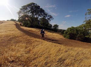
Park at the top of Adobe Canyon Road in the gravel parking lot to the left of the ranger kiosk. There is a $7.00 parking fee.There are many options for routes to the top; the easiest of which is mostly paved (although still steep in parts). To take this route, head north out of the trailhead park...
Read more
-
Woodside, California
5.0
4.5 mi
/ 1400 ft gain
Located in the iconic Silicon Valley town of Woodside, Wunderlich County Park offers a number of hiking trails as well as some horseback riding trails through the wilderness.
Once in the parking lot, you will see a number of stables, riding ring, as well as a beautiful historic stable that was o...
Read more
-
Kenwood, California
4.0
2.17 mi
/ 568 ft gain
The Pony Gate-Canyon Loop within Sugarloaf Ridge State Park is a new favorite of mine on my list of family and kid-friendly hikes. Our little girls did great with this hike and loved it. If you can get moving early in the day and begin your hike around breakfast time, you might find there are few...
Read more
-
Santa Rosa, California
4.0
12.67 mi
/ 174 ft gain
Joe Rodota Trail is an out-and-back trail where you may see wildflowers located near Sebastopol, California.
Read more
-
-
-
Sebastopol, California
The Thistle - Creek Loop is a loop trail at Ragle Ranch. This trail is used for hiking and running and offers some cover/shade as well as great views of foliage especially in the fall months. This trail is located near Sebastopol, California.
Read more
-
Bodega Bay, California
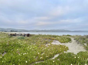
Doran Beach is nestled within the picturesque landscape of Doran Regional Park near Bodega Bay, California. Offering pristine shores and captivating vistas, this is a coastal gem that allows visitors a more protected coastal landscape than nearby Salmon Creek State Beach.
Explore sandy beaches ...
Read more
-
Santa Rosa, California
Hood Mountain Summit via the Lower Johnson and Upper Johnson Ridge Trails is a 6 mile out-and-back trek located in Santa Rosa, CA.
The trailhead starts at the Pythian Road parking lot, accessed from Highway 12. The hike takes 3.5 to 4 hours to complete and is considered strenuous. All trails are...
Read more
-
Bodega Bay, California
Doran Regional Park is located along the coast just south of the town of Bodega Bay, California. There are 5 campgrounds at Doran and Miwok is the tent-only campground with 13 campsites. There is a parking lot at the campground and bathrooms with coin-operated showers.
FEES:
If camping, your e...
Read more
-
Santa Rosa, California
Annadel State Park is located in the historic Valley of the Moon, just 60 miles north of San Francisco, in Sonoma. This popular 5,200 acre park features a wonderful variety of options to explore, boasting views of the Sonoma Valley, rolling meadows of wildflowers, and direct access to 26 acre Lak...
Read more
-
Bodega Bay, California
4.7
1.67 mi
/ 121 ft gain
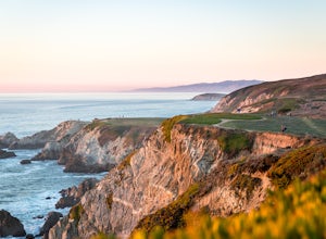
Sitting west of the San Andrea fault, the Bodega Head is a massive chunk of granite from the Salinian Block, a geological terrane that contains Point Reyes and the Farallon Islands, and shares its origins with the Sierra Nevada mountains, the Head itself having been carried hundreds of miles to t...
Read more
-
Antioch, California
This is a fun day hike that takes you through the beautiful hills of the Black Diamond Mines Regional Preserve and a bit of the Contra Loma Recreational Area as well. You can hike here year round, but I suggest going in the spring time when the hills are covered in soft, green grass and the wild ...
Read more
-
Pleasanton, California
This is a 5+ mile out and back trail through the hills in the South Bay. The beginning of the hike has a steeper incline and then becomes more gradual later on. There is a beautiful views of the South Bay that are enjoyable in the day, but are fantastic in the evening. Some areas of the trail hav...
Read more
-
Santa Rosa, California
Santa Rosa Creek Trail: Willowside Road to Fulton Road is an out-and-back trail that takes you by a river located near Sebastopol, California.
Read more
-
Bodega Bay, California
These kind of getaways shouldn't be planned many weeks before the trip. So we didn't booked a campground. And from this experience we learn that you don't have to reserve a campground. Just go there - don't panic when you see campground is full sign in the entrance. There are always available spo...
Read more

