Mount Laguna, California
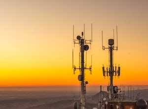
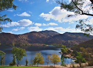
Mount Laguna, California, is a top location for outdoor adventurers and those seeking an unforgettable and exciting experience. With its breathtaking views, numerous trails, and a variety of outdoor activities to enjoy, it's a must-visit for anyone who appreciates nature. Popular attractions include the Pacific Crest Trail, which stretches from Mexico to Canada, as well as the Mount Laguna Observatory and the nearby Anza-Borrego Desert State Park. There are also many other trails and activities to explore, such as mountain biking, horseback riding, rock climbing, and bird watching. Mount Laguna has something for everyone, offering a unique outdoor experience that is sure to be memorable.
Top Spots in and near Mount Laguna
-
Borrego Springs, California
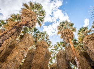
Hike through Borrego Palm Canyon
5.03.25 mi / 450 ft gainBorrego Palm Canyon Trail is located just north of the park visitor center, making it a convenient place to begin your exploration of the Anza-Borrego Desert. To reach the trailhead, drive through Borrego Palm Canyon Campground, the largest developed campground in the park, where an $8 day use fe...Read more -
Jamul, California
Hike Mt. McGinty
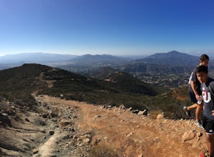
4.8 mi / 1263 ft gainBalancing a good workout, gorgeous views, and minimal time commitment, these 4.8-mile steep trail is definitely a San Diego point of interest, and despite its proximity to the city of San Diego, it remains a low trafficked hike. The Hike: Right away the trail weaves you through beautiful vegetati...Read more -
Borrego Springs, California
Anza Borrego Metal Sculptures
4.6Here's a map I made that marks where most of the sculptures are (here). First, you enter the park and drive through the little city of Borrego Springs. There will be a roundabout you can't miss, so you know you're on the right path. There is nowhere to park to get to the sculptures specifically,...Read more -
Jamul, California
Hiking Otay Mountain
5.015.3 mi / 2903 ft gainThe trek begins on the Otay Mountain Truck Trail at Pio Pico Resort & Campground. You can either park and hike the entire trail, or drive up to a point a couple miles and park before the road becomes steep and rough. The distance on here is if you hiked the whole way. If you have a 4-wheel dr...Read more -
Warner Springs, California
Eagle Rock via the Pacific Crest Trail
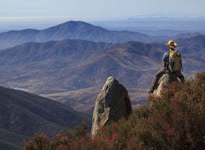
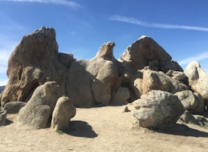
5.06.2 mi / 807 ft gainWith doing more hikes in the SoCal area, I've realized half the battle is just trying to find the damn trailhead.Technically you have 2 ways to enter this trail ... Start from 79 and add a very enjoyable extra 3ish miles, or start from the Warner Springs Fire Station, for a total 7 mile hike.We c...Read more -
Borrego Springs, California
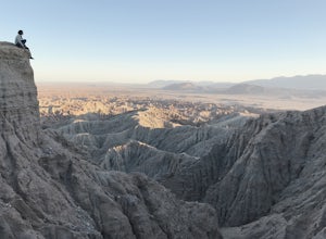
Catch a Sunset at Fonts Point
4.04 miThe best time to go to Fonts point is right before the sun sets. It is located in the desert, so be sure to dress warmly and bring a blanket or two.In order to get to Fonts Point, you'll have to drive through roughly 4 miles of sand and rocks. 4x4 is strongly recommended, but keep an eye on road ...Read more -
Ramona, California
Mount Woodson's East Approach
3.03.96 mi / 1385 ft gainMount Woodson is a well-known hiking trail in San Diego County. It is known for its breathtaking views and the famous potato chip rock. The Trail on the east side of the Mountain is fairly steep but is about half the distance of the trail on the west side of the mountain. To get to the trail on ...Read more -
Poway, California
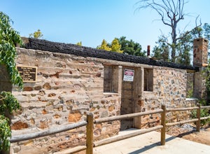
Hike around Goodan Ranch
5.03 miStarting at the Sycamore Canyon Trail head, you will see the sign and gate that leads to Goodan Ranch. Head down the gravel road for 1.1 miles, until you reach a 3-way directional split. Heading straight for another .5 miles will take you directly to the ruins of the old Goodan house. Here you wi...Read more -
Ramona, California
Iron Mountain Peak Trail
4.15.67 mi / 1030 ft gainIron Mountain is the longest wilderness trail in Poway, CA. The parking lot is free and provides bathroom and water fountain amenities. The distance from the parking area to the summit is approximately 3.2 miles. Beginning with a wide smooth trail, slowly transitioning into semi-technical incline...Read more -
Borrego Springs, California
Hike the Calcite Mine Trail in the Anza-Borrego Desert
4 mi / 830 ft gainOpen from March until October - but I would not particularly recommend this hike in the summer months, unless you started in the wee almost dark hours. This is the desert and it gets hot early and quickly.This is a former calcite mine with slot canyons, great rock formations and some shady areas ...Read more -
San Diego County, California
Hike Sheep Canyon
5.03 mi / 1000 ft gainSheep Canyon is probably the most remote palm canyon in Anza-Borrego Desert State Park in California. While Palm Canyon is easily accessed from the State Park campground, Sheep Canyon is on a dirt road that requires stream crossings and potentially a high-clearance 4WD vehicle. The canyon is nam...Read more -
Santee, California
Crystal Cave
4.00.46 mi / 59 ft gainStarting at 8100 Mesa road, you will see parking along the side of the road in a few places, take advantage where you find it. Pass over the trail gate that marks the start of the journey. This will be a quick trip, as the total distance is less than a mile out and back. Head a quarter mile or ...Read more -
Chula Vista, California
Hike Mother Miguel Mountain
5.04.5 mi / 977 ft gainAt the summit, your work will be rewarded with stunning views from downtown San Diego all the way to Mexico. You can also see the surrounding mountain peaks and the Sweetwater Reservoir. This is a great hike to do at sunset - but bring a headlamp / flashlight for the hike back down. This trail i...Read more -
Santee, California
Cowles Mountain via Big Rock Trail
4.04.86 mi / 1207 ft gainStarting somewhat near sea-level, Cowles Mountain via the Big Rock Trail climbs about 1000 ft in elevation. This trail is about 5 miles total, out and back. Arrive at Big Rock park which has good parking. At the park you will walk to the left of the tennis courts past the limits (the fence) of...Read more -
Santee, California
Cowles Mountain via Big Rock Road
4.54.32 mi / 1109 ft gainStart by plugging 8125 Arlette St, Santee, CA into your GPS. This takes you to Big Rock Park, a convenient parking spot for the Cowles Hike. From here you want to walk through the park, and around the right side of the tennis court. This will take you to the fenced entrance to the hike. Head sout...Read more -
Poway, California
Mount Woodson and Potato Chip Rock
4.66.45 mi / 900 ft gainMt. Woodson is located in Poway's most eastern region and is one of San Diego's most popular and most iconic hiking trails. Known for its grand photo opportunistic "Potato Chip Rock", Mt. Woodson is a 7.5mi out-and-back trail with amazing vistas, convenient rest stops and breathtaking views. The...Read more

