Mariposa County, California
Mariposa, California is a top spot for getting outdoors. With its scenic trails, top-notch activities and must-visit attractions, it is the perfect spot for an outdoor adventure. The best trails and activities in and near the area include hiking, biking, kayaking, fishing, and camping. There are also plenty of attractions to explore such as Yosemite National Park, Mariposa Grove of Giant Sequoias, and the Mariposa County Fairgrounds. Whether you're looking for a relaxing day trip or an exciting outdoor experience, Mariposa has something for everyone.
Top Spots in and near Mariposa County
-
YOSEMITE NATIONAL PARK, California
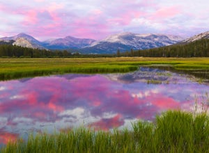
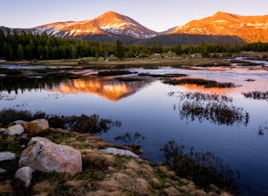
Enjoy a Sunset at Tuolumne Meadows
5.0Tuolumne Meadows at an elevation of 8,619 feet exemplifies the high country of the Sierra Nevada, with its sweeping sub-alpine meadows, granite domes, summer wildflowers and meandering rivers. When the forest opens up park along the side of the road and find a trail. There are also plenty of near...Read more -
YOSEMITE NATIONAL PARK, California
Fletcher Lake and Vogelsang Peak
19.03 mi / 2887 ft gainBefore you head out for the trip, you’ll need to get a wilderness permit. You can get one online from the Yosemite website or pick one up at the Tuolumne Meadows Wilderness Center or from the Wilderness Center in Yosemite Valley. Go to Yosemite and take Highway 120 up to Tuolumne Meadows. You ca...Read more -
YOSEMITE NATIONAL PARK, California
Young Lakes
4.714.14 mi / 1700 ft gainThe Young Lakes trail starts from the Lembert Dome parking area and then winds up around 6 miles into the high country past alpine meadows and stunning views of the surrounding mountains. Lower and Middle Young Lakes are beautiful, but you're going to want to push on to Upper Young Lake, where y...Read more -
Wawona, California
Lembert Dome via Dog Lake Trail
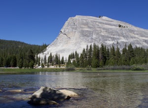
4.03.98 mi / 750 ft gainLembert Dome may seem impossible to scale when observing it from the trailhead, but it is actually a relatively easy hike up to the summit. It is by far the best way to see and admire Tuolumne Meadows, not to mention the granite top, which is a wonderland to explore. There are a few ways to reac...Read more -
Tuolumne County, California
Rock Climb Lembert Dome, Yosemite NP
Lembert Dome stands out clearly as it is right along the road with a fairly large parking lot, about 1/4 mile past the Toulumne Store. There are multiple routes on this dome and for detail on all climbs, pick up the Tuolumne Free Climbs climbing guide. The area around this dome is gorogeous with ...Read more -
YOSEMITE NATIONAL PARK, California
Mt. Conness
5.019.03 mi / 5400 ft gainThis trip is best done as a 3 day, 2 night backpacking trip making camp at Young Lakes, however it is possible to do it in a single day long haul. Start at the Lembert Dome Parking Lot and take the trail via the Dog Lake route towards Young Lakes. It's about 7 miles to the upper of the three You...Read more -
YOSEMITE NATIONAL PARK, California
Dog Lake Loop
3.03.71 mi / 740 ft gainThis 3.7 mile roundtrip hike begins at the center of Tuolumne Meadows (shuttle stop #2) at the Lembert Dome/Glen Aulin trailhead parking lot. There are restrooms and picnic tables at the east side of the lot, there you will also find the trailhead to Dog Lake. The trail begins at 8,500 ft and c...Read more -
37.876736,-119.346085
Glen Aulin
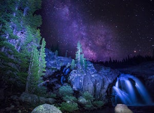
4.812.19 mi / 600 ft gainStart your hike to this waterfall oasis in the heart of the sierra at the parking lot for the Tuolumne Meadows Visitor Center. The Glen Aulin High Sierra Camp sits along the beautifully winding Tuolumne River. White Cascade an 80ft waterfall sits at the edge of camp and provides an excellent swim...Read more -
Groveland, California
Hetch Hetchy to Rancheria Falls
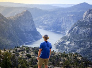
4.812.55 mi / 2500 ft gainSituated in the northwest portion of Yosemite National Park, Hetch Hetchy is is a not often visited treasure of the Central Sierra Nevada. In 1913, in an extremely controversial move, work on the O’Shaughnessy Dam was started to provide water to the growing population of San Francisco. Today, Het...Read more -
Oakhurst, California
Camp at Nelder Grove Campground in Sierra National Forest
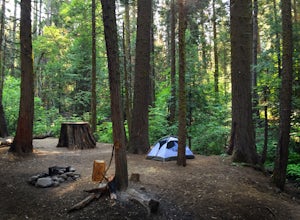
0 mi / 0 ft gainSites are located along Willow Creek with plenty of shape. Right out of the campground you can hike nearby Bull Buck Trail and discover the giant sequoia trees. This is a first-come first-serve campground so arrive early.Directions: Take Hwy 41 north from Fresno; continue thru Oakhurst to Sky Ran...Read more -
Groveland, California
Wapama Falls
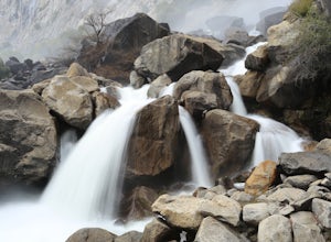
4.71 mi / 623 ft gainHetch Hetchy has a completely different character than other areas of Yosemite National Park, and the hike to Wapama Falls is an excellent way to explore this relatively remote section of the park. You can only imagine what this valley looked liked before it was dammed and is second to none compa...Read more -
Oakhurst, California
Hike the Shadow of the Giants Trail
4.01.1 mi / 85 ft gainThe Shadow of the Giants National Recreation trail is an amazing 1.1 mile self-guided hike through the heart of Nelder Grove. Take Hwy 41 north from Fresno; continue thru Oakhurst to Sky Ranch Road (6S10 or Forest Road 10) travel approx. 5 miles to Nelder Grove, when you reach the camp area take ...Read more -
Bass Lake, California
Camp at Greys Mountain Campground
/ 5293 ft gainFrom Greys Mountain Campground, Sierra National Forest is your oyster! Enjoy hiking, swimming, fishing, mountain biking, boating, paddle boarding, kayaking, canoeing, and more. Each site is equipped with a picnic table and a fire ring. The campground has vault toilets and (sometimes) potable wate...Read more -
Tuolumne County, California
Photograph Dana Fork
Yosemite is filled with some amazing views but rarely do you get to experience these views by yourself. This hidden treasure is located off of Tioga Pass, is near some of Yosemite’s most popular hikes, and offers an outstanding sunrise and sunset views without the crowds. Located 2.5 miles Sout...Read more -
Tuolumne County, California
Lyell Loop
35.88 mi / 5541 ft gainStart the hike at the Mono pass trail. You'll eventually take the fork towards Parker Pass a couple miles in. We tackled the trail in late spring, and it quickly became clear that there was still enough snow to make our lives difficult. As we climbed out of the Parker drainage, the trail essenti...Read more -
Tuolumne County, California
Mono Pass to Silver Lake Trailhead via Koip Peak Pass
20.25 mi / 3606 ft gainThis trip begins in Yosemite National Park and can be completed as an out-and-back or by hiking one-way to the Ansel Adams Wilderness and exiting at Silver Lake on the east side of the mountains. Start at the Mono/Parker Pass trailhead, a few miles past Tuolumne Meadows. Don't forget to make a pe...Read more

