Mammoth Lakes, California
Nestled in the heart of the Sierra Nevada, Mammoth Lakes, California, is a paradise for outdoor enthusiasts. For hikers, the John Muir Trail offers breathtaking views of the wilderness, while the Crystal Lake Trail is a hidden gem for those seeking tranquility. The Twin Lakes Campground is a favorite among campers, with its serene setting and easy access to fishing spots. There are also plenty of opportunities for mountain biking, rock climbing, and backpacking. For water sports, hop on a kayak or try stand-up paddleboarding on the pristine waters of Lake Mary. The San Joaquin River is a hotspot for thrilling rafting adventures. If you're up for a unique experience, Mammoth Mountain's Adventure Center offers zip-lining that will give you a bird's eye view of the stunning landscape. Whether you're a seasoned adventurer or a novice, Mammoth Lakes has something for everyone.
Top Spots in and near Mammoth Lakes
-
Mariposa County, California
Hike from Tunnel View to Glacier Point
5.013 mi / 3000 ft gainBeginning at 4400 feet of elevation in the bottom of Yosemite Valley, this trail will take you up about 3000 feet over 13 miles. You'll finish the hike at Glacier Point and be richly rewarded with one of the most spectacular views of Half Dome in the park.If you are interested in seeing landmarks...Read more -
Mariposa County, California
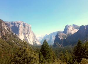
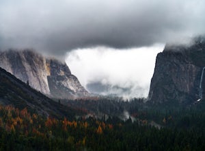
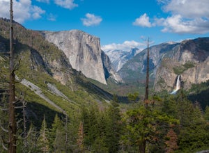
Photograph Yosemite's Tunnel View
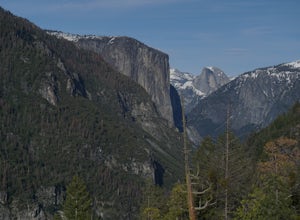
4.3Tunnel View sets you up for an iconic view of some of the major highlights of the Yosemite valley including Bridal Veil Falls, El Capitan and Half Dome in the distance. To access the viewpoint, from Northside Dr., turn right onto Wawona Rd. You'll continue on Wawona Rd. up until you see you parki...Read more -
Mariposa County, California
Backpack Yosemite's South Rim
5.018 mi / 2800 ft gainStep 1: Get Wilderness Permit from the Wilderness Office the day before! Permits are free and required. This trail is a Point-to-Point trail so make sure you have a shuttle situation figured out (or you can always hitch hike). The best option is to get dropped off at Tunnel View so that you don'...Read more -
Mariposa County, California
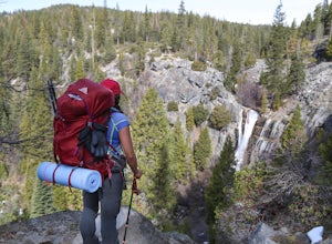
Hike to Alder Creek Falls
10 mi / 1000 ft gainThe trail leads from the parking area across the Mosquito Creek road and heads uphill north through an open pine forest with manzanita growing on dry slopes. The trail provides access to Alder Creek Falls a hidden gem within Yosemite's Wawona wilderness. I did the trail towards the end of Februar...Read more -
Shaver Lake, California
Camp at Voyager Rock Campground
4.0The paved road ends at the Maxson Trailhead parking lot on the SE side of Courtright Reservoir. The adventure starts with a glance to the left, down a rock-strewn dirt track that leads off further into the wilderness. You're wondering, "Is that the trail?" and "Do I dare?"The Dusy-Ershim Trail of...Read more -
Mariposa County, California
Camp at Wawona in Yosemite National Park
Wawona offers over 90 campsites in 3 loops, including 1 group site, 2 horse sites, and RV/ camper access.Every loop has at least 1 bathroom with flush toilets, but keep in mind that there are no showers at this campground.Pets are allowed, but must be kept on leash at all times.Each campground co...Read more -
Bishop, California
Long Lake via Bishop Pass
5.51 mi / 991 ft gainDirections The trailhead for Long Lake starts by South Lake outside Bishop, CA. You'll want to take Line Street, which is the 168, West out of Bishop. Approximately 14 miles up, you'll want to merge left towards South Lake. This junction is well-signed if you keep an eye out for it. Head th...Read more -
Bishop, California
Climb Columbine Peak's NE Ridge
15 mi / 5000 ft gainDirections This Bishop Pass Trail starts by South Lake outside Bishop, CA. You'll want to take Line Street, which is the 168, West out of Bishop. Approximately 14 miles up, you'll want to merge left towards South Lake. This junction is well-signed if you keep an eye out for it. Head the rest ...Read more -
Bishop, California
Backpack into the Palisades from Bishop Pass
18 mi / 4000 ft gainDrive up to the trailhead near South Lake from the town of Bishop (you can get directions at the Ranger Station when you get a permit). The hike goes from approximately 9,000 ft. to 13,000 ft. over the course of 9 miles.The first approximately 6 miles are on trail to the top of Bishop Pass. From ...Read more -
Bishop, California
Bishop Pass Trail to John Muir Trail to Piute Trail
52.67 mi / 9173 ft gainBishop Pass Trail to John Muir Trail to Piute Trail is a point-to-point trail that takes you by a lake located near Bishop, California.Read more -
Bishop, California
Treasure Lakes Trail
5.05.79 mi / 1375 ft gainThe Treasure Lakes Trail is dog and kid friendly, just make sure all parties can handle the elevation gain. The scenery throughout the entire hike is amazing, and early in the summer, the creeks roar. The lake is perfect for cooling off on a hot summer day. The trail is best used in the summer an...Read more -
Bishop, California
Evolution Basin via South Lake
35.66 mi / 7769 ft gainIt’s been called the crown jewel of the Sierra Nevada, the highlight of the entire 211-mile John Muir Trail. Whatever superlatives are used to describe it, Evolution Basin is undoubtedly one of the most incredible landscapes you’ll ever explore. There is a small catch, though: There is no easy ...Read more -
Bishop, California
Bishop Pass Trail
5.011.13 mi / 2165 ft gainTo get to the hike drive twenty miles west from the town of Bishop, California up Hwy 168 to South Lake. There are two parking lots but make sure to get there early because later in the day it's harder to get a spot. The trail starts from South Lake at an an elevation of 9,750 feet. Initially ...Read more -
Tuolumne County, California
Backpack Grand Canyon of the Tuolumne
5.048.29 mi / 10610 ft gainThis is a rugged overnight backpack into the North country of Yosemite dropping in from Tuolumne Meadows into the Grand Canyon of the Tuolumne. The trail begins at an elevation just under 9,000' and drops to a low elevation of 4,500' almost 19 miles later at Pate Valley. Coming up out of Pate Val...Read more -
Mariposa County, California
Hike to Turtleback Dome
1.4 mi / 350 ft gainTurtleback Dome will provide you with views of southern Yosemite and the Valley in a less crowded area. This hike on a service road is relatively easy with a slight elevation gain over the entire 0.7 miles. To get to the Trailhead, take Wawona Road north towards the valley. Use the referenced poi...Read more -
Bridgeport, California
Hike to Peeler Lake
11 mi / 2400 ft gainThis trip can be done as a day trip or backpacking trip. It is around an 11 mile out-and-back trip.Park at Twin Lakes in Bridgeport, CA. There is a $10 fee and it can take a while on busy weekends. A permit is required to stay overnight in Hoover Wilderness. The trailhead can be hard to find; it ...Read more

