Mammoth Lakes, California
Nestled in the heart of the Sierra Nevada, Mammoth Lakes, California, is a paradise for outdoor enthusiasts. For hikers, the John Muir Trail offers breathtaking views of the wilderness, while the Crystal Lake Trail is a hidden gem for those seeking tranquility. The Twin Lakes Campground is a favorite among campers, with its serene setting and easy access to fishing spots. There are also plenty of opportunities for mountain biking, rock climbing, and backpacking. For water sports, hop on a kayak or try stand-up paddleboarding on the pristine waters of Lake Mary. The San Joaquin River is a hotspot for thrilling rafting adventures. If you're up for a unique experience, Mammoth Mountain's Adventure Center offers zip-lining that will give you a bird's eye view of the stunning landscape. Whether you're a seasoned adventurer or a novice, Mammoth Lakes has something for everyone.
Top Spots in and near Mammoth Lakes
-
Yosemite National Park, California
Backpack to Johnson Lake
24 mi / 4500 ft gainYour trek begins at the Chilnualna Falls trailhead in Wawona near the South Gate in Yosemite. The first suggestion I have is to check the weather in the area to make sure you won't be slowed down by rain or snow. It's about 12 miles from the trailhead to the lake and if you are a swift hiker and ...Read more -
Oakhurst, California
Camp at Nelder Grove Campground in Sierra National Forest
0 mi / 0 ft gainSites are located along Willow Creek with plenty of shape. Right out of the campground you can hike nearby Bull Buck Trail and discover the giant sequoia trees. This is a first-come first-serve campground so arrive early.Directions: Take Hwy 41 north from Fresno; continue thru Oakhurst to Sky Ran...Read more -
Shaver Lake, California
Balsam Forebay
4.01.05 mi / 62 ft gainAccess to the forebay starts at the trail head from the parking lot 6,700 ft up, also from the parking lot there is access to two different sets of boulder patches separate from the ones encountered along the hike in. Hike Start the 1 mile out and back hike from the parking lot following the t...Read more -
YOSEMITE NATIONAL PARK, California
Hike to Eagle Peak via Rockslides Trail
4.016.07 mi / 5568 ft gainA Yosemite Valley trip in May has tourist filled buses, noisy car alarms, and crowded trails written all over it. Thus, I wanted to avoid the beaten path. Looking into possible destinations, John Muir once said in regards to Eagle Peak, "where the most comprehensive of all the views to be had on ...Read more -
Wawona, California
Dewey Point Trail
4.95 mi / 315 ft gainThis approximately 5-mile out-and-back trail is a great hike in Yosemite National Park. This trail starts off of Dewey Point's Meadow Trail, but you can also start from the Dewey Point Ridge trail, which you'll pass first when coming up Glacier Point Road. This trail is not dog friendly, but is a...Read more -
Mariposa County, California
Hike to Bridalveil Fall
3.81.2 mi / 200 ft gainSince most things you want to see in Yosemite require a hike, this place is a nice change to see something without having to walk for hours. From the parking lot it is just about a 10 minute walk to the falls.If you scramble up the rocks, you can get a nice view of the falls and the pond. It used...Read more -
Oakhurst, California
Hike the Shadow of the Giants Trail
4.01.1 mi / 85 ft gainThe Shadow of the Giants National Recreation trail is an amazing 1.1 mile self-guided hike through the heart of Nelder Grove. Take Hwy 41 north from Fresno; continue thru Oakhurst to Sky Ranch Road (6S10 or Forest Road 10) travel approx. 5 miles to Nelder Grove, when you reach the camp area take ...Read more -
YOSEMITE NATIONAL PARK, California
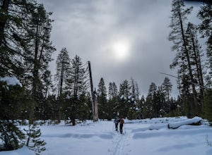
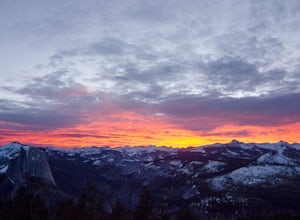
Nordic Ski and Snowshoe to Glacier Point
5.021 miKnown for its breathtaking vistas, towering granite faces, and thundering waterfalls, Yosemite National Park truly is one of the world’s most astounding landscapes. Though the park covers nearly 1200 square miles, the vast majority of the ~4 million annual visitors spend almost all their time ar...Read more -
YOSEMITE NATIONAL PARK, California
Cross-Country Ski to the Ostrander Ski Hut
Start your trip from the Badger Pass ski area. The Glacier point road is closed past here, and you'll spend your first couple of miles skiing mostly downhill to the Bridalveil Falls trailhead.The Bridelveil Creek trail gains slightly less elevation but is less scenic and longer than the more popu...Read more -
Yosemite National Park, California
Winter Backpack to Sentinel Dome in Yosemite
5.019.23 mi / 860 ft gainThe goal for our weekend was to do some winter camping in the Yosemite backcountry; we decided on Sentinel Dome as our destination. The trail is a cakewalk during the summer, but winter turns it into a 10 mile uphill grind from the car. Most people opt to head for the ski hut at Glacier Point, bu...Read more -
Yosemite National Park, California
Dewey Point via Badger Pass Ski Area
5.07.36 mi / 761 ft gainTake the one-hour shuttle ride from the Yosemite Lodge to the Yosemite Ski Area, so that you don't have to worry about driving in the snowy conditions, or finding parking. If you don’t own snowshoes, you can easily rent a pair from the rental shop for the day. Current rates are $24.00 for a full ...Read more -
YOSEMITE NATIONAL PARK, California
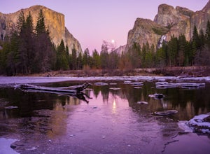
Photographing Valley View
4.5Valley View is a must stop viewpoint in Yosemite National Park. Most people visit Valley View on their way out of the park as it is the last stop, located along the one-way Northside Drive. Look for a small parking area to your left just before Pohono Bridge. There are only about a dozen parkin...Read more -
Mono County, California
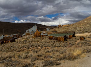
Explore Bodie's Ghost Town
5.0Bodie exploded as a gold mining town in 1876, after the discovery of gold ore. It is estimated that Bodie produced over $34 million worth of gold over the years. The town was finally abandoned in 1942.While driving on 395, turn onto 270 and follow it 17 mi to the ghost town of Bodie. The last thr...Read more -
Mariposa County, California
Dewey Point via Tunnel View
5.09.25 mi / 2979 ft gainDewey Point lies on the western side of the Pohono Trail, across the valley from El Capitan and above Cathedral Rocks. When I was there in September, it was deserted but for a few birds drifting on the thermals above the cliffs. The sunset was stunning. It felt like there was nothing between me a...Read more -
Mariposa County, California
Hike to Inspiration Point in Yosemite NP
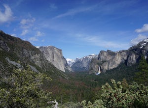
2.4 mi / 900 ft gainInspiration Point is a granite slab located on the mountainside above Tunnel View. Hiking to this scenic point will provide you with the same views you would get from Tunnel View with less people around. Hiking this trail can also take you to different parts of Yosemite if you're so inclined (Bri...Read more -
Mariposa County, California
Hike to Artist Point in Yosemite National Park
4.82 mi / 500 ft gainPark at the Tunnel View parking lot. The Pohono Trail, which you fill follow for the first half mile, starts on the left side of Wawona Tunnel. You should notice a small path starting from the parking lot. The trail quickly ascends up a series of switchbacks before reaching a junction. If you...Read more

