Madera County, California
Madera County, California is a great place for exploring and discovering nature. With its stunning landscape and abundant wildlife, this is an area that will captivate and inspire. Whether you want to take a leisurely stroll, embark on a daring expedition, or simply enjoy the sights, there's something here for everyone. Come see why Madera County, California is the perfect destination for anyone looking for a unique and memorable escape.
Top Spots in and near Madera County
-
Mammoth Lakes, California
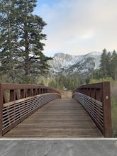
Waterford Bridge
The Waterford Gap bridge creates a picturesque view of the Eastern Sierra as it crosses over Mammoth Creek as part of the town loop and connects Majestic Pines Dr, which runs up to Eagle Lodge, with old Mammoth Road, which is a main road along the south and east edges of town. This is a great spo...Read more -
June Lake, California
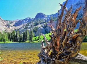
Hike to Fern Lake
5.03.5 mi / 1500 ft gainLess than 30 minutes north of Mammoth Lakes, the beauty of the region is captured even on the drive to get to the trailhead. No bathrooms at the trailhead, however the town of June Lake is a short bit away. Out of the gate, the trail quickly climbs 850 feet in just less than a mile. The way up, w...Read more -
Tuolumne County, California
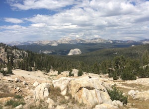
Backpack to Nelson Lake
17 mi / 1000 ft gainHead to any Yosemite wilderness station for a map, bear canister, and permit for Nelson Lake. The trail itself starts in the Tuolumne Campground at Elizabeth Lake trailhead. Follow the trail 2.2 miles up to Elizabeth Lake and remember the lake itself is in a no-camping zone, so you must continue ...Read more -
Tuolumne County, California
Tulomne Meadows to Donohue Pass via JMT
5.027.56 mi / 2953 ft gainDonohue Pass lies on the border of Yosemite National Park and the Ansel Adams Wilderness. Both the John Muir Trail (JMT) and the Pacific Crest Trail (PCT) route through this pass at 11,056 ft. A challenging but beautiful hike that starts from Tuolumne Meadows and follows the JMT for 12.5 miles t...Read more -
Cathedral Lakes Trailhead
Tuolumne Meadows to Yosemite Valley
5.030.82 mi / 6109 ft gainYosemite is an iconic park, and if you are looking for isolation with spectacular views of the backcountry this trip is for you. The trail itself is approximately 33 miles and can be done in 3-4 days, but I recommend a 6 day hike to enjoy the scenery and to have the opportunity to soak in each lo...Read more -
Yosemite National Park, California
Scramble Yosemite's Cathedral Peak
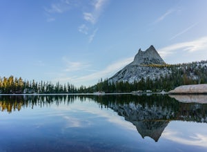
3.0Start at Toulumne Meadows (8000 ft), and take the John Muir Trail, on the south side of Tioga Road. After about 1 mile, an unmarked trail will appear on your left – it is a less-traveled path, primarily taken by climbers. This trail will lead you away from Cathedral Lake to the back of Cathedral ...Read more -
Wawona, California
Cathedral Lakes
4.89.04 mi / 1100 ft gainStarting at the Cathedral Lakes Trailhead near the Tuolumne Meadows parking lot (if parking is full at the TH), this trail wanders through the classic High Sierra forest with large white granite boulders and pine trees. After approximately 4 miles of quiet solitude in the forest, you will reach ...Read more -
Tuolumne County, California
Backpack to Boothe Lake
5.016.6 mi / 1400 ft gainStarting at the Tuolomne Meadows Visitor Center you will head south to jump on the John Muir Trail, move east for 2.8 miles on the JMT until the trail intersects with the Vogelsang High Sierra trailhead, you head south when you reach this trail. Once you hit the Vogelsang trail you are 5.5 miles ...Read more -
37.872112,-119.370472
Hike to Waterwheel Falls
17.32 miWaterwheel Falls may be the most unique waterfall in Yosemite. During high waterflow an extraordinary phenomenon appears as the raging water hits a series of ledges creating a plume, this coupled with strong gust blowing upward create cyclical "waterwheel" effect hence the name. On a good day th...Read more -
Wawona, California
Pothole Dome
5.01.01 mi / 250 ft gainGetting There From the Tuolumne Meadows Visitor Center, head west on Tioga Road/ Hwy 120 towards Tenaya Lake. You'll only travel about 1 mile down the road until you see Tuolumne Meadows open up again on your right, and there will be a very large gravel pull out where you can park. Pothole Dome ...Read more -
Tuolumne County, California
Camp at Tuolumne Meadows Campground
5.0Tuolumne Meadows is on Tioga road northeast of Yosemite Valley, at elevation 8,600 feet. Sites are available July-September at $26. Dogs are allowed but be sure to pack the leash! More info: https://www.nps.gov/yose/plany...Read more -
Mammoth Lakes, California
Lake Basin Path
5.04.43 mi / 554 ft gainLake Basin Path is an out-and-back trail where you may see beautiful wildflowers located near Mammoth Lakes, California.Read more -
YOSEMITE NATIONAL PARK, California
Enjoy a Sunset at Tuolumne Meadows
5.0Tuolumne Meadows at an elevation of 8,619 feet exemplifies the high country of the Sierra Nevada, with its sweeping sub-alpine meadows, granite domes, summer wildflowers and meandering rivers. When the forest opens up park along the side of the road and find a trail. There are also plenty of near...Read more -
YOSEMITE NATIONAL PARK, California
Fletcher Lake and Vogelsang Peak
19.03 mi / 2887 ft gainBefore you head out for the trip, you’ll need to get a wilderness permit. You can get one online from the Yosemite website or pick one up at the Tuolumne Meadows Wilderness Center or from the Wilderness Center in Yosemite Valley. Go to Yosemite and take Highway 120 up to Tuolumne Meadows. You ca...Read more -
Mono County, California
Gem Lake via Rush Creek
5.06.91 mi / 2313 ft gainThis hike starts next to Silver Lake in the June Lake Loop, located just north of Mammoth Lakes, CA off HWY 395. There is a parking lot near the RV park as well as street parking across the road from the trailhead. Once you head out on the hike, you'll start gaining elevation as you hike up tow...Read more -
Lee Vining, California
Hike to Agnew Lake from Silver Lake
4.04.4 mi / 800 ft gainJune Lake never ceases to amaze. In just about any weather, this particular portion of the 395 is something to be experienced in its entirety.If you are dedicating a day or two to explore the June Lake loop, then a trek to Agnew Lake is the perfect hike to throw into the plans. It is not extremel...Read more

