Long Barn, California
Long Barn, California, offers a range of top outdoor adventures, with the best trails and outdoor activities. The Pinecrest Lake Loop Trail is a must-visit for hikers. This moderate 4-mile trail circles the scenic Pinecrest Lake, with stunning views of the water and surrounding forest. For a more challenging trek, try the Emigrant Wilderness Trail. It offers a diverse landscape, including rivers, rock formations, and lush meadows. Don't miss the Columns of the Giants, a unique geological formation near the trail. For a relaxing day, visit the nearby Stanislaus River Parks, perfect for fishing and picnicking. Remember, these outdoor attractions are within and near Long Barn, making them convenient for a day of exploration.
Top Spots in and near Long Barn
-
Pollock Pines, United States
Hiking the Jenkinson Lake Loop Trail at Sly Park
4.0The Jenkinson Lake Loop Trail runs along Jenkinson Lake, making for an easy, shaded, and well-marked hike that the entire family can enjoy. The full loop is over eight miles, but can be easily modified into a shorter trip, as well.Along the way, you will see a variety of activities along the lake...Read more -
Lee Vining, California
Junction Campground, Mono County
Junction campground is by far one of my favorite campsites when I am visiting the High Sierra and Tuolumne Meadows. The only downside is, you can only camp certain months; usually from June through October when highway 120 is open. The Junction campground is far away from the crowds of Yosemite...Read more -
Tuolumne County, California
Middle Gaylor Lake
1.46 mi / 764 ft gainThe main trail to the Middle Gaylor Lake is about 1.5 miles round-trip, but if you’re looking for more adventure, you can hike a little further to Upper Gaylor Lake (which will add a mile to your trip) or continue on to the Great Sierra Mine (which will add 2 miles to your trip). The Gaylor Lake...Read more -
Twain Harte-Tuolumne City, California
Mount Dana
5.04.89 mi / 3120 ft gainThere's something special about the landscape that Yosemite National Park offers, and the scenery around Mount Dana is no different. The trail begins at the Tioga Gate entrance to Yosemite with the trailhead at the north end of the small parking lot south of the gate. It winds through the ponds,...Read more -
Lee Vining, California
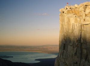
Climb the Third Pillar of Dana
From Highway 120 (Tioga Road) you can park at the lot just above Tioga Lake. Another mile up the road is the Yosemite entrance, so if you hit that, you've gone too far. Follow the trail around the south side of the lake and into Glacier Canyon. After about 2 miles you'll start scrambling on the N...Read more -
Twin Bridges, California
Hike Pyramid Peak via Rocky Canyon
5.07.4 mi / 4100 ft gainPyramid Peak is the tallest peak in the Crystal Range and the Desolation Wilderness, just west of Lake Tahoe. On a clear day it can be seen from the Bay Area over 150 miles away. Named for its distinct shape, Pyramid a massive heap of glaciated granite slabs and talus, and the Rocky Canyon route ...Read more -
Tuolumne County, California
Lyell Loop
35.88 mi / 5541 ft gainStart the hike at the Mono pass trail. You'll eventually take the fork towards Parker Pass a couple miles in. We tackled the trail in late spring, and it quickly became clear that there was still enough snow to make our lives difficult. As we climbed out of the Parker drainage, the trail essenti...Read more -
Tuolumne County, California
Mono Pass to Silver Lake Trailhead via Koip Peak Pass
20.25 mi / 3606 ft gainThis trip begins in Yosemite National Park and can be completed as an out-and-back or by hiking one-way to the Ansel Adams Wilderness and exiting at Silver Lake on the east side of the mountains. Start at the Mono/Parker Pass trailhead, a few miles past Tuolumne Meadows. Don't forget to make a pe...Read more -
South Lake Tahoe, California
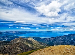
Hike to Freel Peak
5.07.3 mi / 2474 ft gainMt. Tallac may be one of the Lake Tahoe Basin's most famous peaks to hike because of its fantastic views of Lake Tahoe, but my personal favorite view in Tahoe is from the top of Freel Peak or Jobs Sister. Freel Peak is the tallest peak in the Lake Tahoe Basin at 10,881 feet.From the top of Freel...Read more -
Fish Camp, California
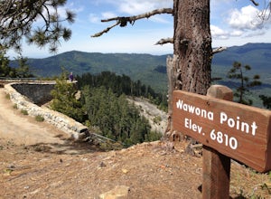
Hike through Mariposa Grove to Wawona Point
6 mi / 1200 ft gainThere is easy parking in the Mariposa Grove parking lot. There are a variety of trails through the grove; you can follow the NPS guide maps to see each of the iconic trees. These include tunnel trees you can walk through as well as overturned trees showing the immense root systems. From the parki...Read more -
Placerville, California
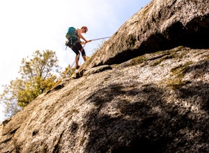
Rock Climb the Cosumnes River Gorge
5.0Consumes River Gorge is a good climbing spot that is relativity close to Sacramento, California. it is located just outside of Placerville, California, making it a must-stop climbing spot for any Sacramento or Eldorado county local. The climbing spot boasts granite climbing areas with over a hund...Read more -
Twin Bridges, California
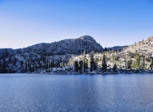
Ropi Lake via Pyramid Creek
4.74.87 mi / 1581 ft gainThe trailhead to begin this hike is located at: 38.8117 N, 120.1237 W. From Hwy 50 just south of Lake Tahoe, take Hwy 50 southwest for almost 11 miles, where you'll turn into the parking lot after crossing Pyramid Creek. There is a $5 day-use fee to park in the trailhead parking lot. The hike i...Read more -
Twin Bridges, United States
Hike Horsetail Falls
4.22.8 mi / 700 ft gainGreat views are waiting for you at the top of Horsetail Falls. Pyramid Creek flows down the steep, glacier carved granite faces of Desolation Wilderness to create this awesome waterfall that is estimated to be about 800 feet tall. You will follow Pyramid Creek up the granite rocks to the top of t...Read more -
Kyburz, California
Hike Pyramid Peak
5.0Although it stands only slightly higher than its neighbors, Pyramid Peak nonetheless dominates the Crystal Range atop which it sits. Great views from the summit make this a must-do.The Route: The route is fairly straightforward to Lake Sylvia (see map). Simply follow the well-defined Lyons Cr...Read more

