
Hike Pyramid Peak
Kyburz, California
Description
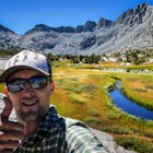
Added by Kyle Frost
Summit the tallest peak in Desolation Wilderness - 9,983'Spend a night or two next to Sylvia Lake. Duration: Overnight (don't forget to get your overnight permits!).
Although it stands only slightly higher than its neighbors, Pyramid Peak nonetheless dominates the Crystal Range atop which it sits. Great views from the summit make this a must-do.
The Route: The route is fairly straightforward to Lake Sylvia (see map). Simply follow the well-defined Lyons Creek trail up Lyons Creek, until you reach Lake Sylvia (about 4.6 miles). Over this distance, you've gained about 1,300 feet. Pyramid Peak is now only 1 mile away, but almost 2,000 feet above you. Obtain an overnight permit from the Service Range Station or Visitors Center (see below) and spend the night on the south end of the trail to Lake Sylvia before getting up to summit Pyramid Peak. If you're really looking to push it, this trek can be done in a full day.
From Lake Sylvia, aim for the obvious notch SSE of the lake. This is the trickiest part of the climb, as it involves some scrambling up the the saddle over loose rock, with some routefinding required. Fear not, however, as this is pretty easy going. From the notch, hang a left and walk up the south ridge of the peak. Don't stop until you're on top of the mountain. It is that easy. This is a longer route up the peak, but it is unquestionably the easiest way to summit.
To get there, take Highway 50 to Wrights Lake Road. This road is located about 35 miles east of Placerville (or about 6 miles west of Twin Bridges). Follow the winding Wrights Lake Road about 5 miles in a northerly direction until you reach the "Lyons Creek Trailhead". There is limited parking here. At the trailhead, you can self-issue a required wilderness permit for day hikes (overnight permits are subject to quota and must be issued at the Visitor Center or at Forest Service Ranger Stations). Source
Forest Service Ranger Station:PACIFIC RANGER DISTRICTLocated four miles east of Pollock Pines on Highway 50.7887 Highway 50, Pollock Pines, CA 95726Phone: (530) 647-5415
Visitor Center(s):LAKE TAHOE VISITOR'S CENTERLocated three miles north of the Highway 50/89 junction at South Lake Tahoe, on Highway 89.Call for hours, phone: (530)543-2674
LAKE TAHOE BASIN MANAGEMENT UNITLocated two miles east of hte Highway 50/89 junction in South Lake Tahoe on Highway 50. From the highway turn right on Al Tahoe Blvd. and then turn right at first signal.35 College Drive, South Lake Tahoe, CA 96150.Phone: (530)543-2600
Download Outbound mobile app
Find adventures and camping on the go, share photos, use GPX tracks, and download maps for offline use.
Get the appFeatures
Hike Pyramid Peak Reviews

This is a great route. Heard the other way is straight up and down (but only 4 miles each way) so this is definitely the scenic route. The scramble is definitely difficult. Take it slow if you're still getting used to the altitude like I was because it is a quite ascent. But on the other side is a gorgeous open view of desolation and can't be beat. Started to late and were worried about time so we didn't completely summit but the view just below was amazing as well! Definitely recommend. Only problem with camping is the mosquitos!! Left there with tons of bites just walking through🙃
5.0
I did this for three days and two nights on my first backpacking trip in 1995. I've been back and done it several times since and still love it. I highly recommend it as long as you are okay with a little scrambling up the initial "notch" from Lake Sylvia. After that, it's all hiking and some giant boulder hopping until you are at the summit.
5.0
Leave No Trace
Always practice Leave No Trace ethics on your adventures and follow local regulations. Please explore responsibly!
Nearby

Desolation's Primitive Western Edge through Rockbound Pass Loop

Twin and Island Lakes

Grouse, Hemlock, and Smith Lake

Smith Lake

Pyramid Peak via Rocky Canyon

Summit Price & Agassiz from Desolation Wilderness
Discover
Community
Mobile Apps

© 2026 The Outbound Collective - Terms of Use - Privacy Policy