Julian, California
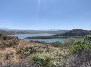
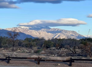
Julian, California is a great place to explore. From scenic trails to attractions, there are plenty of options to explore. The best trails and outdoor activities in Julian, California include the Julian Creek Trail, the Volcan Mountain Wilderness Preserve, and the Cuyamaca Rancho State Park. The Julian Creek Trail is a great place to observe local flora and fauna, while the Volcan Mountain Wilderness Preserve provides stunning views of the area. The Cuyamaca Rancho State Park offers a wide range of activities, such as camping, fishing, and horseback riding. Additionally, the area also contains a variety of attractions like the Julian Pioneer Museum, the Julian Historic District, and the Julian Town Hall. Whether you're looking for a leisurely day outdoors or an adventurous experience, Julian, California has something for everyone.
Top Spots in and near Julian
-
San Diego, California
South Fortuna Mountain
5.04.59 mi / 997 ft gainHiking at sunset/night is a great way to beat both the heat and the crowds. On a clear day, you can see from Mexico to Catalina Island! If you stay long enough, you can see all of San Diego's city lights turn on, or the marine layer fog creeps into the canyons. South Fortuna Peak is part of Miss...Read more -
Jamul, California
Hiking Otay Mountain
5.015.3 mi / 2903 ft gainThe trek begins on the Otay Mountain Truck Trail at Pio Pico Resort & Campground. You can either park and hike the entire trail, or drive up to a point a couple miles and park before the road becomes steep and rough. The distance on here is if you hiked the whole way. If you have a 4-wheel dr...Read more -
San Diego, California
Los Penasquitos Waterfall via Los Penasquitos Canyon Trailhead
4.34.15 mi / 115 ft gainThe Los Penasquitos Preserve waterfall is a hidden gem of San Diego and a popular spot for locals within the area. The hike to the waterfall lies within a preserve of approximately 4,000 acres. There are many different trailheads that lead to the waterfall all offering a unique experience. I alwa...Read more -
Temecula, California
Dripping Springs Trail
4.013.68 mi / 3287 ft gainThe trail immediately begins to climb out of the campground on a well-graded incline. The next mile contains some climbing leading to a set of switchbacks. A long strenuous climb ensues until the 3200' elevation is reached. The trail then makes an easy southward traverse to the basin before resum...Read more -
Campo, California
Photograph the Mexican Border on the PCT Southern Terminus
4.5From San Diego head East on Hwy 8 for roughly 60 miles to Buckman Springs Road (Exit 51). Take a right on Buckman Springs road an drive South for 10 miles. Turn right on CA-94 W (Campo Rd) and drive for 1.5 miles. After crossing the railroad tracks turn left on Forrest Gate Road. Take this road f...Read more -
Aguanga, California
Vail Lake Loop
4.07.25 mi / 922 ft gainVail Lake Loop is a loop trail that takes you by a lake located near Temecula, California.Read more -
Chula Vista, California
Hike Mother Miguel Mountain
5.04.5 mi / 977 ft gainAt the summit, your work will be rewarded with stunning views from downtown San Diego all the way to Mexico. You can also see the surrounding mountain peaks and the Sweetwater Reservoir. This is a great hike to do at sunset - but bring a headlamp / flashlight for the hike back down. This trail i...Read more -
Mountain Center, California
Cactus Spring Trail
31.73 mi / 6407 ft gainCactus Spring Trail is an out-and-back trail where you may see wildflowers located near Mountain Center, California.Read more -
San Diego County, California
Hike to the Goat Canyon Trestle
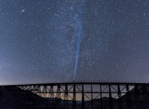
5.07 miThe main attraction of this hike is the wooden trestle. This engineering marvel was built in 1932 and still remains the tallest and longest curved wooden trestle in the U.S.This hike is recommended for the physically and mentally prepared. From Mortero Palms, it's a 3.5 mile (7 miles roundtrip) t...Read more -
San Diego, California
Hike the Rose Canyon Trail
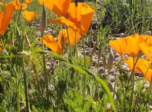
3.58.9 mi / 725 ft gainThis hike is open year-round but is especially beautiful in the spring when the wildflowers are blooming and the spring is running. This trail offers good entry level mountain biking, with mostly flat well maintained trails and a couple of challenging but doable hills.Read more -
Mountain Center, California
Dunn Road
15.55 mi / 994 ft gainDunn Road is an out-and-back trail where you may see beautiful wildflowers located near Palm Springs, California.Read more -
Solana Beach, California
Annie’s Canyon Trailhead
4.72 mi / 100 ft gainIf you're looking for a super short hike, this 10 minute flat walk couldn't be more ideal. Start at 840 N Rios Avenue, Solana beach and walk east towards the FWY 5 where you will see Annie’s Canyon on your right. There is only one way to go up the canyons and it gets pretty tight in places, but y...Read more -
San Diego, California
Balboa Park Loop
4.64.34 mi / 226 ft gainThe Balboa Park Trail offers the chance to see wildlife and is open year-round. The trail is shared by runners, families, hikers, and bikers. Dogs are able to use the trail but must be kept on leash. There is a dog park you will pass by.Read more -
San Diego, California
Torrey Pines Beach Trail Loop
4.72.15 mi / 374 ft gainThe beach trail brings you from the parking lot across the lodge from the bluff down to the beach. You can choose to visit the Red Butte, the Razor Point, and the Yucca Point trails along the way. Of the other trails, this trail seems to provide a complete walkthrough of geological features; it a...Read more -
San Diego, California
Razor Point, Beach Trail, & Broken Hill Trail Loop
5.03.21 mi / 440 ft gainThe parking area for all of Torrey Pines State Natural Reserve is located right off North Torrey Pines Road (where the location is for this hike), about 20-30 minutes north of San Diego. It's $10 to park, and there was also a smaller parking lot at the top of the hill if you want to avoid the ini...Read more -
San Diego, California
Beach Trail
5.01.43 mi / 259 ft gainI'm stoked for those of you to find this adventure! Torrey Pines is home to a species of tree that is one of the most rare native pines in the United States. Below I have directions on how to get to the trailhead as well as the parking lot to park for the hike. There is a charge to get into the...Read more

