Julian, California
Julian, California is a great place to explore. From scenic trails to attractions, there are plenty of options to explore. The best trails and outdoor activities in Julian, California include the Julian Creek Trail, the Volcan Mountain Wilderness Preserve, and the Cuyamaca Rancho State Park. The Julian Creek Trail is a great place to observe local flora and fauna, while the Volcan Mountain Wilderness Preserve provides stunning views of the area. The Cuyamaca Rancho State Park offers a wide range of activities, such as camping, fishing, and horseback riding. Additionally, the area also contains a variety of attractions like the Julian Pioneer Museum, the Julian Historic District, and the Julian Town Hall. Whether you're looking for a leisurely day outdoors or an adventurous experience, Julian, California has something for everyone.
Top Spots in and near Julian
-
Poway, California
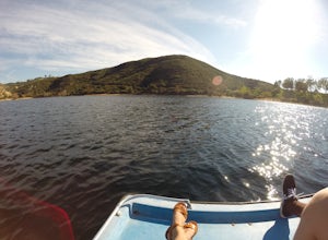
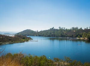
Relax at Lake Poway
4.0It costs $5 to enter the park and they are open 6am to sunset everyday. There is plenty of parking and this park is huge! This place has so many outdoor recreational activities such as fishing, hiking, running, archery, feeding ducks, or just having a picnic. With so many possibilities in this on...Read more -
Poway, California
Blue Sky Ecological Reserve to Ramona Dam
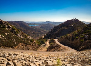
3.05.3 mi / 984 ft gainStarting at the trail head where you park your car, head south along the Green Valley Truck Trail. After less than a mile, you will notice the city and noise start to fade behind you, and a beautiful sight of towering oaks, willows, and sycamores appear as you walk along the Creekside Trail. You ...Read more -
Campo, California
Kitchen Creek Falls Trail
4.04.83 mi / 722 ft gainKitchen Creek Falls Trail is an out-and-back trail that takes you by a waterfall located near Pine Valley, California.Read more -
Palomar Mountain, California
Hike Thunder Spring and Chimney Flat Loop
3.04 mi / 900 ft gainPalomar Mountain is the hidden gem of San Diego. Well, not so hidden per se- but most don't know that the little climb up the mountain can transport you from the prevalent brush-filled terrain of SD to a lush, diverse forest.The great thing about Palomar is that every day you visit could be compl...Read more -
Palomar Mountain, California
Hike to French Valley
5.03.8 mi / 450 ft gainWhen it comes to Palomar Mountain State Park, most people stick to Doane Lake and Upper Doane Valley. Yet on the far right of the parking lot at Doane Pond, there is actually a trailhead that will guide you to a completely different section of the park. The Lower Doane Valley trail is, in my opti...Read more -
San Diego County, California
Hiking the Laguna Hills via the PCT
5.020 mi / 2000 ft gainThis trail is well-maintained, but gets a little rocky on the PCT, and the Chariot Fire burn-zone between Penny Pines and Hayes peak will have a few downed trees and some overgrown grasses. On the other hand, the trail network of the BLT is confusing to follow as the entire network is named "Big ...Read more -
Borrego Springs, California
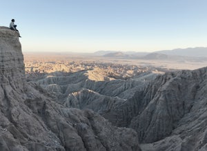
Catch a Sunset at Fonts Point
4.04 miThe best time to go to Fonts point is right before the sun sets. It is located in the desert, so be sure to dress warmly and bring a blanket or two.In order to get to Fonts Point, you'll have to drive through roughly 4 miles of sand and rocks. 4x4 is strongly recommended, but keep an eye on road ...Read more -
Escondido, California
Camp at Dixon Lake
2.1 mi / 295 ft gainDixon Lake is Escondido's best kept secret! A man-made reservoir located right next to Daley Ranch, Dixon Lake offers overnight camping, boat rentals, fishing, and hiking, along with picnic areas, a kids park, and more. The campground is open year-round and is located next to the lake with a lof...Read more -
San Diego County, California
Hike to Mountain Palm Springs, Anza Borrego SP
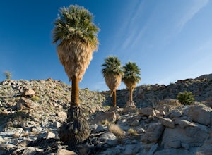
3 mi / 350 ft gainAt first glance the Anza-Borrego desert appears lifeless, a wasteland of rocky plain peaks rising up from Carrizo Plains covered in Cholla cactus and Ocotillo. But one of the surprises is a mirage of California fan palm groves hidden in a series of canyons.The Mountain Palm Springs oasis loop is ...Read more -
Poway, California
Catch a Sunset at Twin Peaks Mountain
2 miStart by parking at Silverset Park. You will see the trail head for Twin Peaks just behind the park. Park outside of the park if you think you'll be staying past sunset, as the park gates close at dark! Once you spot the trail head, veer left to the path heading up towards the peaks. You will eve...Read more -
San Diego, California
Battle Mountain's Cross
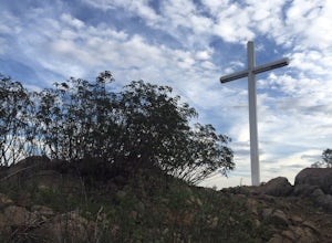
5.00.45 mi / 256 ft gainThis is a quick and easy hike for everyday explorers desiring a 20-minute sweat-inducing power walk leading to incredible views of urban development, Iron Mountain, Mt. Woodson, Mule Hill, and The 15. Come enjoy the views while sitting under the beautiful 20ft cross you've been admiring from the ...Read more -
Escondido, California
Bernardo Mountain Summit Trail
5.07.15 mi / 1060 ft gainBernardo Mountain is located on the Coast to Crest Trail in San Dieguito River Park. The 7.15-mile out-and-back trail to the 1060 ft. summit starts on the east side of I-15. It's a relatively easy hike all the way to the top. It picks up a little once you make it to the Summit Trail junction, wh...Read more -
Jamul, California
Hike Mt. McGinty
4.8 mi / 1263 ft gainBalancing a good workout, gorgeous views, and minimal time commitment, these 4.8-mile steep trail is definitely a San Diego point of interest, and despite its proximity to the city of San Diego, it remains a low trafficked hike. The Hike: Right away the trail weaves you through beautiful vegetati...Read more -
San Diego County, California
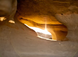
Exploring Anza Borrego's Wind Caves
4.8The drive to the caves is pretty lengthy, so be prepared.First you will drive through Anza Borrego State Park on Highway 78, then on a Split Mountain road which eventually turns into gravel road, and you need to look out for the entrance to the wash-road (which if you like to off road, is a perfe...Read more -
Borrego Springs, California
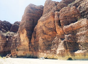
Off-Road through Split Mountain in Anza Borrego
4.011 mi / 0 ft gainFor all you desert lovers- this is a must. Or for all you SD residents that want to try something new and take a break from the populated trails within the county- spend a day in Anza Borrego and include this on your list.This state park is just a quick jaunt outside of the town of Julian. This m...Read more -
Santee, California
Cowles Mountain via Big Rock Trail
4.04.86 mi / 1207 ft gainStarting somewhat near sea-level, Cowles Mountain via the Big Rock Trail climbs about 1000 ft in elevation. This trail is about 5 miles total, out and back. Arrive at Big Rock park which has good parking. At the park you will walk to the left of the tennis courts past the limits (the fence) of...Read more

