Hacienda Heights, California
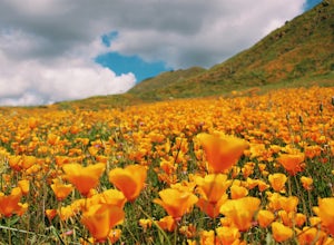
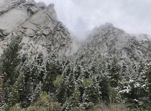
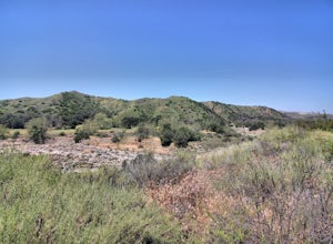
For top outdoor adventures in Hacienda Heights, California, the must-visit hiking trail is the Schabarum Regional Park Trail. This scenic 2.5-mile loop trail offers moderate difficulty and is best for outdoor activities like walking, running, and bird watching. The trail features a lake and beautiful wild flowers, making it a visually appealing walk. Another attraction near to this location is the Powder Canyon Loop Trail. This 4.4-mile trail is a bit more challenging, with steep slopes and rugged terrain. It's a great spot for mountain biking and trail running. Both trails offer stunning views of the San Gabriel Valley. For the best trails and outdoor activities in Hacienda Heights, these two spots are a must-visit.
Top Spots in and near Hacienda Heights
-
Laguna Beach, California
Aliso Peak via the Valido Trail
5.01.14 mi / 325 ft gainThe Valido Trail trailhead can be found just off West street off the Pacific Coast Highway, just south of Aliso Beach. Park on West Street past the trailhead. The trail proceeds approximate .5 miles till it intersects with the Aliso Peak Trail. Go left .4 miles to the obvious summit and wooden p...Read more -
Topanga, California
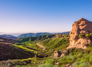
Eagle Rock in Topanga State Park
4.45.99 mi / 1106 ft gainEagle Rock is located in Topanga State Park in the Santa Monica Mountains, and it is a unique formation that provides an amazing panoramic view of Santa Monica. On a clear day, the Catalina Islands and Palos Verdes Peninsula are visible. You can park on along the street of Entrada Rd. or pay $10 ...Read more -
Topanga, California
Parker Mesa Overlook via Trippet Ranch
4.06.75 mi / 1181 ft gainThis is a 6.8 mile round-trip hike that starts at Trippet Ranch in Topanga Canyon. Even though the range in elevation is 400 feet from peak to trough, the up and down trail totals to approximately 1800 feet elevation gain making this a beginner to intermediate adventure. The trail itself is pre...Read more -
Laguna Beach, California
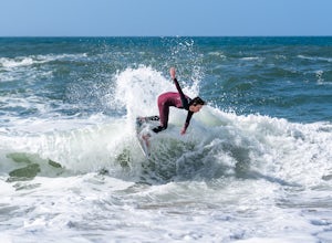
Skimboard Table Rock Beach
Laguna Beach is both the birthplace *and* and the capital of skimboarding, and for good reason: it boasts an impressive array of beaches where (if you know where to look) you can find one where the conditions are right for one of the most difficult but rewarding of water sports. Table Rock is one...Read more -
Laguna Beach, California
Laguna Beach Caves
3.8Explore some beautiful caves right on the beach in Laguna. The stairs leading down to the beach are just off the side of PCH at 9th st. You can park anywhere along the PCH on both sides near 9th st. Head down the stairs and the main caves are on the left. To the right there are also some small c...Read more -
Laguna Niguel, California
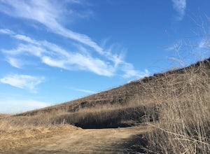
Colinas Ridge Trail
2.01 mi / 131 ft gainFirst, you'll be parking in the parking lot for the dog park. It's free parking and there are roughly 40 spaces, so there is plenty of parking. I've never seen more than 20 cars here at any one time. Once parked you'll find the trail head/ start on the northwest side of the lot (opposite the dog ...Read more -
Topanga, California
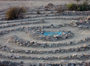
The Labyrinth at Tuna Canyon Park
1.45 mi / 299 ft gainThis is a simple but steep 2.4 mile round-trip hike to a clearing on a mountaintop in Topanga/Malibu, about an hour's drive west of downtown LA. At the end of the hike you'll reach a clearing with incredible views. On a cloudy or foggy day, it feels like you're floating above the clouds; on a cle...Read more -
Lake Elsinore, California
Explore Walker Canyon
4.3Walker canyon is within easy driving distance from most places in Orange County and San Diego which makes for a great day trip. While there is no official parking lot for the trail you will be able to find parking all along Lake Street and Walker Canyon Road. The trail begins at the corner of L...Read more -
Topanga, California
Top of Topanga Overlook
1 mi / 1613 ft gainThe Top of Topanga Overlook is where you can simply park your car, and sit in one of the benches to view the San Fernando Valley. But there is one hiking trail in that area which lets you get better vantage points, as well as a quick workout. Once you get to the overlook, park your car and safel...Read more -
Riverside, California
Hike Two Trees Trail
2.5 mi / 977 ft gainParking is free at the trailhead, but there is only room for approximately five cars. The trailhead is on the edge of a neighborhood, so you can park there if needed. From the parking lot, head west, and immediately veer right and across the bridge. If you go left at the first fork, you can stay ...Read more -
Lake Elsinore, California
Ride the San Juan Trail
4.511 mi / 3400 ft gainThe San Juan Trail is located off the Ortega Highway (Hwy 74) in Southern Orange County. It is done frequently as a long, 11 mile climb that is rewarded by an almost continuous descent of 3400ft. The out-and-back trail head is back Hot Spring Canyon Rd from the San Juan Fire Station. It can also ...Read more -
Los Angeles, California
Reseda Point
4.00.2 mi / 30 ft gainFrom the 118 FWY, exit Reseda and head north until you pass by Calle Vista Circle. Once passed, make a U-turn and park on the side of the street. Here you will find the trailhead for the Palisades Trail Hike. To get to the scenic lookout, simply walk up the short trail leading up the hill, and h...Read more -
Dana Point, California
Hike the Salt Creek Trail
5.03 mi / 20 ft gainStarting from the Salt Creek Beach parking lot (a paid lot that takes cash, debit, and credit cards and charges by the hour. There are pay stations at a few points in the parking lots), you head west towards the ocean...through a tunnel and down the hill towards the beach. Once you get to the bas...Read more -
Dana Point, California
Surf Salt Creek
5.0There are two HUGE parking lots off of PCH, so parking isn't an issue (unless it's on a weekend in the summer, then it does get full). This is a paid lot with a few pay stations located around the parking lot, and they take cash and credit/ debit card...you can pay by the hour. Once you find your...Read more -
Trabuco Canyon, California
Bell Canyon Trail
3.86 mi / 102 ft gainBell Canyon Trail is an out-and-back trail where you may see wildflowers located near San Juan Capistrano, California.Read more -
San Juan Capistrano, California
Hike the Pinhead Peak Trail at Ronald W. Caspers Wilderness Park
4.02 mi / 220 ft gainRonald W. Caspers Wilderness Park is the perfect place to getaway from the hubbub of LA. Enjoy the scenic drive north on Ortega Highway before reaching the entrance gate to the park. Parking Fees are currently $3 on Weekdays and $5 on Weekends. Camping Fees vary depending on your group size. The...Read more


