Glendale, California
Looking for the best hiking in Glendale? We've got you covered with the top trails, trips, hiking, backpacking, camping and more around Glendale. The detailed guides, photos, and reviews are all submitted by the Outbound community.
Top Hiking Spots in and near Glendale
-
Silverado, California
Hike to Black Star Canyon Falls
4.87.5 mi / 913 ft gainWaterfalls in Orange County are far and few between, with the best lying near and inside the Cleveland National Forest. Black Star Canyon Falls are some of the best just after a rain if you are heading out during a dry time of the season you should still expect to see some water. Free parking, ea...Read more -
Castaic, California
Hiking the Piru Creek Gorge Trail
Take the I-5 exit North of Castaic, CA at Templin Hwy. Turn onto Golden State Hwy heading the only direction it goes from the exit, North. When it dead-ends in a few miles at the National Forest Gate, you are at Frenchman's Flat.You can camp here, or hang with the day hikers. Heading North along ...Read more -
Corona, California
Skyline Drive Trail
3.09.07 mi / 1946 ft gainThis trail is shared by hikers, mountain bikers and trail runners. Rock climbers can find areas to boulder off the trail. Bring lots of extra water as this trail is rather dusty and can get very hot. This is a good training hike for those looking to do some backpacking. The trail is open year-r...Read more -
Newport Beach, California
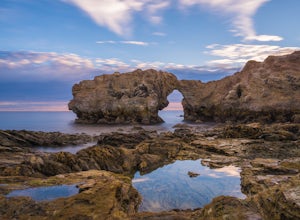
Exploring the Arches at Little Corona del Mar
4.9Little Corona del Mar Beach is a secluded beach located on Poppy Avenue across Ocean Boulevard in Corona del Mar. Known as one of the less crowded beaches in the area, this spot is the perfect place to chill for the day or photograph a sunset. You will find plenty of free street parking in the ne...Read more -
Malibu, California
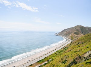
Scenic Trail
4.01.53 mi / 322 ft gainThe trailhead is located in the day use area of Point Mugu State Park. Park in the day use area parking lot. There is a parking fee of $12/day or $3/hr. From the parking lot, walk through the campground until you reach the old service road. After passing through the gate, turn left at the si...Read more -
Malibu, California
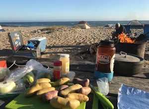
Camp at Point Mugu State Park's Thornhill Broome Campground
5.0Beach camping in California seems elusive these days, but we were able to pitch our tent just feet from the surf! We stayed for two nights and felt like we had our own private stretch of beach. First, you'll want to make reservations at www.reserveamerica.com. It was fairly easy to reserve a spot...Read more -
Malibu, California
La Jolla Valley Walk-In Camps
5.010.58 mi / 2146 ft gainHello Friends! I just took a really chill overnight backpacking trip to the La Jolla Valley Backcountry campsite and I’m going to give you some details so you can have as nice of an outing as I did! The trailhead is conveniently just off of the Pacific Coast Highway, across the street from the T...Read more -
Malibu, California
La Jolla Canyon Falls
1.75 mi / 449 ft gain...I think out of all the State Parks in the Santa Monica Mountains, Point Mugu State Park is without a doubt the best one. Maybe it has something to do with its proximity to the beach, or the endless trails and epic views, but the energy and diversity here is just so much more wild. With the par...Read more -
Lancaster, California
Little Butte Trail
4.02.09 mi / 213 ft gainLittle Butte Trail is an out-and-back trail that is moderately difficult located near Llano, California.Read more -
Lancaster, California
Saddleback Butte State Park Loop
0.58 mi / 46 ft gainSaddleback Butte State Park is a state park in the Antelope Valley of the western Mojave Desert. It’s oftentimes looked over, but you’d be surprised what you can find there. Definitely a place to stop. It is located east of Lancaster. It can get hot so make sure to bring lots of water and wear su...Read more -
Newport Beach, California
Bommer Ridge from the Pacific Ridge Trailhead
7.54 mi / 394 ft gainThe Bommer Ridge West Trailhead aka The Pacific Ridge Trailhead begins at the edge of Ridge Park Road, overlooking CA State Highway 73, and marks the northwest entrance to the Laguna Coast Wilderness and its neighbor, Crystal Cove State Park. From the well-marked trailhead follow the trail south...Read more -
Newport Beach, California
Explore Deer Canyon
6.9 mi / 1489 ft gainThe Deer Canyon Loop Trail is an easy drive from Orange County and Newport Beach. In the spring, wildflowers are abundant along the trial. This is a favorite spot for trail runners, hikers, and mountain bikers. The trail is kept in great condition year-round and is very wide. There is very little...Read more -
Lytle Creek, California
Old CC Spur Trail via Big Tree Cucamonga Rd
5.11 mi / 1138 ft gainOld CC Spur Trail via Big Tree Cucamonga Rd is an out-and-back trail that takes you by a waterfall located near Fontana, California.Read more -
Lake Forest, California
Hike Borrego Canyon to Red Rock Canyon Trails
4.64.2 mi / 500 ft gainJust south east of the city of Irvine, on the southern end of Orange County, is the scenic Whiting Ranch Wilderness Park. Don't let the newly developed shopping centers restaurants fool you, because just beyond the parking lot ($3 Daily Use Fee) of the Borrego Canyon Trailhead, you will find your...Read more -
Malibu, California
Hike Point Mugu Peak
4.52 mi / 1250 ft gainPoint Mugu State Park offers some amazing rolling mountains, sweeping meadows of tall grass, and beautiful coastal views. I suggest going in the spring. I recently went, and the wildflowers were blooming everywhere. There are campgrounds available in different parts of the park that you can make ...Read more -
Malibu, California
Hike Mugu Peak Loop via Chumash Trail
5.06.5 mi / 1255 ft gainFrom the parking lot at the trailhead, follow the steep trail going up the mountain. This part is quite challenging, so I recommend stretching out your legs before starting the hike. Once you reach the top, you will see your first junction. Go right if you want to go straight for the peak, and th...Read more


