Forks of Salmon, California
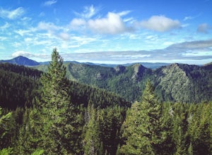
Forks of Salmon, California, offers top outdoor adventures with its scenic hiking trails. The best Trails and Outdoor Activities in this area include the Russian Wilderness Trail. This moderate difficulty trail provides breathtaking views of the surrounding mountain peaks and lush green forests. Along the way, you'll come across a variety of flora and fauna, adding to the overall appeal of the trail. Another must-visit is the Pacific Crest Trail, a long-distance hiking and equestrian trail that traverses through the state. It's known for its stunning views of the mountains, rivers, and lakes. The Salmon River, a popular spot for fishing and rafting, is also nearby. These outdoor activities and attractions make Forks of Salmon an ideal destination for those seeking an active getaway.
Top Spots in and near Forks of Salmon
-
Pacific Crest Trail, California
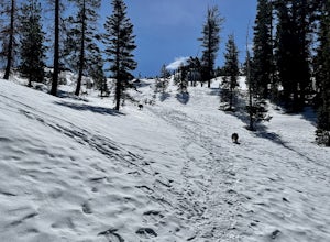
Hike or Backpack the Dead Falls Lake Trail
5.08.1 mi / 1358 ft gainThe Dead Falls Lake Trail is perfect for families, dog, and all adventurers. In the spring and summer, there are gorgeous and abundant wildflowers. There is a perfect lunch spot at Deadfall Lake. Close to the gargantuan Shasta, Mount Eddy is the highest peak in the Klamath Mountain. Mount Eddy o...Read more -
Crescent City, California
Devil's Punchbowl, Six Rivers National Forest
4.08.33 mi / 1660 ft gainLocated in extreme Northern California, the Siskiyou Mountains are the largest sub-range of the Klamath Mountain range and among the most rugged. The Siskiyou Wilderness, designated in 1984, encompasses three national forests: Siskiyou, Klamath and Six Rivers for a total of 182,802 acres. Because...Read more -
Trinidad, California
Explore Luffenholtz Beach Park
On a road trip with a friend in July of 2019, this beach came recommended to us. The tidepools, rocks cutting into the sea, and photography opportunities made it a spectacular stop. There are stairs down to the beach and we were the only ones at the park. If I remember correctly, it’s quite a n...Read more -
Trinidad, California
Wedding Rock Trail
5.00.23 mi / 85 ft gainWedding Rock Trail is an out-and-back trail where you may see wildflowers located near Trinidad, California.Read more -
Trinidad, California
Patrick's Point Trail
5.00.21 mi / 92 ft gainPatrick's Point Trail is an out-and-back trail where you may see wildflowers located near Trinidad, California.Read more -
Trinidad, California
Strawberry Rock Trail
5.02.99 mi / 505 ft gainTo get there: From the south, take the Trinidad exit, from which you will take a slight left/ go straight onto Trinidad Frontage rd. From The north, get off at the Trinidad exit, cross under the freeway, and take a left on Trinidad Frontage rd. Once on Trinidad Frontage rd, go straight to the end...Read more -
Klamath, California
Hike to the Klamath River Outlook
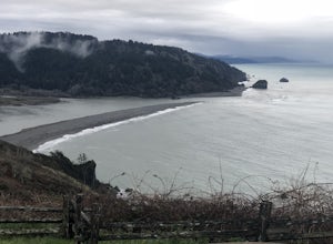
3.01 mi / 500 ft gainFun drive on Requa Road off 101 takes you to a great little outlook. Take the trail descent down to the beach or connect with the CA Coastal trails for a three or four mile jaunt to either Hidden Beach or Lagoon Creek Beach. This spot is a local gem with minimal visitors. It also offers a likely ...Read more -
Trinidad, California
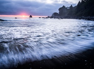
Watch a Sunset at College Cove Beach
5.00.25 miFollow the trail leading from the end of the parking lot down onto the beach. From the parking lot to the beach the walk is about a quarter of a mile, with a slight decrease in elevation as you move down to the beach. To get to the beach, take 72B off of Highway 101 and turn west onto Main Stree...Read more -
Trinidad, California
Hike Trinidad Head
4.81.5 mi / 300 ft gainPark in the large parking lot at Trinidad Beach. The trailhead is at the south end of the parking lot. The loop trail can be hiked in either direction.The trail is half dirt singletrack, half paved switchbacks, and climbs steadily to the top of Trinidad Head. The view of the ocean and California ...Read more -
Douglas City, California
Camp at Steel Bridge Campground
Steel Bridge is located along the Trinity River. About three miles east of Douglas City on State Highway 299, turn north onto Steel Bridge Road and go about 2 miles to the campground.This campground is open from Mid-May until winter weather forces closure. The campground is home to 12 camping s...Read more -
Douglas City, California
Camp at Douglas City Campground
The campground amenities include 20 tent/trailer campsites, group picnic area, picnic tables, telephone, beach, paved loop road, flush and vault toilets, potable water, and fire rings. MAX trailer length is 28 feet.Douglas City is located along the Trinity River. Follow State Highway 299 to Dougl...Read more -
Klamath, California
Hike the Yurok Loop Trail
4.01 mi / 20 ft gainThe Yurok Loop Trail is a small loop on the northern end of the growing California Coastal Trail. This family-friendly hike starts at a picturesque lagoon near False Klamath Cove before crossing a bridge and entering the Sitka spruce forest. From the trail junction, you have the choice of passin...Read more -
Klamath, California
Relax at False Klamath Cove
4.0Wilson Beach in False Klamath Cove is a small but scenic spot in Del Norte Coast Redwoods State Park. Surrounded by thick forest, the dark gray sandy beach is scattered with driftwood, interesting rocks formations, and tide pools. The small free parking area has picnic tables and is a popular spo...Read more -
Del Norte County, California
Backpack to Raspberry Lake
1.012 mi / 1800 ft gainIf you wish to experience the beauty of the Siskiyou Wilderness and avoid the crowds associated with The Devil’s Punchbowl, then consider a visit to Raspberry Lake. Beginning at the Young’s Valley Trailhead (Coordinates: 41.889919, -123.654755), this hike is a great option for those seeking wide...Read more -
Dunsmuir, California
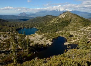
Hike to Heart Lake in the Klamath Mountains
4.52.2 mi / 600 ft gainScenes like this are rarely so accessible. Heart Lake is nestled in a bowl below Castle Peak, on the edge of the Castle Crags Wilderness just west of I-5 and the city of Mt. Shasta. The parking lot and trailhead are both located on the shore of Castle Lake, a much larger lake that is stunning in ...Read more -
Dunsmuir, California
Heart Lake Trail From Castle Lake
5.02.46 mi / 719 ft gainHeart Lake Trail From Castle Lake is an out-and-back trail where you may see beautiful wildflowers located near Dunsmuir, California.Read more

