Forks of Salmon, California
Looking for the best hiking in Forks of Salmon? We've got you covered with the top trails, trips, hiking, backpacking, camping and more around Forks of Salmon. The detailed guides, photos, and reviews are all submitted by the Outbound community.
Top Hiking Spots in and near Forks of Salmon
-
Forks of Salmon, California
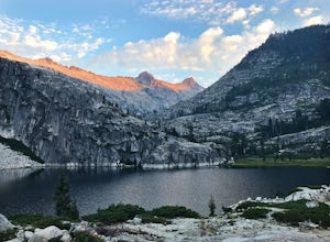
Grizzly Lake via China Gulch Trailhead
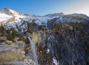
4.414.6 mi / 5112 ft gainGrizzly Lake is in the Trinity Alps Wilderness. The lake is know for its brilliant waterfall flowing from the lake's surface straight off the side of a cliff and roughly 600 feet down to the meadow below. Grizzly lake is located in some of America's most amazing and remote alpine wilderness, incl...Read more -
Etna, California
Hike to the Etna Mountain Summit
6 mi / 800 ft gainTo start off, you're going to want to navigate to the Etna Summit Trailhead (5956 ft). There's a small parking lot off to the side and we did not need any passes for our overnight trip. Since the summit isn't the main destination for many people in this area, you'll want to follow the Pacific Cre...Read more -
Forks of Salmon, California
Hike to the Caribou Lakes, Shasta-Trinity Alps
4.016 mi / 3000 ft gainHike through the most majestic and unforgettable mountain ranges, alpine terrains, glacier lakes outside of the Sierra Nevada in Northern California. Yes, it's a long drive there and a lengthy hike, but if you have any doubts about whether this is worth the effort, just go! I struggled with the s...Read more -
Fort Jones, California
Sky High Lakes in the Marble Mountains
5.011.88 mi / 2070 ft gainThe Marble Mountains are part of the Klamaths, a biologically and geologically diverse range of peaks and ridges often overshadowed by its western neighbors in the Cascades. The Marble Rim is the signature feature of this subrange, a white wall of rock that glimmers in the sun. The nearby Sky Hig...Read more -
Junction City, California
Scramble Thompson Peak
4.022.7 mi / 6100 ft gainThis adventure begins at the Canyon Creek Lakes in the Trinity Alps wilderness. Park at the Canyon Creek Trailhead near Junction City and hike the well-maintained and easy-to-follow trail for 8 miles. Once you reach the Canyon Creek Lakes, your off-trail adventure officially begins. I’d recommend...Read more -
Junction City, California
Backcountry Camp in the Canyon Creek Drainage
9 mi / 2600 ft gainThe first half of the Canyon Creek Drainage is one of the most popular destinations within the Trinity Alps, but the second half goes largely unexplored and uninhabited by sojourners. Four peaks – Thompson Peak, Wedding Cake, Mt. Hilton, and Sawtooth Peak – surround the basin and offer adventurer...Read more -
Junction City, California
Canyon Creek Lakes
4.314.35 mi / 2605 ft gainNumerous starting points with over 550 miles of trail and easily 50+ different featured trails depending on length and what type of activity you are are looking for. One of the more popular trails, and rightfully so, is Canyon Creek Lakes Trail. This 16 mile roundtrip hike has an overall elevatio...Read more -
Orick, California
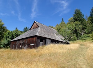
Hike Lyons Ranch
4 miThis is really a dirt road that is gated off from Bald Hills Road. The trail head parking can fit about 6 cars but seldom do people venture out this way. After all, the attraction of Redwood National Park is the redwoods but this high prairie is definitely worth exploring.The walk to the ranch is...Read more -
Trinity Center, California
Stoddard Lake
5.07.01 mi / 1325 ft gainThe trail is a bit rocky, so wear sturdy hiking boots or trail runners. While your elevation gain is only 800 total, you will travel upwards of 1,982ft in elevation given the ups and downs of the trail. At mile 1.75, there is a spring that feeds into a large meadow. At mile 3, there is another sp...Read more -
Trinity Center, California
Backpack to Bear Basin and The Four Lakes Loop
30.1 miDay 1 Swift Creek Trail Head to Bear BasinThe trip begins at the Swift Creek trailhead in the Trinity Alps Wilderness. Permits are very easy to get, just stop by the Ranger station in Weaverville, CA. They are free and can be self-issued in front of the ranger station, or you can go in if you wou...Read more -
Trinity Center, California
Stuart Fork Trail to Emerald and Sapphire Lakes
5.027.06 mi / 4213 ft gainThe trail begins just past the Trinity Alps Resort, a private collection of cabins near Weaverville, CA. Hikers wanting an early start can spend the night at the Bridge Camp Campground, located next to the trailhead. The path starts out wide and level, following an old road to the wilderness bou...Read more -
Trinity Center, California
Stuart Fork to Alpine Lake
16 mi / 4265 ft gainNestled in the heights of the Trinity Alps, this hike to Alpine Lake is not for the faint of heart. Before embarking on this adventure call the Weaverville Ranger station to check snow levels as well as the flow of the Stuart Fork River. If you are too early in the summer season the snowpack wi...Read more -
Humboldt County, California
Hike the Emerald Ridge - Redwood Creek Loop
6 mi / 900 ft gainThis loop begins at the Tall Trees Trailhead. To access this parking area, you must have a permit that you can obtain from the Kuchel ranger station. The gate is locked. When you get the permit, the ranger will also give you the combination to the gate. Once you drive through, close the gate ...Read more -
Orick, California
Tall Trees Grove, Redwood Creek, Emerald Ridge Loop
4.44.41 mi / 1043 ft gainDay 1: Check with the Rangers station before heading up for best camping opportunities. Assuming you've checked with the rangers for approval...if there are openings, off of the main road, there are side streets with access to the beaches. Pull into one of these areas and drive down as far as you...Read more -
Humboldt County, California
Hike to Tall Trees Grove, Redwood NP
5.03.9 mi / 690 ft gainNOTE: You need a permit, albeit free, to do this hike.First, you'll need to go to the Thomas H. Kuchel Visitor Center just off Highway 101 south of Orick, CA. Once there, write down your license plate number and go up to the counter and ask one of the rangers for a permit for Tall Trees Access Ro...Read more -
Gazelle, California
Hike the Fen Trail at Kangaroo Lake
The Fen Trail around Kangaroo Lake is a beautiful secluded camping and hiking area in the Klamath Forest of Northern California. It connects to the Pacific Crest Trail (PCT), where you can hike up through Oregon and Washington to Canada, or south through to Yosemite.The trailhead starts at the Ka...Read more

