Emerald Hills, California
Top Spots in and near Emerald Hills
-
Half Moon Bay, California
5.0
1.22 mi
/ 518 ft gain
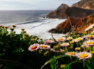
Starting at the parking lot adjacent to Gray Whale Cove State Beach, proceed to the start sign indicating "Grey Whale Cove Trail".
GWCT is a fun brisk hike with slight elevation gain that should be easy enough to take a small group or even children to. Take note of the tight spaces you may encou...
Read more
-
Half Moon Bay, California
4.5
2.23 mi
/ 367 ft gain
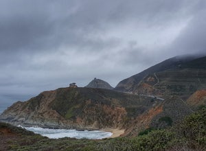
Gray whale cove trail is a splendid, short, and easy hike for the entire family with beautiful ocean views. The starting point is conveniently located near a parking lot that accesses Montara State Beach. From the south end of the parking lot, follow the trail up through the coastal scrub. Within...
Read more
-
Half Moon Bay, California
4.3
7.22 mi
/ 1929 ft gain
NOTE: as of 2019, North Peak has been fenced off around the installation of a radio tower and weather station. Additionally, the summit has been found to be a habitat for the endangered San Bruno elfin butterfly.
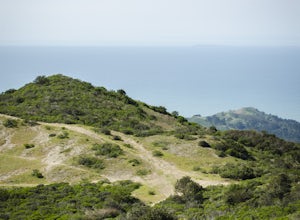
The Gray Whale Cove State Beach is a popular seaside trail that’s just 20 minutes s...
Read more
-
Half Moon Bay, California
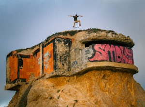
The Devil's Slide Bunker is perched out on a point the defiantly juts out into the ocean. The Bunker is covered in constantly changing graffiti, which provides a stunning contrast to the gorgeous seaside.
Hop on Highway 1 South. Just south of Pacifica there is a tunnel. Once you go through the t...
Read more
-
La Honda, California
Like redwood hikes? We do too, they're always very scenic and take you away from the hustle and bustle of the bay area. Not to mention, they also stay cool during the summer months. If you want a hike in the middle of the peninsula, this is a great bet.When starting this hike, head out from headq...
Read more
-
Los Gatos, California
Communes, dairy, and gold. These words are not often associated with trail running, but out on Monte Bello Ridge and Black Mountain which rise high above Silicon Valley, you might just hear them uttered.From the parking area in Skyline Open Space we start our run by crossing Skyline Boulevard and...
Read more
-
Pacifica, California
If you're looking for a place to surf and Ocean Beach isn't quite your speed or Santa Cruz is too far, head to Pacifica, specifically Linda Mar. Linda Mar is usually more wind protected and user-friendly than ocean beach. Break out your longboard or hybrid board and head to this beach. There is e...
Read more
-
Pacifica, California
4.8
2.54 mi
/ 276 ft gain
Start at the parking lots close to the pier, where bathrooms are also available. Walk along the pier to watch the sunset as it begins.
Next, walk along Sharp Park Beach to discover the plethora of wild flowers and friendly locals always ready to guide you on your walk.
Take the stairs up to the...
Read more
-
San Jose, California
This tranquil 20.6 acre park is open year round from 8am to sunset. It’s the gateway to the Don Edwards San Francisco Bay National Wildlife Refuge. It is filled with boardwalks, trails, and all kinds of wildlife. I went here with the sole intent of catching a pretty sunset after a long week. I g...
Read more
-
Pacifica, California
Rockaway is a dark sandy beach located in the south of Pacifica, CA. It has numerous hiking trails around it, most notably Mori Point. The Mori Point trail will take you through the hills and overlooks Rockaway Beach. There are paths to come down to the beach.
There are biking paths and park...
Read more
-
Pacifica, California
5.0
2.51 mi
/ 558 ft gain
Found this hike with some friends after spending some time googling in my car when we were in the area looking for a quick hike with a view!
Dog friendly Free parking (but quite limited) Ocean views Known to have gorgeous wildflower blooms (we were not there during this)Porta-potty type toilet...
Read more
-
Pacifica, California
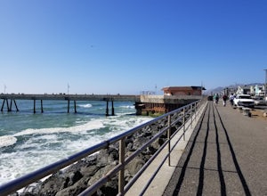
A medium size beach with darker sand with big rocks and a paved path for walkers and joggers. The beach is a great place to bring a picnic and watch the sunset. It is located next to Pacifica Pier, which is popular for fishing.
Read more
-
Saratoga, California
The Seven Springs loop is only one great option of several in the preserve. Starting from the Prospect Rd parking lot the loop is 2.8 miles of rolling hills in and out of the shade. Most of the trail is at least 2 person width so easy to walk with a friend or furry companion. There have been larg...
Read more
-
Pacifica, California
This is a great place for fishing or just taking a walk to watch the sunset. It's a great place to walk or jog, or even bring a pup! There are lot of people fishing throughout the pier.
A short walk away is Sharp Park Beach, where you can relax and bring a picnic to watch the sunset.
Read more
-
Fremont, California
Lake Elizabeth is located in central Fremont. It offers a nice break from the city streets and can be enjoyed by walkers, joggers, and bikers alike. It is a park for all ages.
Other attractions include volleyball nets, multiple playgrounds, and aqua adventure park, geese, and peddle boats.
...
Read more
-
San Francisco, California
5.0
16.71 mi
/ 1975 ft gain
The San Francisco Crosstown Trail runs point-to-point from Candlestick Point to Land End.
The SF Crosstown Trail officially opened in 2014. It connects park trails to neighborhoods and communities. In it's in entirety it's almost 17 miles long with 5 Sections available for those looking to bre...
Read more

