El Granada, California
Looking for the best hiking in El Granada? We've got you covered with the top trails, trips, hiking, backpacking, camping and more around El Granada. The detailed guides, photos, and reviews are all submitted by the Outbound community.
Top Hiking Spots in and near El Granada
-
Sausalito, California
Hawk Hill
5.00.76 mi / 144 ft gainIf you're leaving from SF, head over the bridge and exit onto Alexander Ave. Make the immediate left under the overpass and you'll be on the road to Hawk Hill. There's a parking area just below the gate leading up to Hawk Hill. From the parking lot you can walk west about ten yards along the outs...Read more -
Sausalito, California
Black Sands Beach
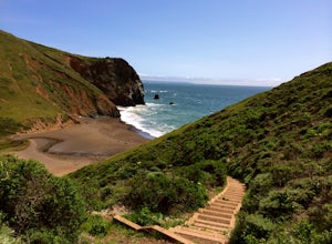
5.00.54 mi / 285 ft gainBlack Sand Beach is a beautiful, mile-long stretch of black sand just north of the Golden Gate Bridge. On a sunny day, it’s best to try and arrive in the morning, as the parking lot can fill up quickly. To get down to the beach, you’ll need to hike for about 5 minutes down 250 or so wooden steps....Read more -
Mill Valley, California
Kirby Cove
4.72 miThis scenic hike is a 1.8 mile out-and-back trail located near Sausalito, CA. From the trail and beach, you'll get scenic of the Golden Gate, San Francisco's skyline, and glimpses of the East Bay. The best news, there's rarely any crowd. Consider packing a blanket and a small picnic. With panora...Read more -
Sausalito, California
Battery Spencer
4.00.47 mi / 46 ft gainThis is a very popular spot to hike up to from Conzelman Road. You can find parking in the lot or on the street and do the quick hike up to Battery Spencer. You can get a perfect view of the Golden Gate Bridge and SF from the Marin side of the Bay. This is a unique perspective as you also get the...Read more -
La Honda, California
Hike through Portola Redwoods State Park
4.87 miLike redwood hikes? We do too, they're always very scenic and take you away from the hustle and bustle of the bay area. Not to mention, they also stay cool during the summer months. If you want a hike in the middle of the peninsula, this is a great bet.When starting this hike, head out from headq...Read more -
La Honda, California
Hike Peters Creek and Long Ridge
4.05.7 miFrom the parking lot, take the connector trail towards the Peters Creek Trail for 0.4 miles. As you descend into a small valley, notice the sound of running water that appears. When you reach the first trail intersection, turn left on the Peters Creek trail. This will give you your first encounte...Read more -
Mill Valley, California
Rodeo Cove to Point Bonita Lighthouse
5.03.64 mi / 568 ft gainIf you're looking for a little hike and a lot of beach, you'll find your ideal combo at Rodeo Beach and Point Bonita Lighthouse. Park at the Marin Headlands Visitor Center at the head of the 0.8 mile trail to the beach. From the lighthouse to the beach, it will be another 1.5-2 miles there and ba...Read more -
Sausalito, California
Ninja Loop
9.37 mi / 1831 ft gainThis loop can start from several different locations, including Rodeo Beach and the Golden Gate Bridge parking lot. Starting from the GGB will add 2 more miles onto this run. I like to start at the Coastal Trailhead parking lot off of McCullough and Conzelman Roads (just a notch down from Hawk Hi...Read more -
Sausalito, California
Marin Headlands Trail Loop
10.5 mi / 1990 ft gainThis trail starts at the Coastal Trail in Marin Headlands Park, where there's a small parking lot and outhouse bathroom off the circle when coming from Conzelman Road.Take the Coastal Trail until you intersect with Bunker Road (you can even turn right and spit off the trail just before intersecti...Read more -
Mill Valley, California
Miwok, Marincello and Bobcat Trail
8.17 mi / 1391 ft gainMiwok, Marincello and Bobcat Trail is a loop trail that takes you by a river located near Sausalito, California.Read more -
Mill Valley, California
Coastal Trail from Rodeo Beach to Muir Beach
11.35 mi / 3264 ft gainThis hike has beautiful views in the Marin Headlands. You'll find easy parking in the Rodeo Beach Parking lot if you get there early (by 8:30 am). This hike goes along the Coastal Trail which has a few steep areas as you make your way to Tennessee Beach. The Tennessee Beach has gorgeous dark b...Read more -
Mill Valley, California
Hill 88 Loop
4.05.5 mi / 1086 ft gainThis quick, yet challenging trail run is located just minutes north of the Golden Gate Bridge. Grab your dog (on-leash), park in the large lot next to Rodeo Beach and hit the trail! The climb starts up the Coastal Trail to the right end of the parking lot if you're staring at the beach. Take the...Read more -
Rancho San Antonio Open Space Preserve, California
Hike Deer Hollow Farm Trail
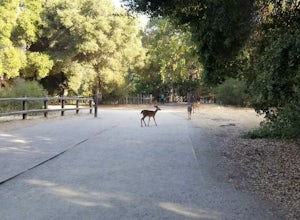
4.02.7 mi / 259 ft gainRancho San Antonio Open Space Preserve has many beginner to intermediate hiking trails. Deer Hollow Farm Trail Loop is a hiking trail for beginners, families, or anyone wanting to go on a short hike with nice views of the bay. The trail passes by a farm and deer can often be seen wandering aroun...Read more -
Castro Valley, California
Lake Chabot Regional Park Loop
4.08.65 mi / 1263 ft gainLooking for a fun day on a lake, but don't want to drive too far? We recommend heading out to the East Bay where you can combine a nice hike with an afternoon of fishing. This moderately challenging hike remains scenic throughout the 8.5 mile trek around the lake, and offers many opportunities fo...Read more -
Mill Valley, California
Tennessee Beach via Tennessee Valley Trail
4.63.64 miThe Tennessee Valley trail is leisurely 3.6 mile roundtrip hike that turns around at Tennessee Valley Cove. Along the way, you’ll hike past shrublands, wetlands, and a lake before you get to a cool little secluded beach that many people picnic at. This is probably the easiest to access, and most...Read more -
Mill Valley, California
Coyote Ridge Loop
5.06.15 mi / 1001 ft gainStarting just before the Tennessee Valley parking lot, head out from the Miwok Trailhead. This Mill Valley hike offers incredible views of the San Francisco Bay, the Pacific Ocean (fog permitting of course!), and on occasion, wildlife. Unfortunately, this trail is not dog-friendly. Keep in mind...Read more


