Danville, California
Looking for the best hiking in Danville? We've got you covered with the top trails, trips, hiking, backpacking, camping and more around Danville. The detailed guides, photos, and reviews are all submitted by the Outbound community.
Top Hiking Spots in and near Danville
-
Half Moon Bay, California
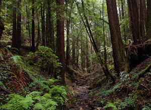
Purisima Creek Trail and Craig Britton Trail Loop
4.06.95 mi / 1411 ft gainThis hike is perfect for any time of year, always staying cool because it is near the coast, and there are multiple creeks that flow year-round. Even on foggy days, the fog condenses on trees to make it seem like it is "raining." Be warned that this hike has a lot of elevation change and is stre...Read more -
Mill Valley, California
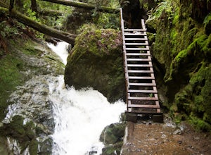
Steep Ravine Trail via Pantoll Station
5.03.96 mi / 1079 ft gainThe trailhead Pantoll Station is easy to find on GPS and there are friendly rangers there as well to answer questions.Maps: Paper map are available at the trailhead Pantoll Station in Marin, CA. For a moderate hike, I suggest going the one and a half miles down the trail to the ladder and retu...Read more -
Mill Valley, California
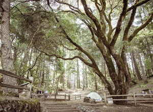
Camp at Mt. Tam's Pantoll Campground
5.0Need an escape from SF, but can't seem to find an available campground, then head to Pantoll Campground in Mount Tamalpais State Park. If you get there early on friday (or even better Thursday afternoon), you should be able to lock down one of these first-come, first-serve campgrounds. Each of th...Read more -
Marin County, California
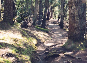
Dipsea Trail - Steep Ravine Loop
5.03.97 mi / 1204 ft gainThis is definitely a worthwhile short hike, with views of the Bay Area, Marin Headlands, Golden Gate, and the San Mateo coastline. It's a 3.8 mile loop which takes you through forests of Redwoods and out to the coastline, even above the clouds on a lucky day. The trailhead begins at the Pantoll ...Read more -
San Rafael, California
Terra Linda Sleepy Hollow Ridge Trail
5.05.85 mi / 1089 ft gainThis San Rafael neighborhood trail is quite popular, but there is plenty of room for everyone and the parking is easy. After you park at the trailhead, you walk (or bike) up a relatively short and steep path that takes you to the beginning of the trail. This hike takes you along a scenic ridge ...Read more -
Half Moon Bay, California
McNee Ranch to Planet of the Apes
4.88 mi / 1427 ft gainMcNee Ranch to Planet of the Apes is a 4.8 mile trail located near Montara State Beach that offers ocean views when it is not too cloudy. You can get amazing views when you hike up above the clouds. This hike follows one of the main trails up the mountain, but there are many smaller trails to e...Read more -
Fairfax, California
Lake Lagunitas
4.01.6 mi / 176 ft gainLocated near Fairfax, California, this trail is relatively flat and provides peaceful views of the lake as you pass over small creeks and groves of redwoods. It's good for all skill levels and is accessible year-round. It's a great trail for families and beginner mountain bikers.It can be a littl...Read more -
Marin County, California
Picturesque Views from Mt. Tam's East Ridge
5.0This road provides one of the most scenic views of the pacific from north of the Golden Gate. It's a little bit of a windy drive or ride along Highway 1 or Panoramic Highway (depending on which way you choose) to get to East Ridgecrest. But, if you remembered to pack a picnic, brought your friend...Read more -
Stinson Beach, California
Cataract Trail Loop
4.58.7 mi / 1670 ft gainDuration: 3.5-4 hour hike at a moderate to quick pace with a short break for lunch. Starting at an elevation of 1989ft and maxing at 2001ft, you achieve 1428 of elevation gain through a beautiful peak and valley hike. From the free Rock Springs Parking Area, the basic trailheads to follow along...Read more -
Mill Valley, California
Trojan Point
4.50.25 mi / 75 ft gainThe endlessly scenic Trojan Point can be reached by taking the Panoramic Highway to Pantoll road from Stinson Beach to the west, or Mill Valley / Highway 1 to the east. It can also be reached by taking West Ridgecrest Boulevard from the north from the Fairfax-Bolinas road. Park at the large par...Read more -
Rancho San Antonio Open Space Preserve, California
Hike Deer Hollow Farm Trail
4.02.7 mi / 259 ft gainRancho San Antonio Open Space Preserve has many beginner to intermediate hiking trails. Deer Hollow Farm Trail Loop is a hiking trail for beginners, families, or anyone wanting to go on a short hike with nice views of the bay. The trail passes by a farm and deer can often be seen wandering aroun...Read more -
Portola Valley, California
Sunrise Hike at Windy Hill
5.0There are a few options to this hike. Usually I would recommend parking in the lot on Portola Road, but because the preserve doesn't open until 30 minutes before sunrise, it's best to park up on Skyline Boulevard (Highway 35). There are two places to park up on Skyline, but the main parking lot i...Read more -
Napa, California
Lake Marie Road, Marie Creek, Buckeye Trail Loop
3.55.8 mi / 961 ft gainEnter the parking lot just off of Hwy 221. Plan to pay a $5 entrance fee at the kiosk. The trail head begins at the edge of the parking lot where you'll soon be passing by the Martha Walker Native Habitat Garden on your right. Veer left to continue along Lake Marie Road where you'll enter the blu...Read more -
Redwood City, California
Hike the Methuselah and El Corte De Madera Creek Loop
6.2 mi / 1800 ft gainThis loop hike will provide people with the opportunity to experience the tranquility of the lower canyons of the preserve, which tend to be more isolated than the heavier-trafficked trails that are closer to the main highway. Be warned that this hike is fairly strenuous because of the large amou...Read more -
Half Moon Bay, California
Hike Along the Half Moon Bay Coastal Trail
4.65 mi / 104 ft gainStart at the visitor center along Kelly Avenue. Take note that the day parking fee is $10 in 2016 for each vehicle. You will then be able to enjoy both the Coastside Trail and Francis Beach (plus other beaches) with access to the amenities such as coin-operated showers and a semi-private beach.Th...Read more -
Moss Beach, California
Pillar Point Bluff Loop
4.71.84 mi / 154 ft gainSitting on a 140 acre bluff top, the Pillar Point Bluffs are a simple, easy hike with breathtaking views throughout. The bluffs are 22 miles from San Francisco – a 30 minute drive depending on the traffic. There is a small 10 car or so parking lot off of Airport Blvd, but there are two additional...Read more

