Bishop, California
Bishop, California is a great destination for outdoor activities and attractions. Nestled between the Sierra Nevada to the west and the White Mountains to the east, Bishop offers a wide array of outdoor activities. For those who enjoy rock climbing, the Buttermilk Boulders and the Happy and Sad Boulders in the Volcanic Tablelands are popular destinations. These areas are not only for climbers but also offer scenic hiking trails, mountain biking routes, and opportunities for bird watching and photography. Bishop Creek Canyon, southwest of Bishop, is a natural wonderland of mountains, lakes, streams, forests, and waterfalls. It's a great place for camping, fishing, and simply enjoying the breathtaking scenery. Bishop has something for everyone, ensuring you get the most out of your trip and the beauty of nature.
Top Spots in and near Bishop
-
Mono County, California
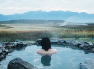
Crab Cooker Hot Springs
Getting There: Take Highway 395 heading toward Benton Crossing Road. Turn onto Benton Crossing and you’ll see an adorable wee green church. Continue two miles down the road. You’ll make a left turn and head down a dirt road. Cell service is scant in this area, so you'll probably want to...Read more -
Mono County, California
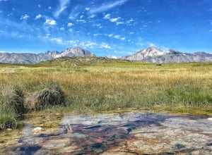
Shepherd Hot Springs
4.0Located a short distance from US 395 near Mammoth/Yosemite Airport, Shepherd Hot Spring provides a great opportunity to relax while taking in spectacular views of the Eastern Sierras and surrounding area. After a hard day on the slopes or long day on the trail this hot spring provides a comforta...Read more -
Mammoth Lakes, California
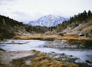
Hot Creek Interpretive Trail
5.00.37 mi / 69 ft gainHot Creek Interpretive Trail is a loop trail that takes you by a hot springs and good for all skill levels located near Mammoth Lakes, California.Read more -
Mono County, California
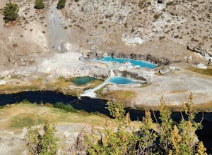
Hot Creek Geological Site
4.8Hot Creek Geological Site is a must see when you are in the Mammoth Lakes area. It is just West of Highway 395 and only minutes form the town of Mammoth Lakes, which has great food, a ski resort, world class mountain biking, and a brewery. Bishop is about 40 minutes South which is well known for ...Read more -
Lakeshore, California
John Muir Trail: Camping at Lake Virginia
5.0You'll find an ample supply of warm, sunny campsites here. After a tough climb leading up to this area, a plunge in the cold water and sunbathing on the warm granite surrounding the lake is just what the doctor ordered. This is one of the sites that you want to plan around - even if you arrive at...Read more -
Mammoth Lakes, California
Relax at Laurel Lakes
0 mi / 0 ft gainThe Laurel Lakes trip, just south of Mammoth Lakes, is a worthwhile day trip that can easily be made into a hiking/camping trip.To get there, make your way to Laurel Lakes Rd via Sherwin Creek Rd either from Old Mammoth Rd or from the 395. The road to the lakes is not too bad initially but you'll...Read more -
Lakeshore, California
Evolution Valley via Florence Lake
4.530.36 mi / 3238 ft gainYou can get to the Evolution Basin a variety of ways, but the easiest is through the Florence Lake Trailhead. Here, you can choose to either take the Florence Lake Ferry across the lake, or save $25 and hike the extra 4 miles around the lake. Personally, I would choose the ferry. About five mile...Read more -
Lakeshore, California
Backpack to Crater Lake, Sierra National Forest
8.4 mi / 2100 ft gainStarting at Lake Florence, this hike starts out with a climb up and keeps this up over the next 3 miles. After about 3 miles of climbing you reach another lake, Dutch Lake which provides shade and a nice place to rest. From there it's a relatively flat 1.2 miles in to your destination. Once at Cr...Read more -
Mammoth Lakes, California
Valentine Lake via Sherwin Lakes Trail
5.09.76 mi / 2026 ft gainPark at the Sherwin Lakes Trailhead. Begin your ascent through scrubby foliage and old pines. Once you arrive at a junction with a bench, turn around. Note that the uphill climb is pretty decent past Sherwin Lakes, so if you're feeling overly winded after the arriving at these lakes, this may be...Read more -
Mammoth Lakes, California
Sherwin Lakes Trail
5.04.42 mi / 850 ft gainJust outside the town of Mammoth Lakes, CA is the Sherwin Lakes Trailhead. An easy 10 minute drive down some dirt roads will get you to the dirt parking lot where you can safely leave your vehicle and begin your fairly easy 2.5 mile hike to Sherwin Lakes. (Valentine Lake is not much further beyon...Read more -
Dyer, Nevada
Hike Boundary Peak
5.010.4 mi / 4000 ft gainBoundary Peak received its name because it straddles the border of California and Nevada. While technically in Nevada, just a few hundred feet away lies its taller neighbor Montgomery Peak (13,442') in California. Many people bag both peaks at once, but the rotten rock and unstable trail make Mon...Read more -
Mammoth Lakes, California
Heart Lake
5.02.11 mi / 500 ft gainYou will see a couple of trailheads starting by parking at the Coldwater Creek Campground parking lot. This one is specifically marked Heart Lake. There will be a couple of forks in the trail, but if you stay right and on the more obvious path, you will be up to Heart Lake in no time. (Going left...Read more -
Mammoth Lakes, California
Duck Lake via Duck Pass Trail
4.79.29 mi / 1880 ft gainThe Duck Pass trail in the John Muir Wilderness combines breathtaking views, wildflowers and plenty of icy mountain lakes for swimming into a trail that is moderate in both difficulty and distance. With multiple lakes along the way to pitch your tent and plenty of day hike options from a base cam...Read more -
Mammoth Lakes, California
Arrowhead Lake
5.02.25 mi / 538 ft gainIf you make your way to the Goldwater Campground there is plenty of parking. The trailhead you take leads to many lakes but the Duck Pass trailhead is the on you want to take. This is a easy trail to follow and walk with very little obstacles. You follow it along for around a mile and you won't ...Read more -
Mammoth Lakes, California
Pika Lake via Duck Pass Trail
9.41 mi / 1880 ft gainAs many of the other hikes start in this area, you start at the Goldwater Creek Campground where there is plenty of parking and restrooms. You will take the Duck Pass Trailhead for this hike. • I wanted to point out that this is not the easiest hike to do as a day hike. Many people do overnighte...Read more -
Mammoth Lakes, California
Skelton Lake Trail
5.03.2 mi / 804 ft gainThe hike to Skelton Lake in Mammoth Lakes, CA starts off at the Duck Lake Pass trailhead just past Lake Mary. The hike starts off with quite a few switchbacks as you climb through the John Muir Wilderness. About one mile up the trail, you'll see an option to veer off to Arrowhead Lake. Continue o...Read more

