Big Creek, California
Looking for the best hiking in Big Creek? We've got you covered with the top trails, trips, hiking, backpacking, camping and more around Big Creek. The detailed guides, photos, and reviews are all submitted by the Outbound community.
Top Hiking Spots in and near Big Creek
-
Bishop, California
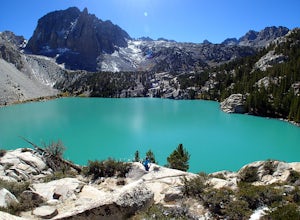
Big Pine Lakes via North Fork Trail
5.012.69 mi / 3196 ft gainThe North Fork Big Pine Creek Trail offers some of the best high alpine scenery in the Sierras. As the peaks of the Palisades pierce the sky with its craggy span of summits you will find it is as picturesque and dramatic as any in California. Nestled beneath these giant peaks are the glacier scou...Read more -
Big Pine, California
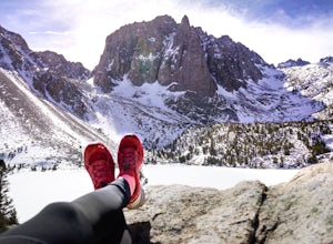
Fourth Lake via Big Pine Creek North Fork Trail
4.012.6 mi / 3205 ft gainFrom Big Pine, you'll turn onto Crocker St. to head towards the mountains. Once you are about 11 miles down the road you will see a sign and a turnoff on the right for trailhead parking. That is where you are going to want to park if you are staying overnight but you can continue to where the roa...Read more -
Bishop, California
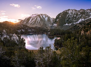
First and Second Lake via Big Pine Creek North Fork
5.09.57 mi / 2392 ft gainThe North Fork of Big Pine Creek is often cited as having the most unbelievable scenery reachable in a single day. And it's hard to disagree. The Big Pine Creek North Fork trail is just minutes outside of Big Pine off the 395. If going in the winter, access to the trailhead can be closed off, so...Read more -
Mariposa County, California
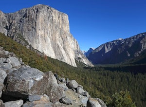
Hike Old Big Oak Flat Road
4.1 mi / 1070 ft gainOld Big Oak Flat Road used to be one of the main entries into Yosemite Valley, before HWY 120, 140 and 41. It was a dangerous road which had to be realigned, reconstructed and maintained continuously and was eventually closed in the 1940’s after a giant rockslide made it completely irreparable. T...Read more -
Sierra, California
Hike to Mist Falls
4.59 mi / 600 ft gainThe trailhead starts at Roads' End (the end of Hwy 180). Take the Bubbs Creek/Kanawyer Loop Trail and hike east. For the first three miles the trail is relatively flat through an open pine forest. Make sure to look up as there are some great views of the valley. The granite walls on both sides of...Read more -
Sierra, California
Rae Lakes Loop
5.039.08 mi / 7316 ft gainDay one: After checking in with the park ranger and getting your required permits you will start your hike along a 1.8 mile stretch along the south fork of the Kings River. At this point, people typically go clockwise toward Paradise Valley but you can also go counterclockwise along Bubbs Creek. ...Read more -
Yosemite Valley, California
Tenaya Lake
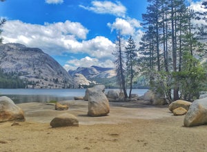
4.63.08 mi / 0 ft gainTenaya Lake is located alongside Tioga Road in the park's Tuolumne Meadows region. There is a family-friendly trail that surrounds the lake. Though some spots along the trail on the western shore may require fording the waters, the 2.5-mile trip is an easy hike for all to enjoy. Many others pre...Read more -
Mariposa County, California
Half Dome & Clouds Rest Loop
22.7 mi / 7000 ft gainStart and end this loop from the Sunrise Lakes TH along the Tioga Road, and in between you'll travel over 26 miles through Yosemite's backcountry gaining and losing over 7,000 feet in elevation. Unlike typical mountain summit hikes where it's climb climb climb to the top and then descend, this w...Read more -
Mariposa County, California
Sunrise Lakes to Clouds Rest
4.718.93 mi / 1775 ft gainStart out at the Tenaya Lake Trailhead, where you can head directly onto the trail for Clouds Rest or you can branch off after 2.7 miles to Sunrise Lakes. This allows you to break up the hike, spend a night relaxing and help you have an early start back on the trail. Once re-connected to the Clo...Read more -
Mariposa County, California
Porcupine Creek Trail to Indian Ridge Natural Arch to North Dome
10.04 mi / 2089 ft gainPorcupine Creek Trail to Indian Ridge Natural Arch to North Dome is an out-and-back trail where you may see beautiful wildflowers located near Yosemite Valley, California.Read more -
Mariposa County, California
Clouds Rest via Tenaya Lake
5.014.5 mi / 1775 ft gainThe "younger" brother of the world famous Half Dome, Clouds Rest is in fact a solid 1,000 feet taller despite receiving significantly less attention. If you know about this hidden gem however, you're in luck. Starting out from the Tenaya Lake trailhead will save you crowds on the trail and the ...Read more -
Mariposa County, California
Clouds Rest to Half Dome
18.52 mi / 4000 ft gainBecause this is not a loop, you will need to figure out a shuttle situation. There are two options for this: 1. Drive your car to the Tenaya Lake Trail Head, and leave it parked there. Once you reach the Valley you will be car-less, but then the next day you can take one of the free shuttles u...Read more -
Three Rivers, California
Hike Little Baldy
5.03.5 mi / 700 ft gainA short hike with impressive views of Sequoia National Park, the Little Baldy trail is the less touristy version of Moro Rock. When we hiked it on a beautiful Sunday morning in the summer, we had the entire summit to ourselves. Even if other hikers had been up there, it would have still felt em...Read more -
Mariposa County, California
Hike to Tuolumne Peak Plateau
11.7 mi / 1800 ft gainThe most direct route begins at Murphy Creek trailhead, on the north side of Tioga Road near Tenaya Lake. Walk north on Murphy Creek trail for 2.5 miles with minimal elevation gain. Polly Dome Lakes are a great side trip via the social trail on the right side of the trail before the first junctio...Read more -
June Lake, California
Parker Lake Trail
5.03.55 mi / 584 ft gainParker Lake is tucked beneath the giant mountains of Mount Wood, Mount Lewis, and Parker Peak. I hiked the Parker Lake trail during peak foliage season and I was blown away by the amazing fall colors. The trail starts off with a steady and rocky climb. After you pass the elevation gain, the trail...Read more -
Mariposa County, California
May Lake Trail
4.02.34 mi / 489 ft gainMay Lake is a stunning, serene subalpine lake that rests at the base of Mt. Hoffmann. The May Lake turnoff is located four miles past Tenaya Lake. From the turnoff, it's 1.8 miles to the trailhead parking lot. During summer time, I will recommend getting to the parking area early to get a spot ...Read more

