Ansel Adams Wilderness, California
Top Spots in and near Ansel Adams Wilderness
-
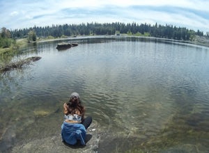
Shaver Lake, California
Access to the forebay starts at the trail head from the parking lot 6,700 ft up, also from the parking lot there is access to two different sets of boulder patches separate from the ones encountered along the hike in.
Hike
Start the 1 mile out and back hike from the parking lot following the t...
Read more
-
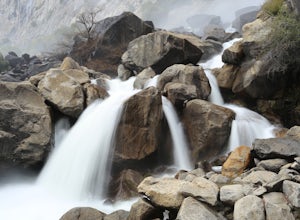
Groveland, California
Hetch Hetchy has a completely different character than other areas of Yosemite National Park, and the hike to Wapama Falls is an excellent way to explore this relatively remote section of the park. You can only imagine what this valley looked liked before it was dammed and is second to none compa...
Read more
-
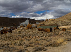
Mono County, California
Bodie exploded as a gold mining town in 1876, after the discovery of gold ore. It is estimated that Bodie produced over $34 million worth of gold over the years. The town was finally abandoned in 1942.While driving on 395, turn onto 270 and follow it 17 mi to the ghost town of Bodie. The last thr...
Read more
-
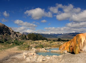
Bridgeport, California
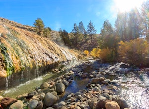
After you’ve bagged an Eastern Sierra peak, you deserve a little soaking to soothe your aching feet and tired muscles. Luckily, our great Mother Earth provides what you need.
Travertine Hot Springs sits only a few dirt miles from highway 395. Before you head out, grab some local brews from the g...
Read more
-
Bridgeport, California
From the parking lot, walk down the short but steep incline to the springs (200m). There is also a campsite within 0.25 miles.
Read more
-
Bishop, California
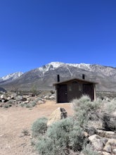
Great find! Close to Buttermilks and town. Clean vault toilets but bring your own water. The time we went there the pumps were not working. Each site has fire rings, picnic tables and latern hooks. It can get pretty windy and exposed, so bring the appropriate gear.
The campground has 49 tent/RV ...
Read more
-
Bishop, California
Pleasant Valley Pit offers 75 sites, fires outside camping area need a permit, a dumpster is in the campground, 4 vault toilets, no water, some tables, fire rings. To get here, head 0.5 miles off of the Pleasant Valley Road. $2 per vehicle. Learn more at blm.govThis campground is dog-friendly, bu...
Read more
-
Bishop, California
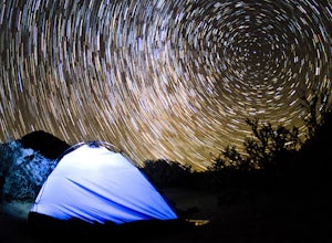
The Eastern Sierras have some of the most spectacular views in the world. This area in particular is known for its rock climbing. It also has amazing opportunities for photographers.The nights during a new moon are incredibly dark and create great astro photography shots. During the day, the l...
Read more
-
Bishop, California
The Buttermilks is a historical climbing area that is home to some of the worlds most famous rock climbs. It is located at the base of the Eastern Sierras near Bishop, CA. In this region there are 3 main bouldering areas: The Happies, The Sads, and The Buttermilks.The Buttermilks are massive gr...
Read more
-
Lakeshore, California
The transition from mostly sheer granite slopes to open grassy space is a welcomed one. Set up along the creek meandering through Evolution Basin and explore the area. You won't tire your legs out because it's pretty flat. Whip out your camera to catch some amazing reflections of the Sierra in th...
Read more
-
Shaver Lake, California
The paved road ends at the Maxson Trailhead parking lot on the SE side of Courtright Reservoir. The adventure starts with a glance to the left, down a rock-strewn dirt track that leads off further into the wilderness. You're wondering, "Is that the trail?" and "Do I dare?"The Dusy-Ershim Trail of...
Read more
-
Bishop, California
5.0
14.73 mi
/ 2802 ft gain
Buttermilk OHV Road is a point-to-point trail that provides a good opportunity to see wildlife located near Bishop, California.
Read more
-
Bishop, California
Before heading out, you will need to get a backpacking permit to stay overnight in this area. You can buy one here to pick up in town at the Bishop, CA Ranger Station, in the morning.The trailhead begins at North Lake campground (9,345'), in a beautiful lush area, with streams and aspen groves. A...
Read more
-
Bishop, California
5.0
5.8 mi
/ 1562 ft gain
Starting out at North Lake Campground, the trail to Lamarck Lakes is a fairly gradual ascent. After climbing out of the meadows near the trailhead, you will find yourself on a ridge with few trees to block the great views of Grass Lake and the valley below. Lake Sabrina is on the other side of ...
Read more
-
Groveland, California
Finding Rainbow Pool is a little tricky, since it is off the side of a highway, but when you find it there is parking and bathrooms. There is a easy walkway to get down to the pool itself, and trails to climb to the top to slide or jump off the rocks. Many people tend to fish up top underneath th...
Read more
-
Bishop, California
Starting in Aspendale at 8500 feet, this 5 mile hike is very invigorating and beautiful. To get here, take hwy 395 until in Bishop. Turn onto hwy 168 until you pass the small town of Aspendale. The road dead ends about another mile up the road and you can park. Walk past the yellow gate toward la...
Read more

